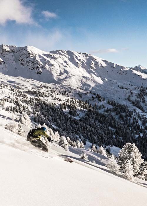
GO! SUIVEZ LE GUIDE. FOLLOW THE GUIDE - VAL D'ANNIVIERS
←
→
Transcription du contenu de la page
Si votre navigateur ne rend pas la page correctement, lisez s'il vous plaît le contenu de la page ci-dessous
S T- L U C / C H A N D O L I N

RANDONNÉES HIVER

                                 FR -De -eN
  VALDANNIVIERS.CH

   GO!
     SUIVeZ Le GUIDe.
  FOLGeN SIe DeN SPUReN.
    FOLLOW THe GUIDe.
Ha!
BIeNVeNUe.
WILLKOMMeN.
WeLCOMe.

RaNDONNÉES HIVER 2019
SCHNeeSCHUHTOUReN WINTeR 2019
WINTeR 2019 SNOWSHOe TOURS

ST-LUC / CHaNDOLIN
1. Sentier du réservoir           4
2. Sentier des Teppes             5
3. Chemin de Prosper              7
4. St-Luc / Hôtel Weisshorn       8
5. Sentier du Pas-de-Bœuf         10
6. Boucle Gouille Brune           13
7. Chandolin / Tour de la Rèche   14

Sécurité - Sicherheit - Safety    16

                                       3
4                                  4,6 KM > 1 H 50

                1. SeNTIeR DU RéSeRVOIR
            - DÉPART : 1936 m /                 217 m /         217 m -

    Départ :                                  auf der rechten Seite zurückführt.
    à l’Office du Tourisme de Chandolin       Überqueren Sie die Skipiste bis zur
    Monter la piste de ski de l’Illhorn       Illhorn-Hütte und gehen Sie weiter
    et bifurquer à gauche sur le célèbre      Richtung Saint-Luc bis zur ersten
    chemin de Sierre-Zinal jusqu’au lieu-     Alp. Von hier aus steigen Sie wieder
    dit « Pramarin ». Après une courte        hinunter bis nach Chandolin.
    montée, suivre le sentier supérieur
    qui revient sur la droite. Traverser la
    piste de ski jusqu’à la cabane Illhorn    Starting
    et continuer en direction de St-Luc       point: tourist office
    jusqu’au premier alpage. Depuis là,       Go up the Illhorn ski slope and
    redescendre jusqu’à Chandolin.            head left on the path of the famous
                                              Sierre-Zinal footrace until you reach
                                              the place called Pramarin. After a
    Start:                                    brief walk, follow the upper path
    beim Verkehrsbüro                         that goes to the right. Cross the ski
    Steigen Sie die Skipiste des Illhorns     slope to reach the Illhorn cabin in
    hinauf, biegen Sie nach links auf         the direction of St-Luc to the first
    den berühmten Weg Siders-Zinal            pasture. From that point, descend
    ab und laufen Sie bis nach Prama-         to Chandolin.
    rin. Nach einem kurzen Aufstieg
    folgen Sie dem oberen Weg, der
4,8 KM > 2 H 15

             2. SeNTIeR DeS TePPeS
        - DÉPART : 1655 m /               420 m /        97 m -

Départ :                               Wald „Forêt des Teppes“, bis Sie zur
au centre du village de St-Luc         Forststrasse gelangen. Bevor Sie
Derrière la Maison Bourgeoisiale,      den Sessellift erreichen, steigen
prendre à gauche direction Chan-       Sie die Skipiste hinauf und laufen
dolin sur le chemin de la Fortuna.     Sie anschliessend nach Chandolin
Longer le chemin qui traverse la Fo-   hinunter.
rêt des Teppes. Le sentier continue
dans la forêt avant de rejoindre la
route forestière. Avant d’arriver au   Starting point:
télésiège, remonter la piste de ski,   center of the village of St-Luc
avant d’entreprendre la descendre      From the rear of the House of the
sur Chandolin.                         Bourgeoisie, go to the left in the
                                       direction of Chandolin on the
                                       Fortuna path. Follow this path into
Start: im Dorfzentrum von Saint-Luc    the Teppes forest. The path contiues
Hinter dem Burgerhaus (Maison          in the forest before connecting
Bourgeoisiale) biegen Sie links        with a forest road. Before reaching
in Richtung Chandolin auf den          the chair lift, go up the ski slope,
Weg „Chemin de la Fortuna“ ab.         before going down to Chandolin.
Folgen Sie dem Weg durch den

                                                                              5
6
3,9 KM > 2 H

              3. CHeMIN De PROSPeR
                - DÉPART : 1655 m /              528 m -

Départ :                                die Route den Weg „Chemin de la
au centre du village de St-Luc          Fortuna“. Folgen Sie dem Wander-
Derrière la Maison Bourgeoisiale,       weg „Prosper“ durch den Wald bis
prendre à gauche direction Chan-        nach Tignousa.
dolin. La première partie de l’iti-
néraire est le même que la liaison        1. Möglichkeit, die Wanderung
avec Chandolin. Après 15 minutes        		 am Parkplatz „La Forêt“ zu
de marche, l’itinéraire se détache      		 beginnen (Dauer: 1 Std.).
du chemin de la Fortuna. Suivre le
chemin de Prosper dans la forêt,
jusqu’à Tignousa.                       Starting point:
                                        center of the village of St-Luc
  1. Possibilité de commencer           Behind the House of the Bourgeoi-
		 depuis le Parking de la Forêt        sie, the itinerary is the same as
		 (1 h).                               the one that leads to Chandolin.
                                        After 15 minutes of walking time,
                                        this route leaves the Fortuna path.
Start: im Dorfzentrum von Saint-Luc     Follow Prosper’s path in the forest
Biegen Sie hinter dem Burgerhaus        to Tignousa.
(Maison Bourgeoisiale) links in
Richtung Chandolin ab. Der erste          1. It is possible to leave from
Teil der Strecke ist derselbe wie die   		 the Forest parking area
Verbindung nach Chandolin. Nach         		 (Time required: 1 h).
15 Minuten Wanderung verlässt

                                                                              7
8                               11,9 KM > 5 H 15

                        4. ST-LUC /
                     HÔTeL WeISSHORN
           - DÉPART : 1655 m /              760 m /       642 m -

    Départ :                              Start:
    au centre du village de St-Luc        im Dorfzentrum von Saint-Luc
    Au-dessus de la Maison Bourgeoi-      Nehmen Sie oberhalb des Burger-
    siale emprunter la route sur la       hauses (Maison Bourgeoisiale) die
    droite qui mène jusqu’au grand        Strasse rechts, die zur Suone
    bisse et le suivre jusqu’à Gillou.    „Grand Bisse“ führt, und folgen
    Depuis là, prendre le chemin qui      Sie ihr bis nach Gillou. Nehmen
    monte en direction de l’Hôtel         Sie dort den Weg, der zum Hotel
    Weisshorn (645 m de dénivella-        „Weisshorn“ hinaufführt (645 m
    tion depuis St-Luc). Pour le retour   Höhenunterschied ab Saint-Luc).
    à St-Luc, emprunter le chemin des     Für den Rückweg nach Saint-Luc
    planètes, passer devant Neptune       nehmen Sie den Planetenweg
    et Uranus puis prendre le chemin      („Chemin des planètes“), gehen
    sur la gauche qui descend réguliè-    Sie an Neptun und Uranus vorbei
    rement sur St-Luc, en passant par     und schlagen Sie dann den Weg
    les Girettes.                         links ein, der über Les Girettes
                                          gleichmässig nach Saint-Luc hin-
      1. départ possible depuis           unterführt.
    		 Le Prilet, au fond du
    		village.                              1. Start ab Le Prilet, am Ende
      2. départ possible depuis           		 des Dorfes.
    		 l’arrivée du funiculaire             2. Start ab Tignousa (Berg-
    		 Tignousa jusqu’à l’Hôtel           		 station der Standseilbahn),
    		Weisshorn.                          		 bis zum Hotel „Weisshorn“.
Starting point:
center of the village of St-Luc
Above the House of the Bourgeoisie
take the road on the right that
leads to the bisse (irrigation
channel) and follow it until you
reach Gillou. From there, take the
path that goes up in the direction
of the Weisshorn Hotel (645m up
from St-Luc). To return to St-Luc,
take the “Path of the Planets”, go by
Neptune and Uranus and then take
the path to the left that goes down
to St-Luc, passing by the Girettes.
1. Departure possible from
Le Prilet, at the edge of
the village.
2. Departure possible from
Tignousa (arrival point
of the funicular) on the
way up to the Weisshorn
Hotel.
910 10,3 KM > 4 H 30
5. SeNTIeR DU PAS-De-BœUF
- DÉPART : 2180 m / 628 m / 628 m -
Départ : de Tignousa Start: ab Tignousa
La première partie se fait sur le Der erste Teil führt über den
Chemin des Planètes. Passer entre Planetenweg. Gehen Sie zwischen
Jupiter et le chalet Blanc de Rouaz, Jupiter und dem Chalet „Blanc de
avant de prendre le chemin qui Rouaz“ hindurch und schlagen Sie
monte jusqu’à la Tsigère de la Cohà den Weg ein, der zur Berghütte
(buvette). Une fois la limite des fo- „Tsigère de la Cohà“ hinaufführt.
rêts dépassée, le sentier dévoile Sobald Sie die Waldgrenze hinter sich
les grands espaces blancs du Pas- gelassen haben, eröffnet der Weg
de-Bœuf. Au sommet du téléski, den Blick auf die grossen weissen
redescendre au pied du Touno en Flächen des Pas-de-Bœuf. An der
direction du Chemin des Planètes. Bergstation des Skilifts steigen Sie
Retour au point de départ par ce- am Fuss des Touno wieder Richtung
lui-ci ou redescendre sur le village Planetenweg hinab. Gehen Sie auf
par l’itinéraire N° 4. diesem Weg zum Start zurück oder
steigen Sie über den Wanderweg Nr.
Cet itinéraire est entièrement 4 zum Dorf hinunter.
en-dessus de la limite de la
forêt, c’est pourquoi il ne peut Diese Strecke liegt kompletto-
être suivi que par beau temps. berhalb der Waldgrenze und
En raison du risque d’ava- kann daher nur bei schönem
lanche après de fortes chutes Wetter begangen werden. Auf-
de neige, le sentier n’est pas grund der Lawinengefahr nach
souvent ouvert. Renseigne- starken Schneefällen ist der
ment auprès des Remontées Weg nicht oft geöffnet. Aus-
Mécaniques. künfte erhalten Sie bei den
Bergbahnen Remontées Méca-
niques de St-Luc/Chandolin.Starting point: Tignousa
The first part of this walk runs along
the Chemin des Planètes (Planet
Path). Walk between Jupiter and
the “Chalet Blanc de Rouaz”, before
taking the path that goes up to the
“Tsigère de la Cohà” (refreshment
bar). After going above the forest
line, the path allows walkers to
see the broad white expanses of
the Pas-de-Bœuf. At the top of the
chair lifts, go down to the bottom
of the Touno in the direction of the
Planet Path. Return to the point of
departure along this path or go to
the village on route n° 4.
This path is above the limits
of the forest and can only be
used in good weather. Because
of the risk of avalanches the
path is not often open. Please
check with the offices of the
ski lifts.
1112
2,2 KM > 50 MIN

           6. BOUCLe GOUILLe BRUNe
        - DÉPART : 1676 m /               101 m /        101 m -

Départ :                                Starting point:
parking de la Forêt                     La Forêt car park
Longer la route qui part en direc-      Walk along the road towards St-Luc
tion de St-Luc. Après environ 100 m,    for about 100 metres, then take
un petit chemin monte sur la droite     the small path on the right that
dans la forêt. Suivre ce chemin ba-     goes up into woodland. Follow this
lisé. Le retour se fait sur une route   waymarked path, returning along a
forestière plus large qui rejoint le    broader forest track that leads back
Parking de la Forêt.                    to the car park.

Start:
Parkplatz La Forêt
Nehmen Sie die Strasse in Rich-
tung St-Luc. Nach etwa 100 Metern
führt rechts ein kleiner Weg durch
den Wald hinauf. Folgen Sie diesem
markierten Weg. Der Rückweg ver-
läuft über eine grössere Forststras-
se, auf der Sie wieder zum Park-
platz La Forêt gelangen.

                                                                               13
14 3,6 KM > 1 H 30
7. CHANDOLIN /
TOUR De LA RèCHe
- DÉPART : 1936 m / 221 m / 221 m -
Départ : Start:
depuis l’Office du Tourisme vom Verkehrsbüro
Rejoindre le chemin situé juste Vom Verkehrsbüro aus gelangen
après le magasin de sport à gauche Sie auf den Weg direkt nach dem
et descendre vers le vieux village de Sportgeschäft links. Steigen Sie zu
Chandolin. Poursuivre tout droit en dem historischen Dorf Chandolin
passant sous l’église puis, au bout hinunter. Gehen Sie geradeaus wei-
de la route, tourner à gauche en di- ter, indem Sie unterhalb der Kirche
rection de la Rèche. vorbeigehen, biegen Sie dann am
Après avoir serpenté dans la forêt Ende der Strasse links in Richtung
de mélèzes, le sentier rejoint les La Rèche ab.
mayens du hameau de la Rèche Der Weg schlängelt sich durch den
qui surplombe la vallée. Continuer Lärchenwald und führt zu den
à gauche par la route forestière, les Maiensässen des Weilers La Rèche,
Moulins de Chandolin se trouvent der das Tal überragt. Gehen Sie
juste en-dessous. links auf der Waldstrasse weiter,
Peu après, rejoindre le chemin his- die Mühlen von Chandolin befinden
torique qui relie St-Luc à Chandolin, sich direkt darunter.
tourner à gauche pour boucler ce Wenig später gelangen Sie auf den
joli tour en rejoignant le village là- historischen Weg, der von Saint-
haut. Luc nach Chandolin führt; biegen
Sie zum Abschluss dieser schönen
Rundwanderung nach links ab, um
ins Dorf hinaufzugehen.Starting point:
from the tourist office
Take the path on the left just beyond
the sports shop, and go downhill
towards the old village of Chandolin.
Continue straight on, passing below
the church then, at the end of the
road, turn left towards La Rèche.
The path winds through a larch
forest before reaching the mid-
alpine hamlet of La Rèche, which
overlooks the valley. Continue to
the left via the forestry track, the
Moulins de Chandolin (mills) are
situated just below.
A little further along, take the
ancient track that connects St-Luc
to Chandolin, turn left to reach the
village above and complete this
lovely circular walk.
1516
PRUDeNCe eN MONTAGNe
POUR De BONNeS VACANCeS !
IN DEN BERGEN IST VORSICHT GEBOTEN!
STaY SaFE IN THE MOUNTaINS aND
ENJOY YOUR HOLIDaY!Les Offices du Tourisme déclinent toute responsabilité en cas
d’accident. Pour votre sécurité, renseignez-vous sur la météo
et les conditions de neige avant d’emprunter ces tracés. Respectez
la signalisation et les interdictions (piste fermée et danger d’ava-
lanche). Si vous ne possédez pas suffisamment de connaissances
pour décider de votre parcours de manière autonome en fonction du
degré de danger, il est impératif d’engager un professionnel.
Die Verkehrsbüros lehnen jegliche Haftung bei Unfällen ab.
Bevor Sie sich auf den Weg begeben, erkundigen Sie sich
zu Ihrer eigenen Sicherheit nach dem Wetterbericht und den
Schneeverhältnissen. Beachten Sie die Signalisation und die
Verbote (gesperrte Pisten und Lawinengefahr). Falls Sie nicht über
ausreichende Kenntnisse verfügen, um eine Ihren Fähigkeiten
entsprechende Route auszuwählen, wenden Sie sich bitte an einen
Wanderleiter.
Tourist Offices cannot be held responsible in the case of
accidents. For your safety, check the weather and snow
conditions before setting out on these trails. Observe the signs and
prohibitions (piste closures and risk of avalanche). If you are not
suf ficiently knowledgeable to choose your trail according to your
ability, you are strongly advised to hire a professional guide.
URGeNCeS
NOTRUFNUMMeRN
eMeRGeNCY SeRVICeS
Météo 162 Police 117
Air-Glaciers 1415 Feu 118
La Rega 1414 SOS - URGENCES 144
1718
éCHeLLe DU
DANGeR D’AVALANCHeS
LaWINENGEFaHRENSKaLa
aVaLaNCHE DaNGER SCaLE
HeP!
Pour toute information complémentaire
merci de contacter le Bureau des Guides :
Für weitere Auskünfte wenden Sie sich
bitte an das Bergführerbüro:
For more information please contact
the Mountain Guides Office:
+41 78 965 71 20
info@guides-anniviers.ch1. FAIBLE - GERING - LOW
Conditions généralement favorables. Des déclenchements ne sont en
général possibles que par forte surcharge dans des endroits isolés au
terrain raide extrême.
2. LIMITÉ - MÄSSIG - MODERAT
Conditions principalement favorables. Des déclenchements sont pos-
sibles surtout par forte surcharge et dans les pentes raides indiquées
dans le bulletin. Des départs spontanés d’avalanches de grandeam-
pleur ne sont pas à attendre.
3. MARQUÉ - ERHEBLICH - CONSIDERABLE
Conditions partiellement défavorables. Des déclenchements sont pos-
sibles parfois même par faible surcharge et surtout dans les pentes
raides indiquées dans le bulletin. Dans certaines situations, quelques
départs spontanés d’avalanches de taille moyenne, et parfois grosse,
sont possibles.
4. FORT - GROSS - HIGH
Conditions défavorables. Des déclenchements sont probables même
par faible surcharge dans de nombreuses pentes raides. Dans cer-
taines situations, de nombreux départs spontanés d’avalanches de
taille moyenne, et parfois grosse, sont à attendre.
5. TRÈS FORT - SEHR GROSS - EXTREME
Conditions très défavorables. Spontanément, de nombreux départs de
grosses, et parfois de très grosses avalanches sont à attendre y com-
pris en terrain peu raide.Des questions, des besoins, des urgences ?
Ha! Fragen, Anliegen, Notfälle?
Need help or info?
Office du Tourisme de Chandolin Office du Tourisme de St-Luc
+ 41 27 476 17 15 + 41 27 476 17 10Vous pouvez aussi lire


