The Military Mapper -2019- Le cartographe militaire - Service de Cartographie / Mapping and Charting Establishment - Canadian Military Engineers
←
→
Transcription du contenu de la page
Si votre navigateur ne rend pas la page correctement, lisez s'il vous plaît le contenu de la page ci-dessous
The Military Mapper
               —2019—
         Le cartographe militaire
Service de Cartographie / Mapping and Charting Establishment
Page 2
Page 3

2 MCE Images                            28 Messages from 4 Troop / Divers 4      57 2019 Promotions
    Images du S Carto                      Troupe
                                                                                     Promotion en 2019
                                            FP Squadron / Esquadron PF
3 Table of Contents
    Table des matières                  33 The MCE Archives, Telling the Story
                                           of Military Mapping / Archives du S
4 Commanding Officer, Mapping and          Carto, Raconter l’histoire de la
  Charting Establishment                   cartographie militaire
    LCol Jamie Hopkins                      WO / Adj Terry Warner

5 Commandant, Service de car-           38 Déplacement et rainurage de la
  tographie                                troupe 5 / 5 Troop, Moving and
    LCol Jamie Hopkins                     Grooving
6 Regimental Sergeant Major                 Rob Carroll
    CWO Dominic Pintal                  40 The CFB Halifax Web Map / Ser-
7 Adjudant-Chef Régimentaire               vice en ligne de la BFC Halifax
    Adjc Dominic Pintal                     Sgt Alan Coleman
8 Moving Forward / Progresser!
                                        44 Le 6e étage / the 6th Floor
    Maj Denis Sweet
10 New Opportunities!/Nouvelles op-         Jennie Lee-Groom
   portunités!
                                        46 The Generic Article / L’Article gé-
    Maj Eric Godin                         nérique
12 School of Military Mapping Update        Ben Lawlor & Sam Avella

    Maj Andrew Colpitts                 49 Photogrammetry to LiDAR, em-
14 Mise à jour de l'école de car-          bracing new technologies in mili-
   tographie militaire                     tary mapping / Photogrammétrie
    Maj Andrew Colpitts                    au LiDAR, Adopter les nouvelles
                                           technologies dans la cartographie
16 Destination Unknown / Destina-          militaire
   tion mystère
                                            Capt Padilla-Ramirez
    MWO / Adjm Chris Brace
                                        51 MGCP Topographical Map train-
18 Being the Editor Sucks / Être le        ing / Formation sur la production
   rédacteur est nul                       de cartes topographique du MGCP
    MWO / Adjm Ash Allan
                                            Alan Dodson
20 Foundation Production Squadron /
   Esc de production fondamentale       53 Submarine Electronic Nautical
    John Healey                            Charts / Cartes électroniques de
                                           navigation sous-marines
22 Busy Bees at 2 Troop / Abeilles
                                            Andy Muir
   occupées à la troupe 2
    Cpl Nader Abou-Atme

24 3 Troop, FP Sqn / 3ieme Troop, Esq
   PF
    Ed Batchelor

26 Des perspectives changeantes /
   Shifting Perspectives

    Cpl Natalie Cloutier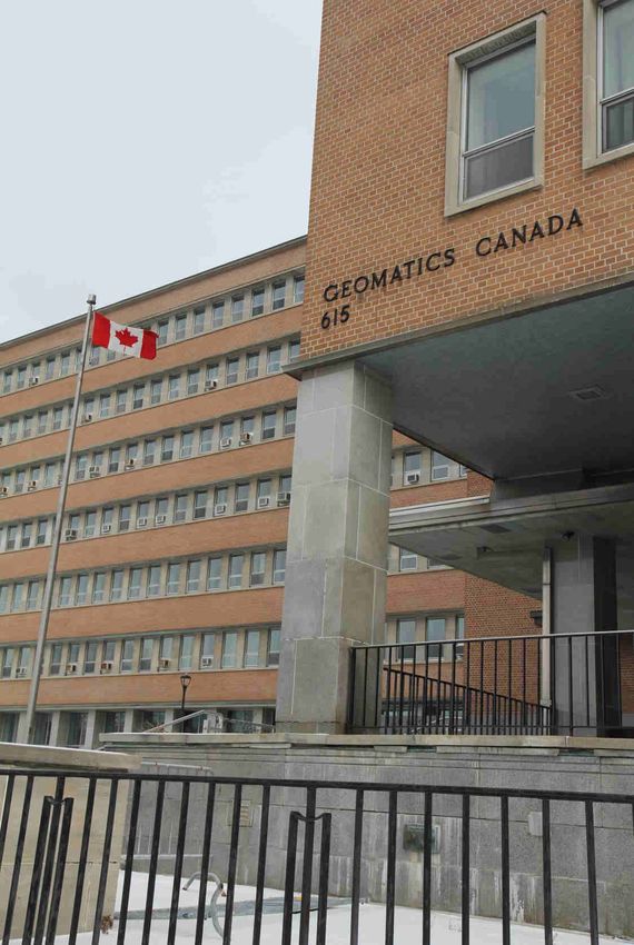
Page 4

                     Commanding Officer, Mapping and Charting Establishment
                     Commandant, Service de cartographie
                     LCol Jamie Hopkins
                     The theme for this year’s mapper is, “We are moving,” which could have been the theme for
                     many mappers in the past, but this time it is actually going to happen. Unlike previous moves
                     it is clear that the building is going to be closed and the site re-developed.

The Army Survey Establishment (ASE) moved into 615 Booth Street in 1961, five years before the unit was re-
named the Mapping and Charting Establishment (MCE). In the 59 years we have been on Booth Street MCE: sur-
veyed and mapped the arctic; moved from analogue to digital processes, for the 75 th Anniversary of Military Map-
ping in 1978 had a peak on Baffin Island renamed, “Military Survey Mountain;” moved from being essentially
non-deployable (outside of the yearly survey campaigns) to supporting domestic and expeditionary operations
with deployed soldiers, and on a few occasions civilians, as well as with base-plant production and reach-back;
the amalgamation of the Topographic Survey and Map Reproduction Technician occupations into the Geomatics
Technician Occupation; MCE has been and continues to be a part of several international co-production pro-
grammes; we have soldiers that graduate from a civilian college as a part of their initial training; we support safe-
ty of navigation for both the Royal Canadian Navy (RCN, and Royal Canadian Air Force (RCAF); and we have
moved more towards web services to better support clients who are more geo savvy than in the past. This list
could go on and I am sure I have missed some things that people would like to highlight, but I need to keep my
thoughts down to article length.

The future will see new challenges with the main body of MCE now housed on Booth Street being split between
Tunney’s Pasture and the Canadian Forces Map Depot on Bentley Avenue, making an already dispersed unit
more so. The move will also bring new opportunities the foremost being co-location with the Canadian Forces
Joint Imagery Centre (CFJIC) will ease collaboration between the two units in areas of mutual Geospatial Intelli-
gence (GEOINT) interest. There will also be stability for many people as the Hydrographic Services Offices, the
Aeronautical Services Offices, the CFMD, and the School of Military Mapping’s presence at Algonquin College will
remain in place for the foreseeable future.

We must also acknowledge that the move is temporary, albeit long term because Tunney’s pasture will also be
divested from the government’s real property portfolio. That being said the subsequent project is already in its
initial stages. I am sure that a decade or so from now that there will be another mapper with a similar theme to
this one.

Finally, I would like to acknowledge that MCE is not a place it is people, and some of those people will use the
move as a natural point in time to retire and move on with the next phase of their lives. Mrs. Kathy Brady is the
first, but will not be the last do take this step. I would like to thank Kathy for her 46 years of service to MCE and
for her support to me personally over the years, particularly in my time as Commanding Officer. To everyone else
who follows Kathy into retirement as a part of the move I thank you all for your valuable contribution and wish
you luck in the future. You will all always be a part of the MCE family.

OSTENDAMUS VIAM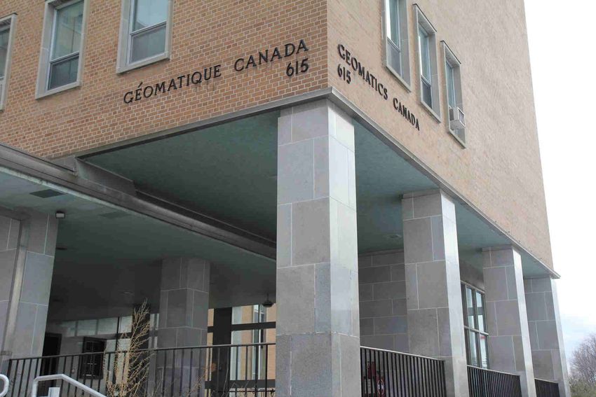
Page 5

                     Le thème du Cartographe Militaire de cette année est « Nous déménageons », ce qui aurait
                     pu l’être de nombreuses fois par le passé; toutefois, c’est ce qui va vraiment se produire
                     cette fois-ci. Contrairement aux déménagements précédents, il est indéniable que le bâti-
                     ment sera fermé et que le site sera réaménagé.

                       Le Service topographique de l’Armée (STA) a déménagé au 615, rue Booth, en 1961, cinq
                       ans avant que l’unité soit renommée le Service de cartographie (S Carto). Nous sommes à
cet emplacement depuis 59 ans, et le S Carto a participé durant cette période à de nombreux projets. Nous
avons arpenté et cartographié l’Arctique, et nos services ont évolué en passant des processus analogiques aux
processus numériques. En 1978, dans le cadre du 75e anniversaire de la cartographie militaire, un des som-
mets sur l’île de Baffin a été renommé le mont « Military Survey ». En outre, nos services qui étaient essentielle-
ment non déployables (sauf dans le cadre des campagnes d’arpentage annuelles) le sont devenus pour appuyer
des opérations nationales et expéditionnaires auxquelles participent sur le terrain nos soldats et, à l’occasion,
certains de nos civils ainsi que la troupe de production de la base et l’appui extérieur. Les professions de techni-
cien de levé topographique et de technicien dessinateur-cartographe sont devenues une seule et même profes-
sion : technicien en géomatique. Le S Carto a participé à plusieurs programmes internationaux de coproduction
et continue de le faire. Certains de nos soldats obtiennent un diplôme d’un collège civil dans le cadre de leur
formation initiale. Nous contribuons à la sécurité de la navigation autant pour la Marine royale cana-
dienne (MRC) que pour l’Aviation royale canadienne (ARC). Enfin, nos services ont évolué davantage vers le Web
afin de mieux appuyer nos clients qui s’y connaissent plus en géomatique que par le passé. Cette liste pourrait
se poursuivre, et je suis convaincu que j’ai oublié certaines choses que les gens aimeraient souligner, mais je
dois me limiter à la longueur de l’article.

De nouveaux défis se présenteront à l’avenir, car le corps principal du S Carto se trouvant maintenant sur la rue
Booth sera localisé à deux emplacements différents, soit au pré Tunney, soit au Dépôt des cartes des Forces
canadiennes sur l’avenue Bentley, ce qui fera du S Carto une unité encore plus dispersée. Le déménagement
offrira également de nouvelles possibilités dont la plus importante sera une colocation avec le Centre d’image-
rie interarmées des Forces canadiennes (CIIFC), ce qui facilitera la collaboration entre les deux unités dans les
domaines d’intérêts communs liés au renseignement géospatial (GEOINT). Il y aura également une stabilité pour
de nombreuses personnes puisque les bureaux des Services hydrographiques, des Services aéronautiques et
du Dépôt des cartes des Forces canadiennes ainsi que les installations de l’École de cartographie militaire au
Collège Algonquin resteront en place dans un avenir prévisible.

Nous devons également reconnaître que le déménagement est temporaire, même si c’est à long terme, car le
pré Tunney sera également retiré du portefeuille immobilier du gouvernement. Cela dit, le projet qui s’ensuit en
est déjà à ses débuts. Je suis persuadé que d’ici une dizaine d’années, il y aura un autre Military Mapper sur un
thème semblable à celui-ci.

Pour conclure, j’aimerais souligner que le S Carto n’est pas un emplacement : ce sont des gens, et certaines de
ces personnes verront le déménagement comme le moment opportun et naturel de prendre leur retraite et de
passer à la prochaine étape de leur vie. C’est notamment le cas de madame Kathy Brady qui est la première,
mais qui ne sera certainement pas la dernière à prendre cette décision. Je souhaite remercier Kathy de ses
46 ans de service au sein du S Carto et du soutien qu’elle m’a apporté personnellement au fil des ans, particu-
lièrement au cours de mon mandat en tant que commandant. À tous les autres qui suivront Kathy dans cette
décision de partir à la retraite dans la foulée du déménagement, je vous remercie de votre précieuse contribu-
tion et je vous souhaite bonne chance pour l’avenir. Vous ferez toujours partie de la famille du S Carto.
Page 6

                        Regimental Sergeant Major
                        Adjudant-Chef Régimentaire
                        CWO/AdjC Dominic Pintal

                        LEAD THE CHANGE AND DON’T BE QUICK TO DISMISS

                        Change is often difficult to lead and manage in the best of cases, and this is especially
                        true when change is forced upon us. By now, the notion of the move has had time to
set into the minds of the members of the Mapping and Charting Establishment (MCE), but justifiably, some
may still be left with anxieties of what is to come. When we discuss change, most of us think in terms of ben-
efits and losses to evaluate the merit of change however since this move is involuntary, we should still com-
prehend the gains and losses in order to best posture ourselves and manage expectations. As our folks will
ultimately find themselves at either 101 Goldenrod (Tunney’s Pasture) or 130 Bentley Avenue (Canadian
Forces Map Depot) the move will unsurprisingly result in adjusting our transportation, our daily routines as
well as our workplace relationships. While some members might be willing to flow with whatever is to hap-
pen, it’s important to note that others might have a harder time with the inevitable closure of 615 Booth
Street. For almost 60 years, 615 Booth Street has been the “mothership” and home to the Geo community,
military Surveyors, Map Reproduction Techs, Geo Techs, a variety of military support trades, Public Servants
and others to name a few.
Leaders must expect some resistance from within an organisation when facing major change, but they must
also be mindful not to think that they will always encounter obstruction to change. What is important is that
we (the leaders) remind ourselves that a negative (human) response to change doesn’t always represent lim-
itations in people’s ability to adapt. In other words, resistance may not necessarily embody a lack of commit-
ment for change but may exist out of allegiance to the memories, traditions, and in this particular case, the
unit and its history. Change can also be a challenging experience for those who have found familiarity or their
“comfort zone”. With this imminent move, the Mapping and Charting Establishment is sure to be different
and it may be difficult to appreciate all that this will encompass. Change can be a disruptive agent but since
this move is unavoidable due to the building closure, perhaps we should exploit and capitalise on this oppor-
tunity as a catalyst to re-shape and re-brand. This is indeed a significant occasion to self-regulate as things
are bound to change and ensure we can maintain organisational relevancy in meeting the needs of the Ca-
nadian Armed Forces and the Department of National Defense.
Ultimately, change impacts people and successful change depends on embracing the challenge. The leader-
ship will ensure it is well prepared to ease the transition of its members and help mitigate the issues that will
surely arise. The MCE leadership (at all levels) will remain steadfast and committed to the relocation effort.
Since this process is already underway, I remind all members of MCE, civilians and military alike to respect
those that may require additional time to settle into the mindset of this change and in particular, after the
physical move has been completed. This is when we will truly be tested as the nuances and adjustments be-
come apparent. As MCE continues to evolve and begin a fresh chapter in its history, I am convinced that we
will persevere through the initial hurdles which will afford us an opportunity to exhibit our professionalism
and resolve.
Proudly yours,

“Vision without systems thinking ends up painting lovely pictures of the future with no deep understanding of
the forces that must be mastered to move here to there.”
    Senge, P (2006), The Fifth Discipline: The Art & Practice of The Learning Organization, (pp. 12), Doubleday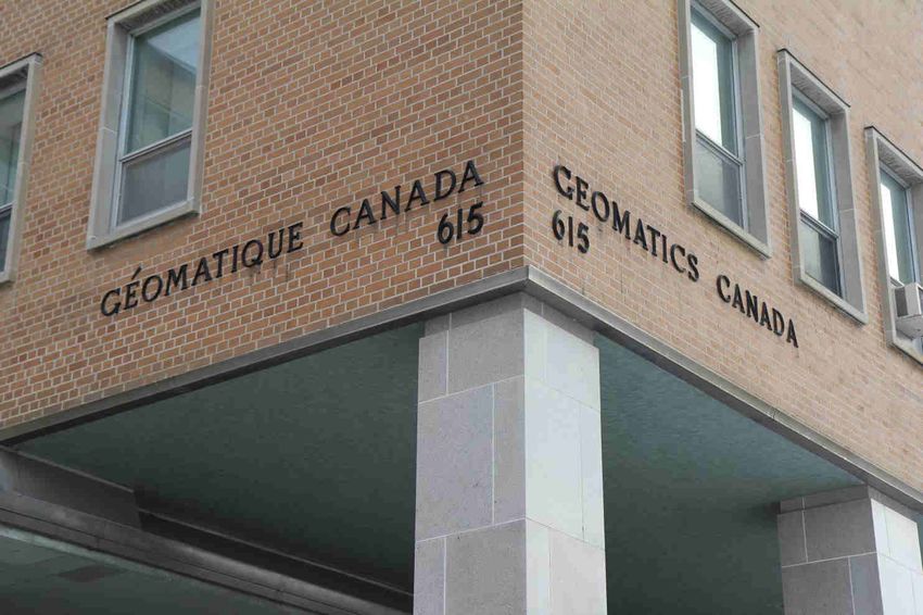
Page 7

MENER LE CHANGEMENT ET NE PAS ÊTRE PROMPT À Y RENONCER
Le changement est souvent difficile à diriger et à gérer dans le meilleur des cas, et c’est particulièrement vrai
lorsqu'il est obligatoire. À ce jour, la notion de déménagement a eu le temps de s’imposer dans l’esprit des
membres du Service de cartographie (S Carto); toutefois, chez certaines personnes, des craintes peuvent à juste
titre persister concernant l’avenir. Lorsque nous discutons du changement, la plupart d’entre nous pensent aux
avantages et aux inconvénients liés au changement pour en évaluer le mérite; toutefois, comme ce déménage-
ment est hors de notre volonté, nous devrions quand même en comprendre les gains et les pertes afin de mieux
nous positionner et gérer nos attentes. Il n’est pas surprenant que ce déménagement nous oblige à modifier nos
habitudes de transport, nos activités quotidiennes ainsi que nos relations de travail, étant donné que nos effectifs
se retrouveront soit au 101, Goldenrod (pré Tunney), soit au 130, avenue Bentley (Dépôt des cartes des Forces
canadiennes). Bien que certaines personnes soient prêtes à accepter ce qui se passera, il est important de noter
que d’autres pourraient avoir plus de difficulté en raison de la fermeture inévitable du 615, rue Booth. Depuis
près de 60 ans, le 615, rue Booth est le « vaisseau mère » et le foyer de la communauté géomatique des arpen-
teurs militaires, des techniciens dessinateurs-cartographes, des techniciens en géomatique, d’un grand nombre
de groupes professionnels militaires qui appuient le S Carto, de fonctionnaires et d’autres, pour n’en nommer que
quelques-uns.
Les leaders doivent s’attendre à une certaine résistance au sein d’une organisation lorsqu’un changement ma-
jeur survient, mais ils doivent aussi ne pas penser qu’ils se heurteront toujours à des obstacles au changement.
Ce qui est important, c’est que nous (les leaders) nous rappelons qu’une réaction (humaine) négative au change-
ment ne représente pas toujours des limites à la capacité d’adaptation des personnes. Autrement dit, la résis-
tance ne constitue pas nécessairement un manque d’engagement pour le changement, mais elle peut exister par
allégeance aux souvenirs, aux traditions et, dans ce cas particulier, à l’unité et à son histoire. Le changement
peut aussi s’avérer une expérience difficile pour les personnes qui ont leurs habitudes et leur « zone de confort ».
À la suite de ce déménagement imminent, le S Carto sera certainement différent, et il pourrait s’avérer difficile
d’apprécier tout ce que cela comprendra. Le changement peut être un agent perturbateur, mais étant donné que
ce déménagement est inévitable en raison de la fermeture du bâtiment, nous devrions peut-être exploiter cette
occasion et profiter de celle-ci comme d’un catalyseur pour remodeler et repositionner notre image de marque.
Ce changement constitue, en effet, une occasion importante de s’autoréglementer, car les choses sont appelées
à changer, et nous devons nous assurer que nous pouvons maintenir la pertinence organisationnelle voulue pour
satisfaire aux besoins des Forces armées canadiennes et du ministère de la Défense nationale.
En définitive, le changement a des répercussions sur les personnes, et le succès du changement dépend de la
capacité de relever le défi. Les leaders s’assureront que le changement est bien préparé afin de faciliter la transi-
tion des membres du personnel et d’aider à atténuer les problèmes qui pourraient certainement survenir. Les
leaders (à tous les niveaux) du S Carto resteront inébranlables et déterminés à poursuivre les efforts visant la re-
localisation. Étant donné que ce processus est déjà en cours, je rappelle à tous les membres du S Carto, autant
les civils que les militaires, de respecter les personnes qui pourraient avoir besoin de plus de temps pour accep-
ter ce changement dans leur esprit et, en particulier, une fois le déménagement physique terminé. C’est à ce mo-
ment-là que nous serons vraiment mis à l’épreuve, étant donné que les nuances et les ajustements à faire de-
viendront manifestes. Alors que le S Carto continue d’évoluer et entame un nouveau chapitre de son histoire, je
suis persuadé que nous surmonterons les obstacles initiaux et que cela nous permettra de faire valoir notre pro-
fessionnalisme et notre détermination.
Fièrement vôtre,

« Une vision partagée sans raisonnement systématique n’est rien d’autre qu’une belle représentation de l’avenir. Sans
aucune idée de la manière dont il faut maîtriser les moyens de l’atteindre. »
    Senge, P. (1991), La cinquième discipline : l’art et la manière des organisations qui apprennent, (p. 28), First.
Page 8

                           Deputy Commanding Officer / Commandant adjoint
                           Major Denis Sweet
                           Moving Forward / Progresser!

                          After nearly 60 years of calling 615 Booth street home and many of those years being
                          told “don’t get too comfortable, we are moving soon” it appears the time is actually up-
                          on us. It may be hard to believe that MCE will ever move from Booth Street but with de-
                          signs complete and construction contracts going out for tender it is pretty safe to say
                          that we will be moving. The exact date of the move is not final yet but we know where
we will be going (101 Goldenrod and 130 Bentley) and that it will be in summer 2020.

          It will be sad to leave our bats, non-potable water and random parking lot closures behind but the new fa-
cilities will provide a few positives. Geo Sp Sqn will have ample space to conduct training and prepare Geo techs
for deployments and surveys. The School of Military Mapping will be getting a new purpose built space including an
additional classroom allowing for new courses to be run in conjunction with CFJIC and DLCSPM. Foundation Pro-
duction Squadron will get a more collaborative work environment with improved access to source data and the
systems required to accomplish their work. GI&S Sqn will be able to take advantage of the newly operational data
diode with their new work space supporting CSNI at every desk. Engineering’s new purpose built assembly and
secure storage area will meet MCE’s growing needs to support GEOINT activities. In addition, co-location with CFJIC
will allow us to explore the synergies between the two units, a crucial step as we move forward in developing Cana-
da’s GEOINT capabilities.

        The move also brings with it opportunities to upgrade our IT systems. Some of these opportunities like the
disaster recovery site’s major upgrades to allow it to handle workloads as the main site is moved to 101 Golden-
rod and new backup systems to replace the antiquated tape system are already being realised. Without the move
many of these upgrades would not have been supported, risking major IT failures.

          Just as the unit was told in 1960, these new buildings are temporary accommodations but unlike in 1960
the design meetings for our purpose built facility are already underway. The new National Defence Secure Campus
is in the early design phase with expected delivery in 2032-2034. This new campus will see MCE reunited in a fa-
cility that is being designed to meet the GEOINT demands of the future. There are big changes and challenges
coming in 2020 but with these there is opportunity for advancement. Of special note: there have been fewer bats
reported in the new locations.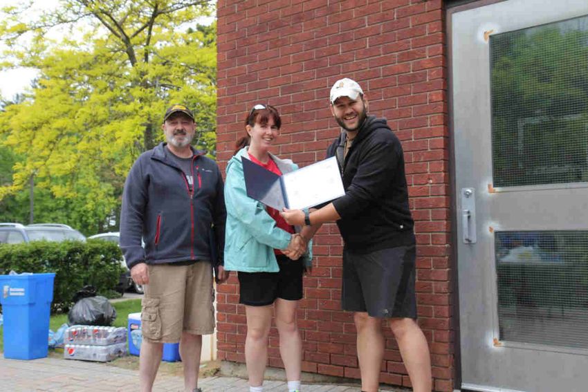
Page 9

        Après plus de 60 ans à appeler le 615 rue Booth notre chez nous et de nous faire dire de ne pas nous
mettre trop confortable car nous déménageons bientôt, il semble bien que ce moment soit bel et bien arrivé. Il est
peut-être difficile de croire que le S Carto quittera la rue Booth, mais avec la conception terminée et les contrats de
construction mis en adjudication, il est assez sûr de dire que nous déménagerons. La date exacte du déménage-
ment n'est pas encore définitive, mais nous savons où nous irons, soit au101 Goldenrod et 130 Bentley pendant
l'été 2020. Il sera triste de laisser nos chauves-souris, notre eau non-potable et nos fermetures de stationnement,
mais les nouvelles installations apporteront quelques points positifs.

        L’Esc de Sp Geo disposera suffisamment d'espace pour offrir une formation et préparer les géomaticiens
aux déploiements et à faire de l’arpentage. L'École de cartographie militaire obtiendra un nouvel espace spéciale-
ment conçu, y compris une salle de classe supplémentaire permettant d'organiser de nouveaux cours en collabora-
tion avec le Centre d'imagerie interarmées des Forces canadiennes (CIIFC) et le Directeur - Administration du pro-
gramme des systèmes de commandement terrestre (DAPSCT).L'Esc de Production de Fondation bénéficiera d'un
environnement de travail plus collaboratif avec un accès amélioré aux données sources et aux systèmes requis
pour accomplir son travail. L’Esc d’I&SG pourra profiter de la nouvelle diode de données opérationnelle avec son
nouvel espace de travail ou chaque espace de travail pourra être connecté à l’IRSC. La nouvelle zone de stockage
et d’assemblage sécurisée de l'ingénierie répondront aux besoins croissants du S Carto pour soutenir les activités
de RensGeo. De plus, la co-localisation avec CIIFC nous permettra d’explorer les synergies entre les deux unités,
une étape cruciale à mesure que nous progressons dans le développement des capacités RensGeo du Canada.

         Cette décision apporte également des opportunités de mise à niveau de nos systèmes informatiques. Cer-
taines de ces opportunités par exemple sont, les mises à niveau majeures du site de reprise après sinistre, le dé-
placement du site principal au 101 Goldenrod et l’amélioration de nouveaux systèmes de sauvegarde pour rempla-
cer le système de bandes obsolètes sont déjà en cours de réalisation. Sans le déménagement, bon nombre de ces
mises à niveau n'auraient pas été prises en charge, ce qui risquerait de provoquer des pannes informatiques ma-
jeures.
        Tout comme en 1960, l’unité avait reçu comme information que ces nouveaux bâtiments sont des loge-
ments temporaires, mais contrairement à cette période, les réunions de conception de notre future installation son
déjà entamé. Le nouveau campus qui nous logera est en phase de conception initiale et devrait être livré en 2032-
2034. Il verra le S Carto réuni dans une installation conçue pour répondre aux exigences de RensGeo futur.
Il y a de grands changements et défis à venir en 2020 mais avec ceux-ci il y a des opportunités d'avancement. À
noter: moins de chauves-souris ont été signalées dans les nouveaux locaux.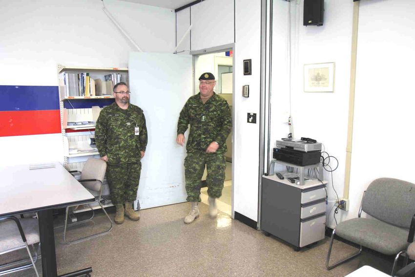
Page
  Page10
       10

                            New Opportunities!
                            Maj Eric S. Godin, OC GI&S Sqn

                            It was asked to write articles for the 2019 military Mapper edition to reflect on MCE’s
                            move to new locations as it has to vacate 615 Booth this upcoming year. For real this
                            time! Hence, according to some civilian personnel, MCE has been on notice to move for
                            the past 20 years.

Being posted to this unit for two years now, at the reins of the Geospatial Information and Services (GI&S) Squadron
(Sqn), I can confirm this sub-unit will have its own challenges being a very complex organization already located in six
different locations across Canada. With this move, say APS 2020, the Sqn HQ and 6 Tp will see itself relocated to
Tunney’s Pasture and be co-located with the Satellite Imagery Order Desk (SIOD) already in place, while status quo
for the remaining Sqn elements, i.e. the Aeronautical Service Office (ASO), the Canadian Forces Map Depot (CFMD),
Hydrographic Service Offices (HSO) located at the Ottawa airport, Bentley Ave and the two Canadian coasts respec-
tively.

Our Sqn’s approached to this move has been very much in line with the combat arms attitude, in my own opinion at
least; let’s not make too many grandiose plans as it will change anyways. Over all, tell us where we sit and make sure
we have the right connectivity to do our work, as for the rest, we will figure it out! As always being in Ottawa means
bureaucratic processes will inevitably delay projects and new endeavors.

This move will provide opportunities to work closely and create new ties with our sister unit, CFJIC, located at Tun-
ney’s. Streamlining processes and improving workflows on all levels of network will definitely be key as we will be
collocated with the proper infrastructure to enable such practices. Examples of improving services will be the acquisi-
tion of satellite imagery, webmaps, and geospatial data pushed and pulled on all networks. This relocation will also
force us to have new TTPs and highlight requirements for the upcoming secure campus that will host CF Int Gp units
IVO Carling Campus. Once MCE LAN is connected to all elements of the Sqn, minus the ASO, the distribution function
will most likely be relocated to Bently Ave. From there, the entire distribution process, weather it be as hard copy
maps or electronic file delivery products will be managed for clients. As well there will be an opportunity to combine
all of MCE’s printing capabilities and distribution within one entity. This will definitely streamline requests, printing,
and the delivery of products to clients.

As technology evolves, so do our requirements and way of doing business. If we want to remain relevant and carry on
with our mission we have to take every opportunity to better ourselves. This also includes listening to people’s ideas
and taking them into consideration when planning, this not only from leadership but from all ranks, including civilian
and military personnel. This relocation will benefit MCE, and will certainly give GI&S Sqn a chance to continue the
great work that it has accomplished over the years.
Page 11
Nouvelles opportunités!
Maj Eric S. Godin, OC esq I&SG
Il a eu une requête pour qu’un article soit écrit pour l’édition 2019 du Cartographe Mili-
taire afin de faire une réflexion sur le déménagement du S Carto, afin de libérer le 615
Booth à l’été 2020. Et cette fois, pour vrai, car selon certain employé de longue date, le S
Carto déménage depuis plus de 20 ans.
Étant en poste depuis deux ans, au commande de l’escadron d’information et service géospatiaux, je suis en me-
sure de confirmer que mon sous-unité aura ses propres défis à relever. Occupant déjà six endroits différents à
travers le Canada, ce déménagement, disons en fin d’été, verra le QG d’esc et ainsi que la Tp 6 relocalisés au pré
Tunney, ou le bureau de commande d’imagerie satellite y est déjà en place. Alors que le reste de l’esc maintien-
dra le statu quo, soit le bureau des services aéronautiques (BSA), le dépôt des cartes des forces canadiennes et
le bureau des services hydrographiques (BSH) demeureront respectivement à l’aéroport d’Ottawa, sur l’ave Ben-
tley et au deux côtes canadiennes.
Notre approche face au déménagement est semblable à la mentalité des armes de combats, du moins selon mon
avis, ne faisons pas trop de plan grandiose, car ils changeront de toute façon. Globalement, assigner nous des
places et faites certains qu’on aura la bonne connectivité pour faire notre boulot, et pour le reste, on va s’arran-
ger! Étant à Ottawa, les processus bureaucratique ne manquent pas et retardent toujours tous les projets.
Ce déménagement permettra de travailler en étroite collaboration et de créer de nouveaux liens avec notre unité
sœur, CIIFC situé au pré Tunney. La rationalisation des processus et l’amélioration des flux de travail à tous les
niveaux du réseau seront définitivement essentielles car nous disposerons de l’infrastructure appropriée pour
permettre de telles pratiques. L'acquisition d'images satellite, de cartes Web et de données géospatiales diffu-
sées sur tous les réseaux est un exemple d'amélioration des services. Ce déménagement nous forcera de revoir
nos pratiques courantes et d’identifier les nouveaux besoins pour le développement du futur campus qui accueil-
lera les unités du Gp Rens FC près du campus Carling. Lorsque le réseau intranet du S Carto sera établi à tous les
éléments de l’esc, le BSA en moins, la fonction de distribution sera relocalisé sur l’ave Bentley. De là, le proces-
sus de distribution entier, que ce soit une requête de données électroniques ou une carte format papier, pourra
être effectué pour nos clients. De plus, il y aura une opportunité de centraliser tous les capabilités d’impression
du S Carto sous une même chaine de commandement. Ceci permettra définitivement d’augmenter l’efficacité du
processus d’acquisition pour les clients.
Au fur et à mesure que la technologie évolue, il en va de même pour nos exigences et de notre manière de faire
les affaires. Si nous voulons rester pertinents et poursuivre notre mission, nous devons saisir toutes les occa-
sions pour nous améliorer. Cela implique également d’écouter les idées des gens et de les prendre en compte
lors de la planification, et ce, non seulement de la part des dirigeants, mais aussi de tous les membres, y compris
du personnel civil et militaire. Cette relocalisation bénéficiera le S Carto, mais donnera surtout la chance à notre
escadron de se démarquer davantage et de continuer l'excellent travail qu'il a accompli au fil des ans.Page 12
School of Military Mapping Update
Maj Andrew Colpitts, Commandant SMM
In 2019 the Military Mapper focuses on the theme of the planned departure of the Map-
ping and Charting Establishment (MCE) from 615 Booth Street, Ottawa in 2020. We look
back on decades of history in this building, of which the Canadian Forces School of Military Mapping (CFSMM)
has shared a significant part. For much of that history, the unit has been told “don’t get too comfortable, be-
cause we’re moving.” Now, however, there is a Plan. There is a Move Project.
According to the plan, elements of MCE currently at 615 Booth Street will be divided into two, with some moving
to the Canadian Forces Map Depot (CFMD) building on 130 Bentley Avenue and others moving to 101 Golden-
rod Driveway to be co-housed with the Canadian Forces Joint Imagery Centre (CFJIC). The CFSMM elements at
615 Booth Street will move to the CFMD, where new classrooms and offices will be built. Only a few elements of
MCE will remain unaffected by this move. One of those elements that will not be directly affected has become
affectionately known as the School of Military Mapping at Algonquin College (SMMAC), which in 2017 passed its
10-year anniversary without any fuss. SMMAC integrates military instructors, topics and assignments into a cus-
tom-built academic program delivered by Algonquin College. This integrated hybrid approach is unique in Cana-
da.
When I arrived at MCE in October 2013, SMMAC was only six years old, and I was the “new guy,” among the of-
ficers. Six years later, SMMAC is one of the current sections with the longest history of stability, and I am the
longest continuously-serving officer of the unit (among those currently posted here, at least). This reversal has
been an amusing phenomenon.
Where are we going?
Letting history be the backdrop, this article addresses the direction in which Geomatics Technician (Geo Tech)
occupational training is heading. We know where the elements of the CFSMM will be physically located, but
what will our training look like? What will we modify so that we remain relevant to the requirements being
placed on Geo Techs? It’s true; I will leave MCE in 2020 and I will be replaced by another officer who may have
different ideas. But having had more than two years to ponder it, here’s what I think:
Corporal Rank Qualification (Cpl RQ)
The basic occupational course currently taught at SMMAC is functional. In 2009, when I was the Engineer Intel-
ligence Officer at 2 Combat Engineer Regiment in Petawawa, and de-facto Troop Commander of the Regiment’s
fledgling Geomatics Troop, I was the beneficiary of the first graduates of this program.
A few times a year I am challenged about the cost and the duration of the program, but the fact remains that
Geo Techs require a significant baseline knowledge to perform their tasks. The program is also cost-effective as
long as class sizes remain sufficiently large. Program costs are as low as $1000 per student-month of training,
compared to $1000 per student-week of training for our other courses, and that figure accounts for meals and
lodging alone, not for transportation, hardware or software costs.
This is not to say, however, that the Cpl RQ cannot be improved. The CFSMM is currently working to establish
Military Modules for the course, to enable students who have equivalent academic qualifications to undergo
their training and become fully-qualified in a shorter timeframe. Concurrently this modularization process may
allow other academic institutions to apply for program equivalency for the non-military-specific portions of thePage 13 Cpl RQ course which will both facilitate Prior Learning Assessment and Recognition (PLAR) for qualified candi- dates and will also open the door for other academic institutions to supplement the production of Algonquin Col- lege, especially for those candidates whose first official language is French. Data Management and Web-Based Services It is my desire to integrate most of the content of the Occupational Specialty Qualification (OSQ) for Geospatial Data and Services Specialists (GDSS) into the Cpl RQ so that these skills become a baseline requirement for Geo Techs. Many customers already require services-based data such as Tile Packages (TPKs) or MapBox tile- sets to feed their applications. All of the applications in the Land Command Support System (LCSS) suite as- sume that basic Web Map Service (WMS) endpoints are available, or are moving in that direction. Networks op- erating at the sub-unit level are providing these service endpoints using MapSpark, but the datasets needed to update these services should be produced and maintained by Geo Techs. If you are a Geo Tech and you don’t know how to adjust your symbology for web display and tailor your data for multiple scales to produce TPKs and tilesets, you are already behind the curve. This is a general requirement that is not, and will not be, limited to LCSS. It’s our objective at the CFSMM to make web services (and related multi-scale data formats) production and management normative across the Geo Tech trade, but actually doing this is a challenge. We may need to rear- range or cut some other content in the Cpl RQ, or attach an additional module to the end of the course. We need to modify our assignments and Validation Exercises to verify these skillsets. We need to modify the Geo-
Page 14

 matics Support Team (GST) Commander’s course to ensure that GST Commanders are able to effectively plan,
 direct, supervise and provide quality assurance for web services. We also need to find a cost-effective and man-
 ageable way to do this at Algonquin College in terms of additional hardware and software. We are currently try-
 ing to determine the best course of action for all of this.
 LCSS-Specific Training

                           Mise à jour de l'école de cartographie militaire
                           Maj Andrew Colpitts Commandant du ecm

                      En 2019, le Military Mapper se concentre sur le thème du départ du Ser-
                      vice de cartographie (S Carto) du 615, rue Booth, Ottawa, en 2020. Nous passons en re-
                      vue des décennies d'histoire dans cet édifice, dont l'École de cartographie militaire des
                      Forces canadiennes (ÉCMFC) a partagé une partie importante. Pendant une bonne partie
                      de cette histoire, il y avait au sein de l’unité une proverbe omniprésente « soyez vigilant,
                      car nous déménageons bientôt ». Finalement, en revanche il existe un Plan. Nous avons
un Projet de déménagement.
Selon le plan, les éléments de l’ÉCMFC situés au 615, rue Booth seront déplacés vers le Dépôt des cartes des
Forces canadiennes (DCFC), où de nouvelles salles de classe et de nouveaux bureaux seront construits. Seuls
quelques éléments de MCE resteront inchangés par ce déménagement. L'un de ces éléments qui ne sera pas di-
rectement affecté est devenu affectueusement connu sous le nom de l'École de cartographie militaire au Collège
Algonquin (ÉCMCA), qui a célébré en 2017 son 10e anniversaire sans fanfare. L’ÉCMCA intègre des instructeurs,
des sujets et des tâches militaires dans un programme académique adaptée aux besoins des Forces canadiennes
et opéré par le Collège Algonquin. Cette approche hybride intégrée est unique au Canada.
Lors de mon arrivé au S Carto en octobre 2013, l’ÉCMCA n'avait que six ans et j'étais le « nouveau gars » parmi les
officiers. Plus que six ans plus tard, l’ÉCMCA est l’une des sections de l’unité actuelles qui possède la plus longue
histoire de stabilité et je suis l’officier avec la plus longue histoire de service continue (parmi ceux qui sont actuelle-
ment en poste ici). Ce renversement est un phénomène amusant.
Où allons-nous?
En contexte de notre histoire, cet article traite la trajectoire prévu de l’entraînement occupationnelle des Techni-
ciens en Géomatique (Tech Géo). Nous savons où seront situés physiquement les éléments de l’ÉCMFC, mais à
quoi ressemblera notre entraînement? Que modifierons-nous pour rester pertinents par rapport aux exigences im-
posées aux Techs Géo? C'est vrai; Je quitterai l’unité en 2020 et je serai remplacé par un autre officier qui pourrait
avoir des idées différentes. Mais après avoir eu plus de deux ans pour y réfléchir, voici ce que je pense :
Qualification de grade Caporal (QG Cpl)
Le cours professionnel de base actuellement enseigné à l’ÉCMCA est fonctionnel. En 2009, lorsque j’étais l’officier
du renseignement-genie du 2e Régiment du génie de combat (2 CER) à Petawawa et commandant de facto de la
troupe de Géomatique nouvellement formée du régiment, j’étais le bénéficiaire des premiers diplômés de ce pro-
gramme.
Quelques fois par an, le coût et la durée du programme sont mises en question, mais le fait demeure que les Techs
Géo ont besoin des connaissances de base importantes pour s'acquitter de leurs tâches. Le programme est égale-
ment rentable lorsque la quantité des étudiants reste suffisamment grande. Les coûts du programme sont aussi
bas que 1 000$ par mois de formation par élève, comparés à 1 000$ par semaine de formation par élève pour
nos autres cours. Ce chiffre ne comprend que les repas et le logement, et non les coûts de transport, de matériel
et de logiciels.
Page 15
Cependant, Je ne veux pas dire que le QG Cpl ne peut pas être amélioré. L’ÉCMFC vise actuellement à établir des
Modules Militaires pour ce cours, afin de permettre aux étudiants ayant des qualifications académiques équiva-
lentes d’être pleinement qualifiés dans un délai plus court. Parallèlement, ce processus de modularisation peut
permettre à d’autres établissements académiques d’établir l’équivalence aux éléments académiques du QG Cpl,
ce qui facilitera à la fois l’évaluation et la reconnaissance des acquis (ÉRA) pour les candidats qualifiés. Cet équi-
valence aidera en particulier les candidats dont la première langue officielle est le français.
Gestion de données et services en ligne
Je souhaite intégrer la majeure partie du contenu de la Qualification de spécialisation professionnelle (QSP) pour
les Spécialistes des données et des services géospatiaux (SDSG) au QG Cpl afin que ces compétences deviennent
une exigence de base pour les Techs Géo. De nombreux clients ont déjà besoin de données basées sur des ser-
vices-web, tels que des Tile Packages (TPK) ou des ensembles de mosaïque pour MapBox, pour alimenter leurs
applications. Toutes les applications de la Système d’appui tactique terrestre (SATT) sont construits selon la sup-
position que les services-web géospatiaux seront disponsibles au niveau du réseau. Les réseaux opérant au ni-
veau des bases d’opérations avancées (BOA) fournissent ces services-web à l’aide d’un serveur MapSpark, mais
les ensembles de données nécessaires à la mise à jour de ces services doivent être produits et gérés par les
Techs Géo. Si vous êtes un Tech Géo et que vous ne savez pas comment ajuster votre symbologie pour l'affichage
aux services-web et adapter vos données pour plusieurs échelles, vous êtes déjà au risque d’être dépassé par la
technologie. Ces compétences s’agissent des exigences générales qui ne sont limitées au système LCSS.
À l’ÉCMFC, notre objectif est de normaliser la gestion et la production des services-web géospatiaux (et des for-
mats de données multi-échelle associés), mais réaliser cet objectif s’agit d’un défi. Nous aurons probablement
besoin de couper d’autre contenu du QG Cpl. Nous devons modifier nos tâches et nos exercices de validation
pour vérifier ces compétences. Nous devons modifier le cours du Commandant d’équipe de soutien Géomatique
(ÉSG) afin de nous assurer que les commandants des ÉSG sont en mesure de planifier, diriger, superviser et four-
nir une assurance de qualité efficace pour les services-web. Nous devons également trouver un moyen rentable et
gérable de le faire au Collège Algonquin en termes de matériel et de logiciels supplémentaires. Nous essayons
actuellement de déterminer le meilleur plan d'action pour tout cela.
LCSS-Specific Training
L’ÉCMFC est également cons-
cient de la nécessité de mieux
préparer les techniciens à pren-
dre en charge les applications
particulières associées aux ré-
seaux de base SATT. Nous envi-
sageons un programme de for-
mation pratique et court
(d’environs une semaine) pou-
vant être dispensé en partena-
riat avec le Directeur - Adminis-
tration du programme des sys-
tèmes de commandement ter-
restre (DAPSCT) aux techniciens
au moment et à l’endroit où ils
en auront besoin. En raison de
la nature en constante évolution des applications LCSS, cette qualification devrait expirer, avec une validité maxi-Page 16
male de 18 à 24 mois avant qu'un reprise ne soit nécessaire. Nous nous attendons à ce qu'une qualification va-
lide Soutien Géo au SATT soit une condition préalable à tout technicien déployant à une opération, exercise ou
unité qui utilise le réseau SATT.
Formation des Adjudants Techniciens en Géomatique
L’un des plus gros problèmes que nous avons actuellement se situe au niveau du QG de l’Adjudant. Le cours de
QG Adj nécessite une mise à jour et cette mise à jour devrait inclure un examen du contenu et du format du cours.
En termes de format, il y a peu de raisons pour que la majorité du QG Adj, même dans sa forme actuelle, ne
puisse être effectuée à distance. La plupart des sujets abordés dans le cours le sont dans d'autres cours et sup-
ports de formation. La partie de résidence du cours dans sa forme actuelle pourrait probablement être ramenée à
une semaine. De même, le QG Adj, au moins en théorie, partage un grand chevauchement avec le cours de Ges-
tionnaire du Renseignement Géospatial (GEOINT), qui sera dispensé par l’École du renseignement militaire des
Forces canadiennes (ÉRMFC). Il serait avantageux d’examiner les deux cours afin de déterminer où des gains d’ef-
ficacité peuvent être obtenus.
Conclusion
Il y a une écart profonde entre notre destination prévue et la réalité. Comme toujours, les problèmes de res-
sources empêchent le CFSMM de faire tout le développement que nous aimerions faire, tout en continuant à exé-
cuter la formation actuelle. Je souhaite que le CFSMM soit bien placé pour poursuivre le développement des cours
au-delà de 2020.
École de cartographie militaire terminéPage 17
Destination Unknown
MWO Chris Brace, Occupational Advisor & Centre of Excellence
The learning curve has been steep during my first year in the position that isn’t. Position
that isn’t, what? Correct, pending the approval to establish the new Geo Tech Occ Adv posi-
tion (hopefully 1 Apr 2020) my position does not exist. Therefore, my duties as Occ Adv will
be double hatted with my new role as the Geomatics Centre of Excellence (GCoE) MWO. In
this capacity, I will be moving with the School of Military Mapping to the Canadian Forces Map Depot. However, if
the established position of Occ Adv comes to fruition, I will be moving to Tunney’s Pasture with the HQ. Confused?
Dinna fash. Being the dedicated soldier you know me to be, I will go where I’m told. Overall, from the perspective of
the Occ Adv, I am very happy with the conduct of APS19. Moves were minimal. People (mostly) were happy with
their new locations. Our numbers are looking good with the class of 32 intake this year. Hopefully this will continue
for the next couple of years. So, as my shipping address remains unknown at this time, you have my assurances
that I will continue my best efforts to represent the Geomatics Trade and the outstanding technicians that make up
its’ ranks both as Occ Adv and GCoE.
Chimo
Destination mystère
Adjm Chris Brace, Conseiller du groupe professionnel militaire et Centre d'excellence
La courbe d’apprentissage fut raide pendant cette première année que j’ai passé dans une
« position qui n’existe pas ». Hein? Comment ça une position qui n’existe pas? Mais c’est
pourtant vrai! En attendant que soit formellement approuvé la création du nouveau poste
de Conseiller des techniciens en géomatique (le 1er avril 2020 si tout se déroule selon les
plans), ma position n'existe pas. Par conséquent, mes fonctions de conseiller GPM seront doublées de mon nou-
veau rôle en tant qu’Adjum du Centre d’excellence en géomatique. À ce titre, je me déplacerai en même temps
que l’École de cartographie militaire dans le Dépôt des cartes des Forces canadiennes lors du déménagement.
Cependant, si la position de conseiller parvient à exister formellement, je me déplacerai au pré Tunney avec le
quartier général de l’unité. C’est dur à suivre? Mais non, pas de panique. Tel que vous me connaissez, comme
tout bon soldat, je vais simplement aller là où on me dit d’aller! Pour ce qui est de mon point de vue de conseiller
GPM, je suis très heureux du déroulement des mutations en 2019. Les déménagements ont été minimisés. Les
membres étaient (pour la plupart) satisfaits de leurs nouvelles positions. Depuis l’arrivée récente de 32 nouveaux
membres sur la formation de base, nos effectifs sont devenus beaucoup plus enviables. Espérons que cette lan-
cée se poursuivra pendant les prochaines années. Bon, malgré que j’ignore encore mon adresse de destination à
l’issue du déménagement, je vous assure que je poursuivrai mes efforts pour représenter notre métier ainsi que
les géomaticiens exceptionnels qui en font partie, autant comme conseiller GPM qu’Adjum du Centre d’excellence
en géomatique.
ChimoPage 18
Being the Editor Sucks, But no one’s Editing my Comments!
MWO Ash Allan, Squadron Sergeant Major GI&S Sqn/Editor Military Mapper 2019
OK so it’s true that being the editor of any publication is a pain in the rump, but being in
possession of the eyes that are the last to check the content of the final product has cer-
tain advantages. So let me pull up a soap box and begin pontificating.
Well it seems the move away from Booth Street is finally a reality, it occurs to me that this
is a physical change that mirrors the functional change that has being slowly happening
over the last decade or so. Let me explain. First put on your helmets as the Geo war-stories begin, come to think of
it given the inherent nerd like nature of we Geo types perhaps a Star Wars Stormtrooper helmet would be more apt.
Back when I joined the trade in 2001 the majority of we military Geo Techs were employed within the hallowed
halls of MCE with only a few brave souls cast adrift within the sea of the CERs, a few HQ positions and of course
SOF. The work here at the mother ship was primarily concerned with base plant production of standard products,
the creation of a small number of custom Operational level products, the operation of the press, and survey. All of
which was done by folks in green with a small cadre of highly specialised civilian employees providing QC/QA, and
working behind the green door. Little did we realise that this small group of folks would grow to become fifty per-
cent of the unit and take over all of the vital production of foundation data and products. And praise be to the Fly-
ing Spaghetti Monster that they did, may you be touched by his noodly appendage! This has freed up Geo Techs to
be employed in the multitude of out-station positions we currently inhabit and began the shift in function and mind
set that we latest generation of Geo Techs have benefitted from. Most of us that have avoided working at MCE and
have instead been infatuated with what we do to support operations and operationally focussed units don’t really
resemble our forefathers in our beliefs of what a geo Tech is or does.
Firstly we are used to working within Intelligence organisations for Intelligence Officers. Granted for a while there
was a bit of a bun fight when we deployed if we belonged to Ops or Int, but that was resolved years ago with the J/
S/G 2 Intelligence staff taking ownership of the Geospatial Intelligence capability in all but a handful of cases.
Next we are comfortable with the reality that deploying on a moment’s notice, being called in after-hours, and work-
ing weekends and holidays is the price of doing business if you want to be operationally relevant. In other words,
Soldier as well as Technician. I’m not saying the Geo Techs in the past didn’t do this, but boy there was a lot of grip-
ing I used to hear about it. That “I work 7 to 3 and not weekends” mind set still floats around the hallways but
thankfully it’s dying a slow death as we attempt to civilianise the legacy positions such as data distribution and the
Map Depot.
Thirdly many of us believe that merely creating maps is not enough, our strength lies in the Geospatial analysis we
can provide to planners and commanders. Adding the spatial context to any Intelligence problem pays huge divi-
dends, having the knowledge of how to exploit imagery for more than visual object recognition by using certain ad-
vanced processes such as signature building through multiple spectral layers, histogram stretching or assigning
specific bands to RGB display, amongst many others, can significantly increase the likely hood of detection and
identification. Added to that is the ability to take fairly nebulous concepts and create a visualisation for a briefer, an
example of such would be areas of influence or tribal allegiances that would require pages of text to explain with-
out a self-explanatory graphic to point towards.
My apologies, I appear to have gotten a little off track here, my point was supposed to be that a change in physical
environment that brings us into a primarily Intelligence populated building is in line with our slow shift to Intelli-
gence focused tradecraft. The possibilities of working together with our Imagery Analyst brothers and sisters on
operationally focussed tasks will increase due merely to proximity and the increased communication opportunities.
Exciting times are ahead and we can steer the trade into new territory if we have the will and foresight to do so, and
since this has always been a bottom up driven trade when it comes to adopting new technologies and procedures
the power is in your hands.Vous pouvez aussi lire