CRUISES via Indian Ocean Croisières via l'océan Indien Edition 2020 - Iles Vanille
←
→
Transcription du contenu de la page
Si votre navigateur ne rend pas la page correctement, lisez s'il vous plaît le contenu de la page ci-dessous
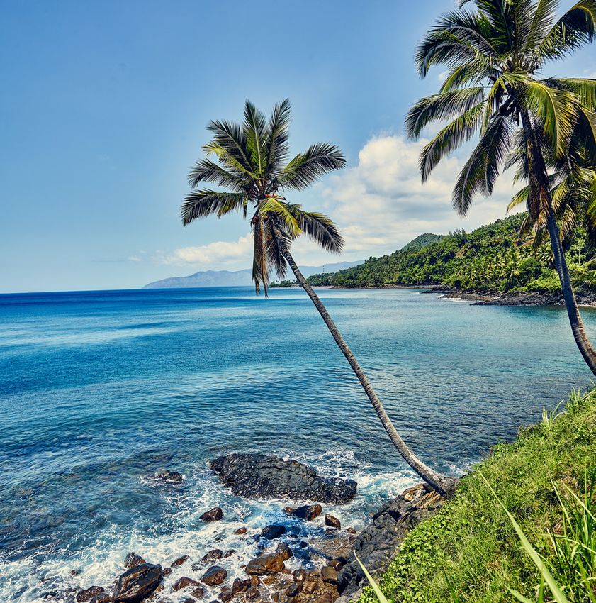
MAYOTTE

                            REUNION

                                            COMOROS

                                                  MADAGASCAR

                                                      MAURITIUS

                                                  THE SEYCHELLES

CRUISES
via Indian Ocean
Croisières via l’océan Indien
Edition 2020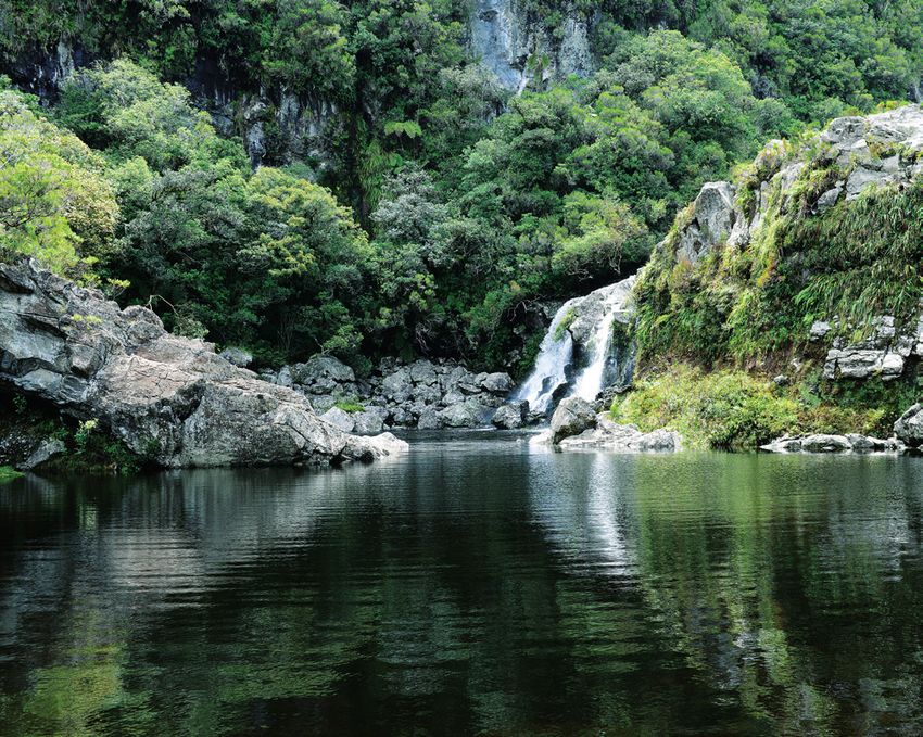
REUNION
Discover Reunion Island,
the ultimate island
Découvrez la réunion, l’ile intense
Réunion Island, the ultimate island La Réunion, l’île intense
REUNION Reunion Island is in the Mascarene Islands, in the south-west Située dans l’archipel des Mascareignes au sud-ouest de l’océan
Le Port of the Indian Ocean and is a land of mixed cultures that is both indien, La Réunion est une terre de métissage ; spectaculaire et
spectacular and bewitching. envoutante.
Reunion Island is an exotic, grandiose, vibrant, relaxing and Intensément exotique, grandiose, vibrante, ressourçante et préservée ;
protected land, with majestic landscapes, an authentic culture, La Réunion émerveille avec ses paysages majestueux, sa culture
unique approach to living together as one and flavoursome local authentique, son vivre ensemble unique et sa cuisine aux milles
cuisine. saveurs.
Reunion Island is a one-of-a-kind island: you can swim with La Réunion est une île unique au monde : on peut y nager avec les
whales here, relax and unwind at the heart of a UNESCO world baleines, se ressourcer au cœur du patrimoine mondial de l’UNESCO,
heritage site, feel enchanted by the sheer power of the volcano se laisser hypnotiser par son volcan et découvrir la culture créole et la
and discover Creole culture and the benefits of a place where richesse du vivre ensemble.
everyone lives together in harmony. à la Réunion les éléments se mêlent : l’eau, la terre, l’air, le feu invitent
PORT LOCATION On Reunion Island, the elements come together: water, earth, fire le voyageur à une épopée unique au cœur de l’océan indien.
Lat. 20° 54’ 50" S - long. 55° 19’ 40" E and air, inviting the traveller to take part in a unique adventure at
the heart of the Indian Ocean.
Top 5 des expériences à vivre à La Réunion
HARBOUR
REUNION
Crédit photos : shutterstock, Stéphane Fournet, IRT / Eric Lamblin
Depuis le cœur de l’océan Indien et jusqu’à son sommet, à 3000m
Time GTM: +4 h
Hours: open 24 hours
Top 5 experiences on Reunion Island d’altitude, découvrez notre top 5 des expériences incontournables
pour vibrer au rythme de l’île intense.
Emergency phone: + 262 692 660 996 From the heart of the Indian Ocean, and right up to the peak, at
1. Partir à la rencontre des dauphins et des baleines à bosse.
Email: off-port@reunion.port.fr an altitude of 3,000m, come and discover our top 5 experiences,
2. Se ressourcer au cœur de la forêt primaire de Bélouve.
to really see all that the intense island has on offer.
Port facilities
Anchorage: allowed Ship 3. Explorer les tunnels de lave d’un des volcans les plus actifs au monde.
Tenders: none 1. Dolphin and humpback whales encounter.
4. Admirer un lever de soleil au Piton des Neiges, le toit de l’océan Indien.
Pilotage: Mandotary 2. Relax and unwind at the heart of Belouve Primary Forest.
3. Explore the lava tunnels of one of the most active volcanos in 5. Contempler la voie lactée dans les Hauts de l’île.
Tugs: compulsory for vessels
the world.
La Réunion, installations portuaires
over 120 m length
Tidal Movement / Range: 0,7 m
4. Admire the superb sunrise at the Piton des Neiges, the peak of
the Indian Ocean.
Top 5 des activités de pleine nature à La Réunion
5. Catch a glimpse of the milky way in the island’s highlands. Vous êtes féru d’activité physique ? La Réunion est une destination
intense et dynamique où vous ne vous ennuierez pas une minute
! Un vaste programme d’activités de loisirs et de plein air vous y
BERTHS • Distances / Transportation: Top 5 outdoor activities on Reunion Island attend :
1. Trail et randonnée pédestre sur les quelques 900 km de sentiers
• Numbers of Cruise quays: Berths 14, 15,20, 21 • City center: 3 km
Are you a fan of physical activity? Reunion Island is an intense balisés de l’île.
• Turning circle: 480 m • International Aeroport: 30 km
and dynamic destination where you won’t have time to get 2. Parapente à la découverte des paysages vus du ciel
• Width: 45 m • Railway Station: no
bored, not even for a second! There’s a vast programme of lei- 3. Plongée sous-marine à la découverte des 3 500 espèces sous-
• Air draft: no limit • Taxi service: yes sure and outdoor activities on offer :
• Minimum stay: no limit • Bus services: yes marines animales et végétales.
1. rail running and hiking on the 900km of marked trails across 4. Canyoning à l’assaut des ravines de l’île.
• Maximum stay: no limit the island.
SAFETY & SECURITY 5. Spéléologie à travers les tunnels de lave.
BERTH SERVICES • Access control to the port (ISPS Code) : yes 3. Deep-sea diving to discover the 3,500 animal and plant underwater
• Gangway: no • Surveillance with CCTV: yes species. Toutes ces activités sont encadrées par les professionnels
• Ship repair: yes • Port Police Patrols: port security service patrols 4. Canyoning down the island’s ravines.
de l’île, pour une pratique en toute sécurité.
• Bunkering: no • Restricted access area: yes 5. Caving through lava tunnels.
• Garbage Disposal: yes • Scanner: no
• Water supply: yes All these activities are led by the island’s professionals, to ensure
PASSENGERS & BERTH SERVICES your safety during the experience.
• Provisions: yes
• Telephone lines: yes • Shuttle bus service: yes
• Tourist info office: yes
PASSENGER SERVICES • Gangway: no
• Clearance Time: no • Folk:
• Procedure: European Union Rules
• Terminal: yes
• Services: WIFI
Platform length Draft
PLATFORM ASSIGNMENT
(m) (m)
14 et 15 Priority for Cruise liners 480 12.50
20 et 21 Priority for Cruise liners 560 14
60 T tugboats equipped with 2 azimuthals propellers (Qty: 2)
40 T tugboat equipped with 2 Schottel propellers (Qty:1)
TUGS
7 T tugboat equipped with 2 Kort exhaust nozzles (Qty:1)
Docking boat (Qty:2)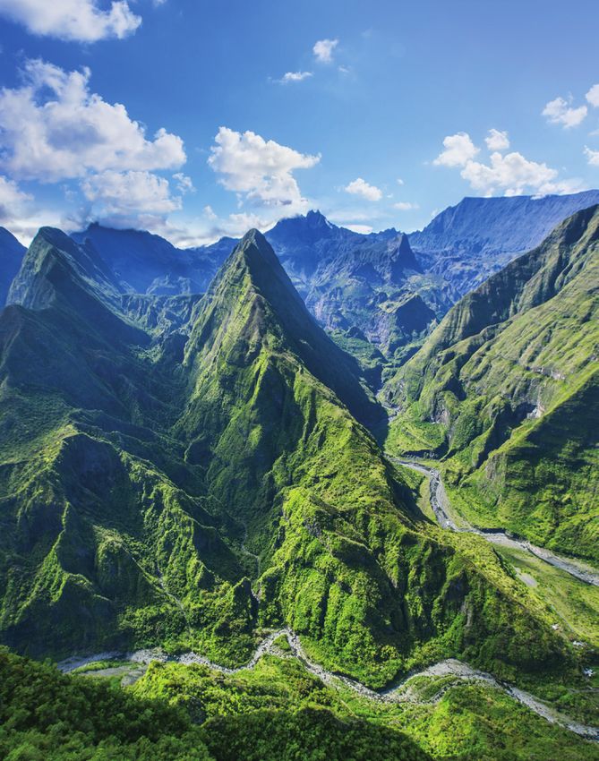
LE PROGRAMME D’ACTIONS FEDER 2019 DE L’ÎLE DE LA RÉUNION TOURISME EST COFINANCÉ PAR L’UNION EUROPÉENNE ET LA RÉGION RÉUNION. © Lione Ghighi.

                                                                                  www.reunion.fr/en

The UltimaTe in
NatUral Beauty.
                  © photos : Shutterstock, Eric LAMBLIN et Stéphane JOURNET.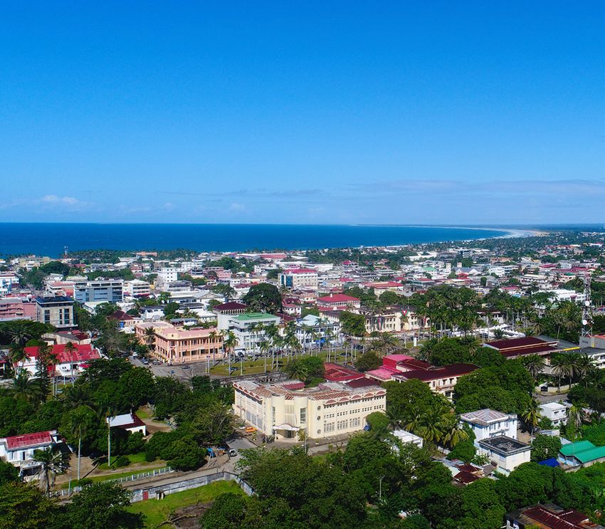
EUROPEAN
                                                       STANDARDS

   LA REUNION, AN ISLAND                                                    HIGH QUALITY
     WITH UNIQUE TASTES                                                      PRODUCTS

           La Reunion offers premium products
in the Indian ocean area. La Maison de l’Export,
         responsible for fostering export growth
by local businesses, is your key point of contact
               to reach out with local producers.

                                                      BEST FUEL OF
                                                    THE INDIAN OCEAN

                                                                               SEAPORT

                                            La Maison de l’Export
 www.maisondelexport.re | Email : maisondelexport@cr-reunion.fr | Telephone : (+262) 262 81 80 45 | blablab
                 Adress : 3 rue Serge Ycard, Parc Technor 97490 Sainte-Clotilde, La Réunion.

                                                                                                              www.tourism-mauritius.mu
MAURITIUS
Attractions & excursions
MAURITIUS
Port Louis
L’île Maurice, activités et excursions
Le Morne Brabant Le Morne Brabant
(Patrimoine mondial de l’UNESCO)
(UNESCO World Heritage) S’élevant à 555 mètres au-dessus de la mer sur la côte
Rising to 555 meters above the sea on the south-western sud-ouest de l’île, Le Morne Brabant est devenu un symbole
coast of the island, Le Morne Brabant has become a world mondial de la libération de l’esclavage. Aujourd’hui, il
symbol of freedom from slavery. Today it represents a représente un mémorial dédié aux souvenirs communs de
memorial to the common memories of all slaves of that tous les esclaves de cette période, incarné par la plaque
commémorative en l’honneur de «l’esclave inconnu». Le
PORT LOCATION period, as represented by the commemorative plaque in
honour of “the unknown slave”. Le Morne Brabant was Morne Brabant a été officiellement déclaré site du patrimoine
Lat. 20° 16’ 44” S - long. 57° 50’ 41” E mondial par l’UNESCO en 2008.
officially declared World Heritage Site by UNESCO in 2008.
HARBOUR
Hours GMT: +4 h
Aapravasi Ghat
MAURITIUS
Hours: open 24 hours
Aapravasi Ghat
Emergency phone: (Patrimoine mondial de l’UNESCO)
(230) 240 3741/206 5466
Email: info@mauport.com (UNESCO World Heritage) Situé à Port Louis, ce site a servi, de 1834 à 1910, de porte
Anchorage: safe anchorage available
Port facilities
Located in Port Louis, this is the very site which served, d’entrée à l’immigration de travailleurs sous contrat venant
inside and outside the harbour limits d’Inde, d’Afrique de l’Est, de Madagascar, de Chine et d’Asie
Ship Tenders: no between 1834 à 1910, as the immigration gateway of
indentured workers coming to the island from India, du Sud-Est pour travailler dans les champs de canne à sucre.
Tugs and pilotage: compulsory Il faisait partie intégrante de l’opération socio-économique
for all vessels over 100 GT East Africa, Madagascar, China and South-East Asia to
Tidal Movement / Range: 60 cm L’île Maurice, installations portuaires work in the sugar cane fields. This was part and parcel
of the socio-economic operation then termed « the great
que l’on appelait alors «la grande expérience».
experiment ».
Nouveau terminal croisière
BERTHS • Distances / Transportation: opérationnel en 2021
• Numbers of Cruise quays, 1 (Cruise Jetty)
can accomodate cruise vessels of up to 300mts only
• City center: 15 minutes walk
• International Aeroport: taxis, buses service
New port terminal
Avec une capacité de traitement de 4000 passagers
• Turning circle: 450m
• Width: no limit
to the SSR International Airport (40 km / 45 minutes)
• Railway Station: no
operational in 2021
• Air draft: no limit • Taxi service: yes
With capacity to welcome 4000 passengers
• Minimum stay: no limit • Bus services: yes
• Maximum stay: no limit
SAFETY & SECURITY
BERTH SERVICES • ISPS compliant since 1 July 2004
• Gangway: no • Access control to the port (EPS Code): yes - access control
• Ship repair: yes at various gate posts
• Bunkering: yes • Surveillance with CCTV: yes - 103 cameras
• Garbage Disposal: yes • Port Police Patrols and security officers
• Water supply: yes • Restricted access area: yes - access passes issued
• Provisions: yes at the Central Pass Office
• Telephone lines: no • Scanner: container scanner and luggage scanner
PASSENGER SERVICES PASSENGERS & BERTH SERVICES
• Clearance Time: • Shuttle bus service: yes
• Procedure: International Standard • Tourist info office: yes
• Terminal: yes • Gangway: no
• Services: Forex
Platform length Draft
PLATFORM ASSIGNMENT
(m) (m)
Cruise Jetty Cruise 124 10.8
1 x 2,620 hp (30 tonnes bollard pull)
1 x 2,670 hp (30 tonnes bollard pull)
1 x 3,600 hp (45 tonnes bollard pull)
1 x 5,680 hp (70 tonnes bollard pull for deep-sea towage, fire
TUGS
fighting and search & rescue operations)
3 x 1,000 hp (12 tonnes bollard pull) for harbour work.
tug of 12 tonnes bollard pull and available at Port Mathurin,
Rodrigues
THE SEYCHELLES
THE SEYCHELLES
Victoria Attractions & excursions
Les Seychelles, activités et excursions
A granite rock paradise Au paradis du granite
Les îles principales de l’archipel des Seychelles sont célèbres
The main islands of the Seychelles archipelago are famous for pour leurs côtes bordées de rochers granitiques. C’est le cas
their granite rock coastlines, such as Mahé, the largest island, de Mahé, la plus grande d’entre elles, où se trouvent le port
which contains the country’s port and international airport. et l’aéroport international. Mahé peut se visiter en
You can visit Mahé in a single day: Victoria, its small capital une journée, à la découverte de Victoria, la petite capitale
with its lively market, Morne Seychellois peak and national au marché animé, des hauteurs du Morne Seychellois
park, and its small beaches huddled among green vegetation. et de petites plages nichées dans la verdure.
The magic of Praslin island Magie de Praslin
THE
A une heure de ferry de Mahé, Praslin abrite quelques plages
Praslin, a one-hour ferry crossing from Mahé, contains some parmi les plus belles du monde : Anse Lazio, Côte d’or...
of the world’s most stunning beaches, such as Anse Lazio L’île est aussi le berceau du coco de mer, aux formes
and Côte d’Or. The island is also home to the endemic sea suggestives, que l’on admire le temps d’une promenade
coconut with its suggestive shapes that can be admired dans la Vallée de Mai ou à Fond Ferdinand.
PORT LOCATION
SEYCHELLES
during a trip to the Vallée de Mai or to Fond Ferdinand.
Lat. 4° 37’ 35” S / Long. 55° 27’ 50” E
La Digue, île nature
HARBOUR La Digue: a nature island Près de Praslin, La Digue a su préserver un art de vivre
traditionnel : on s’y déplace surtout à vélo ou en charrettes
Port facilities
Time GTM: +4 h La Digue, near Praslin, has preserved its traditional lifestyle: à bœufs, entre une plantation de cocotiers et de vieilles
Hours: you can ride a bike or an ox cart between the island’s demeures à l’architecture coloniale. La plage d’Anse Source
Emergency phone: 248 4294701 coconut plantations and historical estates with their colonial d’Argent, avec ses grands blocs de granite, est un des sites
Email: enquiries@seyports.sc architecture. Anse Source d’Argent beach with its large les plus emblématiques des Seychelles.
Les Seychelles,
Anchorage: Yes blocks of granite is a landmark in the Seychelles.
Ship Tenders: Yes
Pilotage: Mandatory Parcs marins
Tugs: Compulsory
Tidal Movement / Range: 1 - 2 M installations portuaires Marine parks L’archipel seychellois compte 115 îles,
souvent minuscules, inhabitées ou très
The Seychelles archipelago is a cluster of 115 islands, many peu peuplées. Plusieurs d’entre elles
of which are tiny, uninhabited or sparsely populated. Several sont facilement accessibles, près de
of them, like Sainte-Anne, Curieuse, Coco and Aride, can Mahé, Praslin ou La Digue : Sainte-
be easily reached from Mahé, Praslin or La Digue. They are Anne, Curieuse, Coco, Aride… Bordées
BERTHS • Terminal: no surrounded by a string of white sand beaches with their de plages de sable blanc à l’eau
• Numbers of Cruise quays: 1 (the northern part • Services: wi-fi, fresh water, bunker transparent water and attract sea bathers and snorkellers translucide, elles sont une invitation
of the principal quay, Mahe Quay) • Distances / Transportation: 200 M who come to marvel at their abundant marine life. à la baignade et au snorkeling, à la
• Turning circle: 400 M • City center: 1 Km découverte d’une foisonnante vie
• Width: No limit • International Aeroport: 5 Km marine.
• Air draft: No limit • Railway Station: no
• Minimum stay: No limit • Taxi service: yes
• Maximum stay: 48 hrs, if exchanging pax • Bus services: yes
BERTH SERVICES SAFETY & SECURITY
• Gangway: yes • Access control to the port (EPS Code): ISPS Code
• Ship repair: limited • Surveillance with CCTV: no
• Bunkering: yes • Port Police Patrols: yes
• Garbage Disposal: yes • Restricted access area: yes
• Water supply: yes • Scanner: no
• Provisions: yes
• Telephone lines: yes PASSENGERS & BERTH SERVICES
• Shuttle bus service: yes
PASSENGER SERVICES • Tourist info office: yes
• Clearance Time: 30 - 45 minutes • Gangway: yes
• Procedure: Seychelles Regulations
Platform length Draft
PLATFORM ASSIGNMENT
(m) (m)
Mahe 371m
LOA 28.50 m, Beam 8.80m, Draught 3.25 m, 2540 BHP, 30 Tons
Bollard Pull, Speed 12 Knots, Range 3000 Nautical Miles
TUGS 2 tugs of the following specs avaible:
LOA 21.30 m, Beam 7.80 m, Draught 2.4 m, 1630 BHP, 30 Tons
Bollard Pull, Speed 11.0 Knots, Range 1600 Nautical Miles
TOAMASINA TOAMASINA (Tamatave)
Port facilities Attractions & excursions
Toamasina, Toamasina, activités et excursions
installations portuaires
MADAGASCAR
Tamatave The main site on Madagascar’s Le phare de la côte Est
Toamasina, également appelée
east coast Tamatave, abrite le port principal
de la côte Est de Madagascar.
Toamasina, also known as Tamatave, is an attractive town Ville attachante, ouverte aux vents
exposed to the winds that blow from the open sea. It contains du large, elle est marquée par de
the main port on Madagascar’s east coast. Toamasina is marked multiples influences. Son avenue
by many influences. Its main avenue lined with tall palm trees and principale, bordée de hauts palmiers,
its large covered market are worth a visit. ou la grande halle de son marché
central méritent la visite !
Beaches and spices Plages et épices
The bathing resort of Foulpointe to the north of Toamasina lies at Au nord de Toamasina, la station balnéaire de Foulpointe s’est
the edge of a lagoon protected by a coral reef. Here, visitors can développée au bord d’un lagon protégé par un récif corallien. On
experience the gentle Malagasy lifestyle, smell the spices that are y goûte à la douceur de vivre malgache, qui prend ici le parfum
grown in the surrounding region and taste the delicious litchis at des épices cultivées dans la région
PORT LOCATION the end of the year. Foulpointe is also steeped in history since the ou la saveur des letchis, à la fin de l’année. Foulpointe
Lat. 18° 09’ 450” S / time of the pirates est aussi un lieu chargé d’histoire, depuis le temps des pirates et
Long. 049° 25’ 475” E and buccaneers, as testified by the old fort at the back des corsaires, comme en témoigne un vieux fort à l’arrière de la
of the beach. plage.
HARBOUR
Time GTM: +3 h
Hours: Open 24 hours Rain forests Aux portes de la forêt
Emergency phone: + 261 34 23 159 85 Les forêts humides du versant oriental de Madagascar, inscrites
The rain forests in the east of Madagascar are a listed UNESCO au Patrimoine mondial de l’UNESCO, abritent une biodiversité
Email: capitainerie@port-toamasina.com
World Heritage site. They contain an unrivalled rich biodiversity d’une richesse sans égale. Non loin de la ville, le site d’Ivoloina en
Anchorage: disembarking passengers not
of which the nearby site of Ivoloina offers an insight. donne un aperçu. Jardin botanique et parc zoologique, il offre à
allowed
The Ivoloina botanical garden and zoological park contains the voir les principales essences des forêts de l’Est, des lémuriens, un
Ship Tenders: none
main species of plants and trees that grow here, native lemurs vivarium de reptiles…
Pilotage: Mandatory
and a reptile vivarium.
Tugs: Compulsory for the vessel over 1500 m3
Tidal Movement / Range: 0,7 m Croisière intérieure
Inland cruise Toamasina est le point de départ du canal des Pangalanes, une
voie navigable qui s’étend sur plusieurs centaines de kilomètres
Toamasina is the starting point of the Pangalanes Channel, a en direction du Sud, à l’arrière de la côte. Quelques dizaines de
navigable waterway that winds its way inland to the south over minutes de navigation suffisent pour pénétrer au cœur d’une
BERTHS • Services: local cruise operator tour several hundred kilometers. After a 20-minute cruise, visitors nature tropicale exubérante.
• Numbers of Cruise quays Mole B/ABJT West and C1 • Distances / Transportation: enter a world of lush, tropical vegetation.
• Turning circle: 400 m • City center: 3 km
• Width: no limit • International Aeroport: yes
• Air draft: no limit • Railway Station: no
• Minimum stay: no limit • Taxi service: Not allowed inside the port
• Maximum stay: 24 h • Bus service: Shuttle bus inside the port
BERTH SERVICES SAFETY & SECURITY
• Gangway: no • Access control to the port (EPS Code): search and
• Ship repair: no ID control (ISPS Code)
• Bunkering: G.O yes by tanker tracks ; Fuel oil : no • Surveillance with CCTV: no
• Garbage Disposal: no • Port Police Patrols: yes
• Water supply: yes • Restricted access area: yes
• Provisions: yes • Scanner: yes
• Telephone lines: mobile only (Orange, Telma, Zain)
PASSENGERS & BERTH SERVICES
PASSENGER SERVICES • Shuttle bus service: yes
• Clearance Time: max 30 minutes • Tourist info office: yes
• Procedure: Madagascar rules. Walking in port is not allowed. • Gangway: no
Shuttle bus. • Folk: yes
• Terminal: yes
Platform length Draft
PLATFORM ASSIGNMENT (m) (m)
Passenger ship, RoRo,
C1 239 m 10.20 m
Other cargo ships
Passenger ship, RoRo,
Môle B/ABJT West 380 m 8.50 m
Other cargo ships
64 T tug boat qty: 01
TUGS 32 T tug boat qty : 01
30 T tug boat qty : 01
Mooring boat Qty : 01
Pilot boat Qty : 01
NOSY BE
Attractions & excursions
MADAGASCAR
Nosy Be Nosy Be, activités et excursions
The jewel of Madagascar Perle malgache
Baignée par les eaux calmes du canal du Mozambique,
The island of Nosy Be, which lies in the tranquil waters l’île de Nosy Be est la perle du nord-ouest malgache.
of the Mozambique Channel, is the jewel of Madagascar’s Terre volcanique au relief adouci par le temps, elle bénéficie
North West region. With its volcanic terrain and relief d’un ensoleillement maximal qui incite aux loisirs balnéaires
softened by time, it enjoys maximum sunshine attracting sea sur les plages qui ont fait sa réputation. L’intérieur vallonné
bathing and water sports enthusiasts to its famous beaches. de l’île offre de superbes points de vue sur le littoral
The island’s hilly interior offers splendid views over et sur la côte nord-ouest de Madagascar, au loin.
the coastline and the more distant north-west coast
of Madagascar.
Îlots de rêve
Nosy Be est entourée de petites îles qui ont, toutes,
Magical islands un charme particulier. Nosy Tanikely, où l’on pique-nique sur
la plage bordée par un véritable aquarium naturel ; non loin,
PORT LOCATION Nosy Be is surrounded by small islands which all exude a Nosy Komba, l’île aux lémuriens ; à l’ouest, Nosy Sakatia
Lat. 013°24’907” S / special charm. They include Nosy Tanikely, ideal for picnicking
NOSY BE
et ses sites de plongée sous-marine ; Nosy Iranja et ses deux
Long. 048°16’143” E on the beach bordered by a natural aquarium, nearby Nosy îles reliées par un cordon de sable… De nombreux bateaux
Komba, the lemur island and, to the west, Nosy Sakatia assurent quotidiennement des rotations vers ces coins
and its diving sites, and Nosy Iranja and its two islands joined
HARBOUR by a sand bar. There are frequent ferry services between
de paradis.
Time GTM: +3 h these magical islands.
Port facilities Jardin tropical
Hours: open 24 hours
Emergency phone: +261 32 11 257 39
Email: danyrasamisoa@gmail.com
Anchorage: yes
Tropical garden L’intérieur de Nosy Be ressemble à un immense jardin
tropical, où les plantations d’ylang-ylang s’étendent sur
les collines. Des distilleries ouvertes à la visite transforment
Ship Tenders: no
Pilotage: no Nosy Be, installations portuaires The interior of Nosy Be resembles a large tropical garden
where ylang-ylang plantations cover the hills. Distilleries open ces fleurs délicates en une huile essentielle achetée par
les plus grands parfumeurs. Fruits tropicaux, épices, café
Tugs: no to the public convert these delicate flowers into essential oils
that are sold to leading fragrance companies. Tropical fruit, prospèrent également sur cette terre fertile.
Tidal Movement / Range: 0,8 m
spices and coffee are grown in the island’s fertile soil.
La forêt des origines
A primitive forest Au Sud-Est de Nosy Be, dans la partie la mieux préservée
de l’île, s’étend le parc national de Lokobe et sa forêt primaire
BERTHS • Services: no The south west of Nosy Be, the most preserved part of the où foisonnent les lémuriens, les oiseaux et une flore d’une
• Numbers of Cruise quays: no • Distances / Transportation: island, contains the Lokobe Nature Reserve and its primitive richesse exceptionnelle.
• Turning circle: no limit • City center: 1km forest with its numerous lemurs, species of birds and Plusieurs circuits pédestres permettent la découverte du site,
• Width: no limit • International Aeroport: 17 km exceptionally rich flora. Several walking trails enable visitors en quelques heures.
• Air draft: no limit • Railway Station: no to discover the area in a few hours.
• Minimum stay: 12h • Taxi service: yes
• Maximum stay: 24h • Bus services: yes
BERTH SERVICES SAFETY & SECURITY
• Gangway: no • Access control to the port (EPS Code)
• Ship repair: no • Surveillance with CCTV: yes
• Bunkering: no • Port Police Patrols: yes
• Garbage Disposal: yes • Restricted access area: yes
• Water supply: no • Scanner: no
• Provisions: yes
• Telephone lines: 032 11 257 39 PASSENGERS & BERTH SERVICES
• Shuttle bus service: yes
PASSENGER SERVICES • Tourist info office: yes
• Clearance Time: • Gangway: no
• Procedure: European Union Rules • Folk: yes
• Terminal: no
Platform length Draft
PLATFORM ASSIGNMENT
(m) (m)
Cruise 70,71 3
LOA 28.50 m, Beam 8.80 m, Draught 3.25 m, 2540 BHP, 30 Tons
Bollard Pull, Speed 12 Knots, Range 3000 Nautical Miles
TUGS
LOA 19.5 m, Beam 7.80 m, Draught 3.4 m, 2400 BHP, 30 Tons
Bollard Pull, Speed 11.6 Knots, Range 1200 Nautical Miles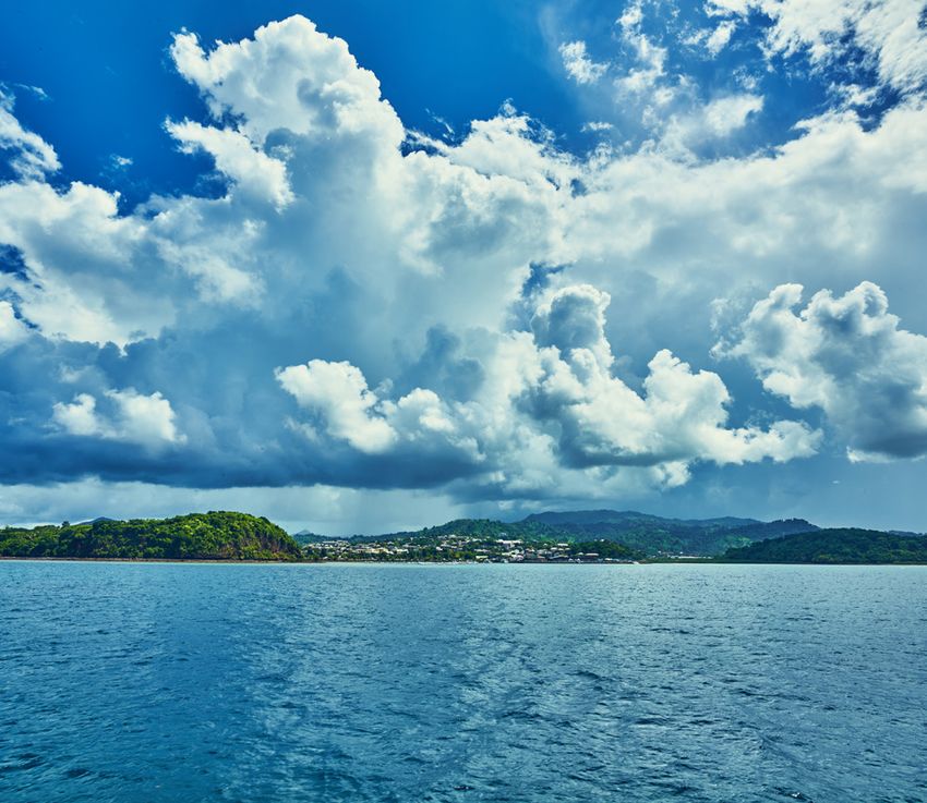
FORT-DAUPHIN
Attractions & excursions
Fort-Dauphin, activités et excursions
MADAGASCAR
Fort-Dauphin
Beachcombing Farniente malgache
A l’extrême Sud-Est de Madagascar, Fort-Dauphin
In the extreme south east of Madagascar, the region (également appelée Tôlagnaro) domine un superbe paysage
of Fort-Dauphin (also known as Tolagnaro) covers a dazzling de baies bordées de plages interminables.
landscape of bays flanked by endless beaches of which Celle de Libanona, au pied de la ville, est une des plus
Libanona, at the bottom of the town, is one of the best réputées. Dans les restaurants, on déguste une fameuse
known. The local restaurants serve red lobster, the region’s langouste rouge, spécialité de la région.
specialty.
Nature luxuriante
© Dadamanga Travel
PORT LOCATION A lush and verdant landscape La nature luxuriante de l’Anosy – la région de Fort-Dauphin –
Lat. 25°05’ S / Long. 047°04’ E se dévoile dans plusieurs parcs, réserves et domaines ouverts
The lush vegetation of Anosy, the region around the town à la visite. On y observe la faune malgache des origines :
HARBOUR of Fort-Dauphin, includes several national parks, reserves
and estates open to the public. They contain indigenous
lémuriens, caméléons, tortues, crocodiles…
Time GTM: UT+3 Mais aussi les plantes endémiques de Madagascar, dans toute
Hours: Day light only fauna such as lemurs, chameleons, tortoises and crocodiles leur originalité. Promenades en barques, randonnées au pied
Emergency phone: +261 34 65 034 65 as well as original endemic plants. Boat trips and hikes des cascades : une immersion en douceur dans le monde
Email: M.Rakotomalala@ehoalaport.com to the foot of waterfalls offer a gentle initiation into the world tropical !
Anchorage: no anchorage of the Tropics.
Ship Tenders: none
Aux portes du Grand Sud
The gateway to the Deep South
FORT-DAUPHIN
Pilotage: Mandatory
Tugs: Compulsory La région de Fort-Dauphin s’étend à la frontière
Tidal Movement / Range: 0,4 m Fort-Dauphin extends to the border of two very different de deux milieux naturels contrastés : l’Est verdoyant et le Sud
natural habitats: the green and hilly east and the semi-arid semi-aride. La vanille, les mangues et les letchis y abondent,
south. The region has an abundance of vanilla, mangoes mais quelques dizaines de kilomètres de route en direction
Port facilities
and litchis, while after some 50 kilometres, the road leading du Grand Sud suffisent pour entrer dans un autre monde,
to the Deep South takes you into a new world of cactuses couvert de cactus et de plantes adaptées à la sécheresse.
and plants that thrive in the dry terrain.
Voyage dans le temps
Fort-Dauphin, installations portuaires A journey through history C’est ici qu’ont débarqué les premiers visiteurs
européens à Madagascar. Non loin du port d’Ehoala,
The first European settlers landed here. Near the port une courte promenade amène au pied des vestiges
of Ehoala, a short walk will take you to the foot of a ruined d’un fort portugais, construit au XVIIème siècle. Un
Portuguese fort dating back to the 18th century. Some peu plus tard, les Français édifièrent une enceinte
decades later, the French built a fortified compound fortifiée sur la pointe rocheuse
BERTHS • Services: no on the rocky headland overlooking the town of Fort-Dauphin. qui domine la ville de Fort-Dauphin. Ses restes
• Numbers of Cruise quays: Berth N°1 - L=275 m / Dft=15,75 m • Distances / Transportation: Its remains have been preserved: a small local museum traces ont été préservés et un petit musée raconte
• Turning circle: 340 m • City center: 8 km the rich history of the region. aujourd’hui la riche histoire des lieux.
• Width: no limit • International Aeroport: 3 km
• Air draft: no limit • Railway Station: no
• Minimum stay: no limit • Taxi service: yes
• Maximum stay: no limit • Bus services: yes
BERTH SERVICES SAFETY & SECURITY
• Gangway: 1 port gangway • Access control to the port (EPS Code): ISPS Code
• Ship repair: no • Surveillance with CCTV: yes
• Bunkering: yes • Port Police Patrols: yes
• Garbage Disposal: no • Restricted access area: yes
• Water supply: yes • Scanner: no
• Provisions: yes
• Telephone lines: no PASSENGERS & BERTH SERVICES
• Shuttle bus service: yes
PASSENGER SERVICES • Tourist info office: yes
• Clearance Time: • Gangway: yes
• Procedure: Rio Tinto & State port rules • Folk: yes
• Terminal: no
PLATFORM Platform length Draft
ASSIGNMENT
ASSIGNMENT (m) (m)
Out of order
2 tugs with bollard pull 48 T each.
TUGS
System ASD.
© Dadamanga Travel service
MAYOTTE
Attractions & excursions
MAYOTTE
Mayotte, activités et excursions
Longoni
One of the world’s largest lagoons L’île au lagon
Mayotte se dresse au milieu d’un des plus grands lagons
Mayotte rises out of one of the largest lagoons in the world. du monde. Une immense barrière de corail entoure Grande
A huge barrier reef surrounds Grande Terre, the main island, Terre, l’île principale, Petite Terre, l’autre île habitée, ainsi
Petite Terre, the other inhabited island, as well as some 30 qu’une trentaine îlots et des bancs de sable blanc.
smaller islands and white sand banks. Within this exceptional Ce cadre naturel d’exception offre de nombreuses possibilités
natural habitat, trips are organised between July and October d’excursions nautiques, à la rencontre des dauphins, des
to encounter dauphins, sea turtles and whales. tortues marines et même des baleines, de juillet à octobre.
A magical underwater world Merveilles sous-marines
Certaines zones du lagon de Mayotte sont des aquariums
Parts of Mayotte’s lagoon are a natural aquarium that attracts à ciel ouvert, qui font la joie des amateurs de plongée sous-
diving and snorkelling enthusiasts. Hundreds of species of marine mais aussi des nageurs en palmes-masque-tuba.
PORT LOCATION coral, sea turtles, an abundance of reef fish and manta rays Des centaines de variétés de coraux, des tortues marines,
Lat. 12° 43’ 10˝ S / Long. 45° 09’ 54˝ E are visible in the lagoon’s calm and transparent water. Visitors des nuées de poissons de récif, des raies manta se laissent
can admire this dazzling marine world only a few meters ainsi observer, dans une eau calme et translucide.
HARBOUR under the water in a glass bottom boat. Des bateaux à fond de verre permettent également d’admirer
Time GTM: GMT+3, +2 hours in winter cette vie foisonnante, quelques mètres sous la surface.
et +1 hour in summer.
Lemurs and baobab trees
MAYOTTE
Hours: open 24 hours
Emergency phone: +262 639 692 182 The interior vegetation is as rich and diverse as the island’s Lémuriens et baobabs
Email: capitaineriemayotte@ marine life. Tall baobab trees tower over the forest in the La nature intérieure de Mayotte est aussi riche que sa vie
developpement-durable.gouv.fr south of Grande Terre with contains a variety of landscapes. marine. De hauts baobabs dominent la forêt dans tout le sud
de Grande Terre, qui offre une grande diversité de paysages.
Port facilities
Anchorage: safe anchorage available On the edge of walking trails, lemurs frolic in the trees among
Ship Tenders: yes dozens of species of birds. Au bord des sentiers, les lémuriens s’ébattent dans les arbres,
Pilotage: mandatory for all vessels with au milieu de dizaines d’espèces d’oiseaux.
a length superior to 30 m
Tropical fragrances
MAYOTTE, installations portuaires Senteurs tropicales
Tugs: not compulsory for vessels at anchor
Tidal Movement / Range: 4 m max
Mayotte is also nicknamed “the island of fragrances” with Mayotte est aussi « l’île aux parfums » :
its ylang-ylang and vanilla plantations, tropical spices and ceux des plantations d’ylang-ylang
tropical fruit that fill the colourful stalls in the local markets. et de la vanille, mais aussi des épices
A stop-off on Mayotte will arouse and tingle your senses. et des fruits tropicaux qui couvrent
BERTHS • Terminal: yes les étals colorés des marchés.
• Numbers of Cruise quays: PIER 1: 130 m – 11 m 50 draft • Services: WIFI Une escale pour faire le plein
PIER 2: 223 m – 14 m draft / Tender Berth Mean Low • Distances / Transportation: 50 m de senteurs !
tide: 0,8 m / Mean High Tide: 3,8 m • City center: 12 km
• Turning circle: no limit • International Aeroport: yes
• Width: no limit • Railway Station: no
• Air draft: no limit • Taxi service: yes on demand
• Minimum stay: no limit • Bus services: yes
• Maximum stay: no limit
SAFETY & SECURITY
BERTH SERVICES • Access control to the port (EPS Code)
• Gangway: no • Surveillance with CCTV: no
• Ship repair: no • Port Police Patrols Port: Security Service Patrol
• Bunkering: no • Restricted access area: no
• Garbage Disposal: yes • Scanner: no
• Water supply: no
• Provisions: yes PASSENGERS & BERTH SERVICES
• Telephone lines: no Shuttle bus service: yes
Tourist info office: yes
PASSENGER SERVICES Gangway: no
• Clearance Time: Folk: French Department
• Procedure: European Union Rules
Platform length Draft
PLATFORM ASSIGNMENT
(m) (m)
Pontoon Mamudzu 12 x 4,60 1,50
1 Tug available 3000 HP classic – 40 tons bollard pull
TUGS
Tug available under 2 hours prior berthing/sailingMORONI
MORONI Attractions & excursions
Moroni, activités et excursions
Port facilities
Moroni, installations portuaires
COMOROS Ngazidja, Grande Comore Ngazidja, la Grande Comore
Plus grande île de l’archipel des Comores, Ngazidja abrite
Moroni
Ngazidja, the largest island in the Comoros archipelago, un riche patrimoine. Le charme du pays se révèle lors
has a rich heritage. The country’s charm unfolds in d’une visite de la capitale, Moroni, dans la médina aux étroites
the capital, Moroni, with its medina and narrow streets, ruelles, sur le vieux marché animé, sur la place Badjanani,
busy old market, Badjanani Square, its mosques, royal ses mosquées et ses vénérables palais royaux, ou sur le port avec
palaces and port with its dhow shipyards. ses chantiers de construction de boutres…
A volcanic and coral island Volcan et corail
La Grande Comore est dominée par la haute silhouette
Grande Comore is topped by the tall outline of Karthala, du volcan Karthala, dont le sommet culmine à 2 361 m
a volcano which rises to a peak of 2,361 m above sea level et forme un des plus vastes cratères du monde. Les côtes de l’île
and forms one of the world’s largest craters. The island’s portent les traces des coulées de lave récentes, dont le noir profond
coastline bear marks of recent lava flows of pitch black tranche avec le sable blanc des nombreuses plages. Au nord, la
colour contrasting with the white sand on the many beaches. région de Mitsamihouli abrite quelques unes des plus belles plages
To the north, the region of Mitsamihouli contains some du pays et le Trou du Prophète, aux eaux émeraudes et turquoises.
of the country’s most beautiful beaches as well as
the natural harbour of Trou du Prophète with its emerald
and turquoise water. Au pays du cœlacanthe
Dans les eaux comoriennes, vit encore une population
Rare coelacanth fish de cœlacanthes, poissons préhistoriques dont l’existence
a été découverte il y a quelques décennies seulement.
PORT LOCATION The waters around the Comoros contain a population Mais devant Ngazidja, la mer recèle bien d’autres merveilles
Lat. 11° 41’ 96” 8S / Long. 43° 14’ 80” 3E naturelles, qui incitent à la plongée ou au snorkeling pour admirer
of prehistoric coelacanth fish that were discovered only
a few decades ago. The sea opposite Ngazidja contains les fonds coralliens et des myriades de poissons tropicaux. La
HARBOUR other natural wonders that attract divers and snorkelers dernière découverte de ce poisson date de juin 2017 à Anjouan.
Time GTM: +3 h who come here to admire the coral on the sea bed
Hours: open 24 hours
Emergency phone: +269 7730008 /
and the myriad of tropical fish. The last discovery of this fish
was in June 2017 in Anjouan.
Témoignages du passé
+269 3482190 De nombreux sites de l’île abritent les
Email: capitaineriemoroni@yahoo.fr / vestiges architecturaux d’une histoire
alimohamedassoumani@yahoo.fr
Anchorage: allowed
Vestiges of the past commencée dès le premier millénaire :
Iconi, Itsandra, Ntsawéni… À Moroni,
Ship Tenders: Yes Numerous sites on the island contain architectural remains, une visite du musée du Centre de
Pilotage: Mandotary such as those at Iconi, Itsandra, Ntsawéni, that date back Documentation et de Recherche
Tugs: compulsory for vessels over to the first millennium AD. The traditions, history and natural Scientifique permet de faire
65 m length habitats of the Comoros archipelago are showcased connaissance avec les traditions
Tidal Movement / Range: 1,6 m at the Museum of the Documentation and Scientific Research et le passé de l’archipel, ainsi qu’avec
in Moroni. des milieux naturels.
BERTHS • Services: no
• Numbers of Cruise quays: no • Distances / Transportation:
• Turning circle: 300 m • City center: 300 m
• Width: no limit • International Aeroport:
• Air draft: no limit • Railway Station: no
• Minimum stay: no limit • Taxi service: yes
• Maximum stay: no limit • Bus services: yes
BERTH SERVICES SAFETY & SECURITY
• Gangway: no • Access control to the port (EPS Code): no
• Ship repair: no • Surveillance with CCTV port security service patrols
• Bunkering: yes • Port Police Patrols: yes
• Garbage Disposal: yes • Restricted access area: no
• Water supply: no • Scanner
• Provisions: yes
• Telephone lines: no PASSENGERS & BERTH SERVICES
• Shuttle bus service: yes
PASSENGER SERVICES • Tourist info office: yes
• Clearance Time: • Gangway: no
• Procedure: Comorian rules • Folk
• Terminal: yesMUTSAMUDU
Attractions & excursions
Mutsamudu, activités et excursions
COMOROS Mutsamudu, Ndzouani Mutsamudu, Ndzouani
Mutsamudu
(Comorian name for Anjouan) (nom comorien d’Anjouan)
Port et ville principale d’Anjouan, Mutsamudu a été fondée
Mutsamudu, the port and main town of Anjouan, was au XVème siècle. Sa médina aux ruelles étroites et sa citadelle
founded in the 15th century. The medina with its narrow qui surplombe la mer portent les traces d’une longue histoire.
streets and citadel overlooking the sea are testimonies to L’île est marquée par des influences arabes et chiraziennes
a long history. The island is marked by Arab and Chirazian (du nom d’une ville de l’ancienne Perse) que l’on devine sur
(from the name of an ancient Persian city) influences that les visages des habitants et dans de nombreux vestiges
can be seen on the faces of its inhabitants and in the local architecturaux.
architecture.
MUTSAMUDU
Anjouan, l’île aux parfums et aux épices
Anjouan: the fragrance Verdoyante et agricole, Anjouan produit de nombreuses
plantes à parfum, dont l’ylang-ylang, de la vanille et diverses
and spice island épices : girofle, poivre, muscade… Leurs odeurs envahissent
Port facilities
les marchés et les plantations, partout dans l’île.
Anjouan is a verdant and agricultural island that produces
numerous fragrance plants including ylang-ylang, vanilla
and various spices: cloves, pepper and nutmeg. Their smells Beautés intérieures
pervade the island’s many markets and plantations. Très montagneuse, avec un sommet culminant à plus de
Mutsamudu, installations portuaires 1 500 mètres d’altitude, Anjouan est creusée de cuvettes
fertiles et parcourue des vallées et de rivières. Les régions
The spectacular interior intérieures, en altitude, apportent une agréable fraîcheur qui
PORT LOCATION Anjouan has a mountainous terrain: its tallest peak,
contraste avec la chaleur tropicale des côtes. Une journée
Lat. 12° 9’ 0” S / long. 44° 23’ 60” E d’excursion permet de parcourir l’île et de découvrir ses
1,500 meters above sea level, is crisscrossed with water
différentes facettes.
basins, valleys and rivers. The cool highlands of the interior
HARBOUR provide welcome relief from the tropical heat of the coast.
Time GTM: +3 h The different facets of the island can be discovered during Villes anciennes
Hours: open 24 hours a one-day excursion.
Emergency phone: + 269 3355510 et côtes sauvages
Plusieurs villes, sur le littoral d’Anjouan,
Email: anjautoport@yahoo.fr /
gm@anjouanstevedoring.com Ancient towns évoquent l’époque des sultans qui
autrefois se succédèrent au pouvoir.
Anchorage: allowed
Ship Tenders: no and an unspoiled coastline Les anciens palais et la médina
de Domoni, sur la côte ouest,
Pilotage: Mandotary Several towns along the Anjouan coast evoke the rule
Tugs: compulsory for vessels en témoignent, tout comme le palais
of successive sultans in previous centuries, as testified by de Mawana à Bambao ou les ruines
over 100 m length the ancient palaces and Domoni medina on the west coast,
Tidal Movement / Range: 1,4 m de Foumbani.
the palace of Mawana in Bambao or the ruins of Foumbani. Plus sauvage, la côte sud de l’île,
The island’s unspoiled southern coast boasts small white abrite de petites plages de sable
sand beaches and several diving sites. blanc et plusieurs sites de plongée.
BERTHS • Services: no
• Numbers of Cruise quays: principal quay • Distances / Transportation:
• Turning circle: 3064 m • City center: 300 m
• Width: no limit • International Aeroport:
• Air draft: no limit • Railway Station: no
• Minimum stay: no limit • Taxi service: yes
• Maximum stay: no limit • Bus services: yes
BERTH SERVICES SAFETY & SECURITY
• Gangway: no • Access control to the port (EPS Code):
• Ship repair: no • Surveillance with CCTV: no
• Bunkering: no • Port Police Patrols port security service patrols:
• Garbage Disposal: yes • Restricted access area: yes
• Water supply: yes • Scanner: no
• Provisions: yes
• Telephone lines: no PASSENGERS & BERTH SERVICES
• Shuttle bus service: yes
PASSENGER SERVICES • Tourist info office: yes
• Clearance Time: • Gangway: no
• Procedure: Comorian rules • Folk
• Terminal: yesCONTACT
info@vanilla-islands.org
www.vanilla-islands.org
© photos : Jonas Akhoun - photos Réunion : Serge Gélabert
Cette
campagne
de promotion
est cofinancée
par l’Union
EuropéenneVous pouvez aussi lire


