Curiosities of Geographical Names - No. 56 JUNE 2019 - the United Nations
←
→
Transcription du contenu de la page
Si votre navigateur ne rend pas la page correctement, lisez s'il vous plaît le contenu de la page ci-dessous

No. 56 JUNE 2019

Curiosities of Geographical Names
The Information Bulletin of the United Nations Group of
                                                          Experts on Geographical Names (formerly UNGEGN
                                                          Newsletter) is issued twice a year by the Secretariat of the
                                                          Group of Experts. The Secretariat is served by the Statistics
                                                          Division (UNSD), Department for Economic and Social
                                                          Affairs (DESA), Secretariat of the United Nations.
IN THIS ISSUE                                             Contributions and reports received from the Experts of the
                                                          Group, its Linguistic/Geographical Divisions and its Working
Message from the Chairperson                  3
                                                          Groups are reviewed and edited jointly by the Secretariat
Message from the Secretariat                  5           and the UNGEGN Working Group on Publicity and Funding.
                                                          Contributions for the Information Bulletin can only be
Special Feature – Curiosities of                          considered when they are made available digitally in
geographical names                                        Microsoft Word or compatible format. They should be sent
• The distinction of women's work             6           to the following address:
   through toponymy
• Proud of being named by exonyms             8           Secretariat of the Group of Experts on
• The curious self-restraint of German        8           Geographical Names (UNGEGN)
   speakers to use their place names                      Room DC2-1508
   for features abroad                                    United Nations
• Considérations sur les curiosités         10
                                                          New York, NY 10017
   toponymiques au Canada                                 USA
• Curiosities of Geographical Names         13
   in Cyprus
                                            15            Tel: (212) 963-5823
• Curiosities of geographical names in
                                                          Fax: (212) 963-9851
   Czechia
                                            18            E-mail:
• Origins of Egyptian Geographical
                                                          blake1@un.org
   Names
                                            21            mailto:geoinfo_unsd@un.org
• Curiosities of geographical names in
   New Zealand
• Cassiterides: how the mythical Tin
                                            23
   Islands became the Azores

From the Divisions
 • Division Afrique Centrale                24          United Nations Group of Experts on Geographical Names
 • East Central and South-East Europe       25          Information Bulletin (ISSN 1014-798) is published by United
    Division                                            Nations Statistics Division, Department of Economic and
Special Projects and News Items                         Social Affairs.
 • Recognizing William (Bill) Watt, 2012-   27
    2019                                                The designations employed and the presentation of the
 • Ninth Session of UN-GGIM                 28          material in this publication do not imply the expression of
In Memoriam                                             any opinion whatsoever on the part of the Secretariat of the
 • Dick Block (1925-2019)                   29          United Nations concerning the legal status of any country,
Upcoming events                             30          territory, city or area, or of its authorities or concerning the
                                                        delimitation of its frontiers or boundaries.

                                                        Previous issues of the Bulletin (formerly Newsletter) can be
                                                        found at

                                                        http://unstats.un.org/unsd/geoinfo/ungegn_info_bulletins.
                                                        htm

                                 UNGEGN Information Bulletin No. 56 • June 2019 •    Page 2
Message from the Chairperson

Chers Collègues,

N        otre Groupe d’experts a été
         créé par une résolution de
         l’ECOSOC de 1959 1 , et en
soixante ans, nos prédécesseurs et
nous avons produit un très
                                                                               aussi combien reste problématique mais urgent l’établissement de
                                                                               règles générales acceptées et appliquées par tous. Et les cas particuliers
                                                                               qui les suscitent constituent les meilleures « pierres de touche » de ces
                                                                               règles, avec aussi l’ensemble des « curiosités » dont certaines
                                                                               alimentent la suite du présent Bulletin.
important corpus de résolutions et
de décisions d’ordre général. Il reste                                           Pour orienter nos travaux maintenant, la première décision prise à
pourtant encore beaucoup à faire                                                l’issue de notre session d’avril-mai 2019 appelle l’élaboration d’un plan
en matière de noms de lieux,                                                    stratégique par le Bureau en étroite concertation avec les États
notamment pour établir les                                                      membres. Le Bureau a convenu que la façon la plus étroite d’assurer
articulations encore nécessaires                                                cette concertation était de partir des propositions formulées par les
entre résolutions d’ordre différent,                                            États membres eux-mêmes. Chaque État membre va donc être invité
pour favoriser l’application de ces                                             formellement à indiquer au Secrétariat pour le vendredi 13 septembre
principes généraux dans des outils                                              2019 les priorités qu’il souhaite voir retenir dans le futur plan
opérationnels et dans des cas                                                   stratégique du GENUNG. Le Bureau se réunira peu après et lancera
particuliers, et pour faire mieux                                               l’élaboration d’un premier projet à partir de ces éléments, puis
prendre en compte ces questions                                                  continuera à solliciter la contribution des États membres au fil de
par les États membres et au sein de chacun d’eux — y compris le mien.          l’avancement du plan stratégique et du programme de travail en vue
Pour ces raisons et à titre personnel, je suis impressionné par la             d’un examen et d’une adoption à la session prévue en 2021.
responsabilité que votre confiance fait peser sur moi depuis que vous          Parallèlement, le Bureau établira son propre programme de travail pour
m’avez élu président pour quatre ans.                                          ces deux années afin de ne pas être réduit à l’inaction en attendant
                                                                               l’adoption du plan stratégique.
Depuis treize ans que je participe au GENUNG, je n’ai pas été le seul à
intervenir souvent pour défendre la diversité linguistique et culturelle en    Je suis sûr que chacun partage la gratitude que je souhaite exprimer
matière de noms de lieux et pour promouvoir leur dimension                     enfin pour tous ceux qui font vivre le GENUNG : les membres du Bureau,
patrimoniale et culturelle. Cela reste des enjeux fondamentaux pour            étendu aux responsables de groupes de travail et aux anciens
moi, mais cela ne le deviendra aussi pour nos gouvernements respectifs         présidents, parmi lesquels je veux citer particulièrement mon
que si nous savons le démontrer par des exemples concrets et par des           prédécesseur, Bill Watt3 ; le Secrétariat au sein de la Division statistique,
applications pratiques. En ce sens, le rapprochement avec l’UNGGIM             les traducteurs et les interprètes à l’occasion des sessions, et les autres
décidé en 20172 est une chance à saisir, à la fois en lui apportant ce qu’il   services concernés des Nations unies ; et pour finir, bien sûr, chacun de
attend comme y travaille particulièrement notre groupe de travail sur les      vous qui portez l’expertise en matière de noms de lieux partout dans le
bases de données, et en le sensibilisant aux enjeux non géographiques          monde ! Merci à chacun de votre coopération et d’une confiance dont
des noms de lieux.                                                             je suis résolu à me montrer aussi digne que possible.

J’ai pu mesurer aussi le sérieux mis par chacun dans sa tâche, qui se
traduit tantôt par la volonté d’avancer vers l’établissement de règles         Pierre Jaillard (France)
communes, tantôt par l’expression de véritables passions autour de             Chair, UNEGGN
certains cas particuliers. Ces passions montrent, si besoin était, combien     E-mail: pierre@jaillard.net
l’enjeu des noms de lieux dépasse la seule géographie. Elles montrent

1                                                                              3
    Résolution 715 A (XXVII) de 1959.                                              Voir page 28
2   Résolution E/RES/2018/2 du 10 novembre 2017, paragraphe 4.

                                               UNGEGN Information Bulletin No. 56 • June 2019 •              Page 3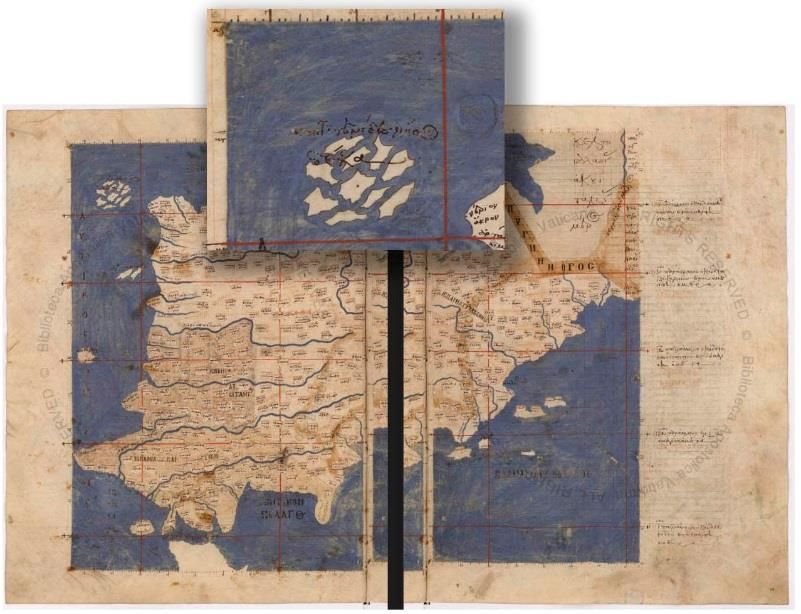
Dear Colleagues,

O
within
        ur Group of experts was
        established by an ECOSOC
        resolution of 1959 4 , and
            sixty     years,       our
                                                                             much the issue of place names goes beyond the sole geography. They
                                                                             also show how problematic but urgent is the establishment of general
                                                                             rules accepted and applied by all. And the particular cases that give rise
                                                                             to them constitute the best "touchstones" of these rules, along with all
predecessors and we have                                                     the "curiosities" some of which feed the rest of this Bulletin.
produced a very large body of
resolutions       and       decisions                                        To guide our work now, the first decision taken at the end of our April-
supporting geographic names                                                  May 2019 session calls for the Bureau to develop a strategic plan in close
standardization. However, much                                               consultation with the Member States. The Bureau agreed that the best
remains to be done on the                                                    way to ensure this consultation, was to start from the proposals made
standardizing of place names; in                                             by the Member States themselves. Each Member State will be invited
particular to establish the links that                                       shortly by formal correspondence to inform the Secretariat by Friday
are still necessary between                                                  13 September 2019 of the priorities it wishes to see reflected in the
different kinds of resolutions, to                                           future UNGEGN strategic plan. The Bureau will meet shortly thereafter
promote the implementation of                                                and will initiate the preparation of a first draft of the Strategic Plan based
these general principles in                                                  on the submissions from Member States. The Bureau will update and
operational tools and in particular                                          seek the input of Member States as the plan progresses, with the
cases, and to ensure these issues are better taken into account by and       objective of having a finalized Strategic Plan and work programme ready
within the Member States — including mine. For these reasons and for         for consideration and adoption at the session scheduled for 2021. At the
myself personally, I am impressed by the responsibility your trust has       same time, the Bureau will establish its own work program for these two
placed on me, with my election as chair for four years.                      years so as not to be reduced to inaction pending the adoption of the
                                                                             strategic plan.
For the thirteen years that I have been involved with UNGEGN, I have
not been the only one to intervene often to defend linguistic and cultural   I am sure that everyone shares the gratitude that I wish to express
diversity about place names and to promote their heritage and cultural       finally for all those who make UNGEGN live: the members of the
dimension. This remains a fundamental issue for me, but it will become       Bureau, extended to the convenors of working groups and past
so for our respective governments only if we can demonstrate it by           presidents, among whom I want to particularly mention my
concrete examples and practical applications. In this sense, the             predecessor, Bill Watt6 ; the Secretariat within the Statistical Division,
collaboration with the United Nations Committee of Experts on Global         translators and interpreters for sessions, and other relevant United
Geospatial Information Management (UN-GGIM) decided in 20175 is an           Nations services; and finally, of course, each of you who carry the
opportunity to be taken, both by bringing to the Committee of Experts        expertise in place names all over the world! Thanks to each of you for
what it expects, as works particularly our working group on toponymic        your cooperation and confidence, which I am determined to be as
data files and gazetteers, and by raising its awareness on the non-          worthy as possible.
geographical issues of place names.

I have also been able to measure the seriousness of each expert in his
task, which translates sometimes into the will to move towards the           Pierre Jaillard (France)
establishment of common rules, sometimes by the expression of real           Chair, UNGEGN
passions about particular cases. These passions show, if need be, how        E-mail: pierre@jaillard.net

4                                                                            6
    Resolution 715 A (XXVII) of 1959                                             See page 28
5   Resolution E/RES/2018/2 of 10 November 2017, paragraph 4.
                                              UNGEGN Information Bulletin No. 56 • June 2019 •             Page 4
Message from the Secretariat

Dear UNGEGN Experts,
A curious theme                                                                UNGEGN, the first session

“C
            uriosities of geographical names” is the theme for this the        The UNSD, UNGEGN Secretariat thanks all attendees to the first (2019)
            56th issue. My first question was, what does this really mean?     session of the “new” UNGEGN, held in New York from 29 April to 3 May
            A search of the Concise Oxford Dictionary defined curiosity as     2019. Two hundred and sixty-four delegates from 71 countries
“The desire or inclination to know or learn about anything, especially         addressed 123 working papers, learnt from four special guest
what is novel or strange; a feeling of interest leading one to inquire about   presentations and adopted six recommendations and 15 decisions. The
anything.” I therefore interpreted this to mean that this issue of the         report (E/2019/75) of the first UNGEGN session is now available in all six
bulletin would be a “humorous” issue, as the focus would be on odd,            languages of the United Nations and can be accessed on the UNGEGN
bizarre, inexplicable place names. A quick desk search unearthed lots of       website. The report should be tabled at the management meeting of the
supporting information on peculiar and odd place names. For example,           United Nations Economic and Social Council in July 2019 for adoption. I
the longest geographical name is found in Thailand which has 163               wish to bring to the attention of our readers and State Members,
letters; Papua New Guinea’s name is from the Malay word "papuah,"              Recommendation one to six, in section I of the report, specifically
meaning "frizzy-haired men; Saint-Louis-du-Ha!-Ha! in Québec, Canada,          recommendation 1 which decided on the development of a draft
is the only city name in the world with two exclamation points; towns          strategic plan and programme of work for the “new” UNGEGN. Over the
with emotive names such as Boring in Oregon, and names that make you           next six months you will be called upon to contribute to the exercise.
hungry such as Hot Coffee and Two Egg. I reasoned therefore that a
strange place name would stir one’s curiosity to find the history and          The Secretariat heartily welcomes the officers of the new Bureau, who
meaning resulting in the name, and this would prod government                  were elected at the end of the first session. Their names, countries and
authorities to develop formal place naming policies. Can one correctly         e-mails are available here:
conclude that curious place names influence geographical names                 https://unstats.un.org/unsd/ungegn/bureau/.
standardization? Further, I questioned what is the true meaning of the
theme? The convenor of the working group on publicity and funding              The Secretariat is delighted to announce that a new UNGEGN website
“burst my bubble”. He informed that the theme seeks to highlight special       was launched, and improvements and updates are continuously being
issues and unforeseen aspects of standardizing geographical names. As          made. Should you experience any problems please do not hesitate to
you would therefore guess, we received eight themed articles with              send us at note at geoinfo_unsd@un.org. If you were not able to attend
various interpretations of “curiosities of geographical names”. The take       the first session, please note that the webcast recordings for the five
away from this exercise was, the meaning of future bulletin themes             days are available for viewing on the first session webpages. Please note
should be explained in the call for articles.                                  that the second session of UNGEGN is scheduled for 3 to 7 May 2021 in
                                                                               New York, USA.
The Working Group on Publicity and Funding and the Secretariat thank
our expert authors from Argentina, Austria, Canada, Cyprus, Czechia,           General Remarks
Egypt, New Zealand and Spain for researching and contributing a
delightful mix of articles. Spain’s article examined the evolution of the      Member States and national institutions responsible for geographical
name Azores, New Zealand’s looked at how mistakes and folk etymology           names are reminded to submit their information for the UNGEGN World
have fashioned their place names, and Czechia’s and Egypt’s                    Geographical Names Database. We also wish to inform our global
contributions shared the origin of place names based on the human body,        experts and persons wishing to learn more about toponymy that they
plants, animals, distinguished persons and other features. A common            can pursue the online BSc level web course and access the recently
thread identified across the articles was the poignant importance of           released Toponymy Training Manual. Your comments on this issue and
place names in serving as records of a country’s history, heritage and         contribution to Bulletin no. 57, to be circulated in December 2019 under
cultural evolution. In hindsight, I thought that should the articles have      the theme “Communication strategies for encouraging the
ventured beyond a description of curiosities to examine whether the            implementation of standardized geographical names”, are welcomed.
naming practices were aligned to UNGEGN resolutions on                         Please remember to repost and circulate the bulletin among your
standardization, would have allowed us to see the relevance and impact         colleagues and hoping you will find this issue enriching and interesting.
of the resolutions. In closing this section, I must share with you the
challenge issued by our Canadian experts in their article, “...for
geographical names to once again delight the world, they will need to…         Cecille Blake
move and amaze us: names conceived like works of art.”                         UNGEGN Secretariat
                                                                               E-mail: blake1@un.org
Extending thanks to all our contributors to this issue and to Andreas
Hadjiraftis of Cyprus for once again designing the front page.

                                               UNGEGN Information Bulletin No. 56 • June 2019 •           Page 5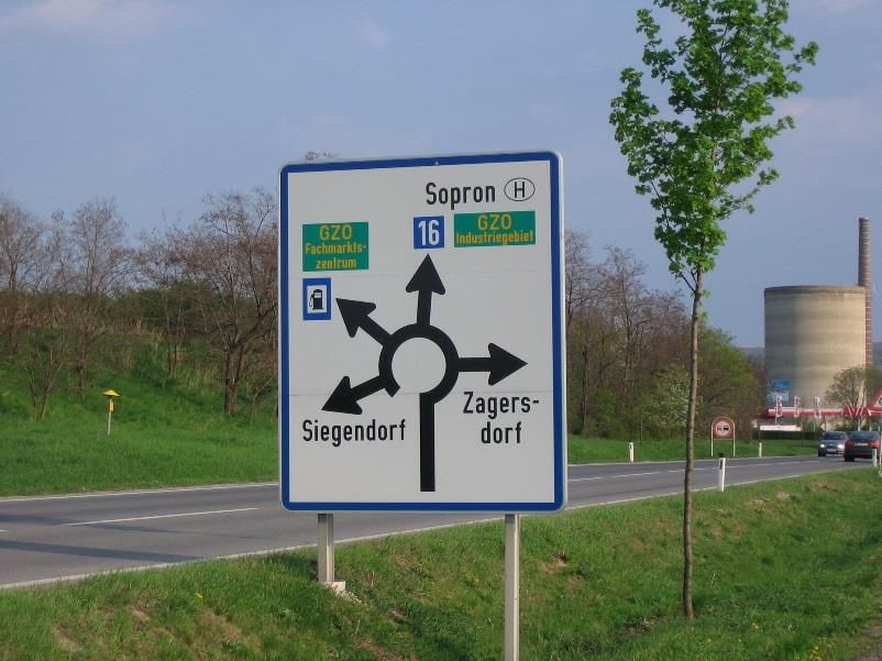
SPECIAL FEATURE
                                   Curiosities of Geographical Names

The distinction of women's work through toponymy

T      he following article is focused on the recognition of the first four
       women assigned to perform field tasks for scientific purposes in
       the freezing temperatures of Antarctica, announcing, on
International Women's Day of 2018, that four geographic features of the
Argentine Antarctic Sector will carry the name of those first four female
                                                                              American Naturalists" published in 1949 and "Antibacterial Inhibitors of
                                                                              Scenedesmus obliquus and Coelastrum microporum" in 1965.

scientists.

Argentine scientific activity in Antarctica began at the end of 1901 with
the help given to the Swedish Antarctic Expedition of Doctor Otto
Nordenskjöld. In February of 1904 the Argentine Republic took
possession of the Meteorological Observatory in the Orcadas del Sur
Islands, thus establishing the permanent presence of Argentine scientists
in Antarctica.

Formerly human presence in Antarctica was reserved only for men,
based on the harsh weather in the region and the characteristics of the
work to be performed. It was in 1968 that this gender barrier was
broken, with the arrival of the first Argentine female scientists
designated to carry out fieldwork at the Melchior base.

The researchers, baptized as "The four of Melchior" performed their
duties in the Argentine Museum of Natural Sciences "Bernardino
Rivadavia" (MACN). They were Elena Martínez Fontes, María Adela Caría,
Irene Bernasconi and Carmen Pujals.
                                                                                    The four scientists at the Melchior Base prepared to go on
                                                                                         field work. Photo: Argentine Antarctic Institute

                                                                              The bacteriologist María Adela Caría was specialized in marine
                                                                              bacteriology. She was the head of Microbiology Section at the MACN and
                                                                              a member of the research career at the National Council of Scientific and
                                                                              Technical Research (CONICET).

                                                                              Irene María Bernasconi worked as a teacher and was also the most
                                                                              outstanding specialist in echinoderms in Argentina. In 1947 she was
                                                                              awarded the Dr. Eduardo Holmberg Prize for her work Asteroides
                                                                              argentinos (starfish). She published more than 50 papers, among them:
                                                                              "Echinoderms: result of the first expedition to Tierra del Fuego", "The
                                                                              echinoderms of the Argentine seas" and "The South American asteroids
                                                                              of the Indian family".

                                                                              Carmen Pujals graduated as a teacher and was also a renowned
                                                                              phycologist (specialist in marine algae) with an outstanding career. She
                                                                              was also a co-founder member of the Argentine Association of Phycology
                                                                              in 1991.
    Irene Bernasconi (sitting), Carmen Pujals, María Adela Caría
    and Elena M. Fontes in a cabinet of the Museo Argentino de                The campaign began the 7th of November 1968 with the departure from
       Ciencias Naturales. Photo: Argentine Antarctic Institute               Buenos Aires, on board the Argentine Navy transport ship A.R.A. "Bahía
                                                                              Aguirre", with destination to the Melchior naval base in Observatorio
                                                                              Island. It is a temporary base that had been closed for five years, so the
Elena Martínez Fontes was the head of the Marine Invertebrate Section         first job of the entire crew was to have it rehabilitated.
of the MACN and she was an internationally recognized specialist in
molluscs. Among her most outstanding works is the "Guide of South

                                              UNGEGN Information Bulletin No. 56 • June 2019 •           Page 6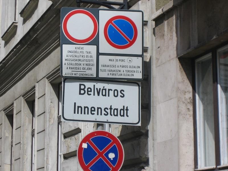
For two and a half months, the scientists worked very intensely, boating     proposed to the Naval Hydrography Service (SHN) the incorporation of
thousand kilometers of coastline, and achieving numerous landings for        four Antarctic place names in tribute to the dedication and tenacity
sampling. They installed a large number of nets in depths of up to 180       imposed by the first female scientists in Antarctica. For its part, the SHN
meters. They made bottom traces up to 150 meters depth to collect            presented the names of Bernasconi cove, Fontes cove, Caría point and
benthonic organisms. They took more than one hundred water and               Pujals cove to the Scientific Council of Antarctic Research (SCAR).
sediment samples, as well as specimens of various species of marine
flora and fauna, as well as carrying out bacterial counts and cultures.

   Cut out of the Nautical Chart H-7 where the Pujals cove Toponym
                           was incorporated.
                   Photo: Naval Hydrography Service                               Cut out of the Nautical Chart No. 101 where the Fontes cove,
                                                                                Bernasconi cove and Caría point Place Names were incorporated.
                                                                                                Photo: Naval Hydrography Service
Among the samples obtained, three specimens of fish called
Parachaenichtys charcoti, a species from which only four specimens had
been extracted worldwide, and a Gymnadraco victori fish, which               Three of them are located in the Melchior archipelago, between
existence was denied in the western sector of Antarctica; the more than      Amberes and Brabante islands, both belonging to the Palmer
two thousand specimens of echinoderms, which allowed the discovery           archipelago. Pujals cove is located in the southeast extreme of Jason
of a family not cited for that region. An important novelty was the          peninsula, from the Antarctic peninsula in the Weddell sea.
identification of the brown algae Cystosphaera jacquinotii in its place of
rooting. The valuable collection of Antarctic seaweed, product of his        Thus, the 8th of March, 2018, on the International Women's Day, the
work, is still part of the Museum Herbarium in which they worked and         National Directorate of the Antarctic, the Argentine Antarctic Institute
serves to train new scientists.                                              and the Naval Hydrography Service paid tribute incorporating their
                                                                             names in the Argentine Antarctic cartography, extending it to all those
On February 2, 1969, the four scientists boarded the A.R.A. “Bahía           who continue to break barriers in the different areas of Antarctic activity.
Aguirre” and undertook the return of such a singular campaign. The long
return allowed them to go through Decepción, Esperanza, Petrel and
Orcadas argentine bases.                                                     Bibliography:
                                                                             • Antarctic National Directorate - Argentine Antarctic Institute
The discoveries made by "The Four of Melchior" during the 1968-1969            (https://www.cancilleria.gob.ar/es/iniciativas/dna)
Antarctic Campaign marked an important advance and turned Argentina          • Naval Hydrographic Service
into one of the countries with the most complete biological collections        (http://www.hidro.gov.ar/Noticias/mpioneras.asp)
in the world. But, undoubtedly, the most significant was to demonstrate      • Foreign Affairs and Cult Ministry
that women could adapt to life in Antarctica as well as men, which meant       (https://www.cancilleria.gob.ar/es/actualidad/comunicados/homena
the frequent inclusion of female research staff in following campaigns in      je-las-primeras-cientificas-argentina-en-la-antartida)
Argentina.

These four researchers were the first women in Argentina to set a
precedent for the role that other scientists in the future would have in     Lieutenant Nancy Anabel Marziali
fields such as glaciology, biology, oceanography and environmental           Head section toponymy
impact, contributing greatly to the development of science in the area.      Naval Hydrology Service
                                                                             E-mail: toponimia@hidro.gov.ar
For this reason, in 2018, marking the 50th anniversary of that Campaign,
the Argentine Antarctic Institute and the Antarctic National Directorate

                                              UNGEGN Information Bulletin No. 56 • June 2019 •           Page 7
Proud of being named by exonyms

W            hen entering on road the Austrian federal province of Styria
             [Steiermark], the traveller is welcomed by signposts
             displaying besides the endonym 24 exonyms of Styria in
various languages (see Fig.). If languages use the same exonym, the
exonym is nevertheless repeated. This practise is exceptional also in
Austria. It shows that it is proud of being recognized by so many other
communities as important and of having obviously dense relations in
history and up to the present day with so many of them. It is indeed a
region that can be traced back as an autonomous political entity to the
High Middle Ages and played – especially as a place of mining for iron
ore – always an important role in the concert of Alpine regions. Thus, this
large number of exonyms can be and is conceived – as it can be
conceived also in all other cases – as honouring the importance of the
feature for a variety of other communities.

It is almost surprising that this example has not found imitators so far,
since there are certainly some other places – also in Austria – having as
many, if not more exonyms. Vienna [Wien], e.g., as a centre of European
trade in the Middle Ages and the metropolis of an empire later, is                Fig.: Signpost with endonym and 24 exonyms, of the province
certainly a champion in this respect. But also Carinthia [Kärnten] as an          Styria where a road enters Styria near Dürnstein in Steiermark
autonomous political entity older than Styria and with an endonym                                      (Photo: Peter Jordan)
difficult to be pronounced in many other languages is very likely in the
position to boast of having even more exonyms than Styria.

Peter Jordan
Austria
E-mail: Peter.Jordan@oeaw.ac.at

The curious self-restraint of German speakers to use their place names for features
abroad

W            hile exonym use in major trade languages, but also in many
             smaller languages seems to be no problem at all, German
             speakers – especially in Germany and Austria – are still
hesitating to use their place names, usually German exonyms, but even
German endonyms in the sense of names of a German minority that has
been made official by the country of residence. Thus, at the occasion of
the recent meeting of the European Council in the Romanian city of Sibiu,
9 May 2019, the venue has in German-speaking media almost exclusively
been addressed just by its Romanian name (Sibiu), although it is
inhabited also by a German minority and has according to Romanian
legislation officially two names, Sibiu/Hermannstadt, that are shown also
on local signposts (Fig. 1, 2).

                                                                                      Fig. 2: Bilingual signpost of Sibiu/Hermannstadt as it
  Fig. 1: Headline of the daily newspaper “Salzburger Nachrichten” (9 May                              can be found in place
        2019, p. 1) reporting of the European Council meeting in Sibiu                       (Source: https://de.wikipedia.org/wiki/)

                                                 UNGEGN Information Bulletin No. 56 • June 2019 •      Page 8
A similar discrepancy arises, when officially bilingual populated places in
western Hungary nearby the Austrian border are announced on traffic
signposts at the Austrian side of the border as it is exemplified by
Sopron/Ödenburg: While this historical centre in Hungary is officially
bilingual (Hungarian/German) and bilingual naming is practised not only
on signposts at the town entrances (Fig. 3), but also on street- and
district-name plates (Fig. 4), Austrian traffic signs mention only the
Hungarian name (Fig. 5).

                                                                                         Fig. 5: Traffic sign at the Austrian side of the border
                                                                                                hinting at Sopron (Photo: Peter Jordan)

                                                                              This attitude can be explained by the shock of World War II with all its
                                                                              atrocities that stigmatized German language as such including its place
                                                                              names for quite a long time and (in decreasing intensity) obviously up to
                                                                              the present day. German speakers in countries actively involved into the
                                                                              Nazi regime like Germany and Austria are still afraid to express a kind of
             Fig. 3: Bilingual signpost of Sopron/Ödenburg                    political nostalgia when using German exonyms and even endonyms as
                           (Photo: Peter Jordan)                              demonstrated by these two cases.

                                                                              Peter Jordan
                                                                              Austria
                                                                              E-mail: Peter.Jordan@oeaw.ac.at

       Fig. 4: Bilingual district-name plate in Sopron/Ödenburg
                          (Photo: Peter Jordan)

                                              UNGEGN Information Bulletin No. 56 • June 2019 •           Page 9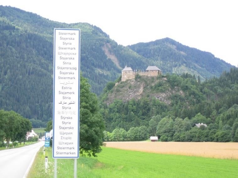
Considérations sur les curiosités toponymiques au Canada
Le contexte                                                                      Des noms géographiques en tant que curiosités toponymiques

       l’instar de princes de la Renaissance qui ont eu des cabinets de          Le Pâtira 7 est le nom d’un lieu-dit situé sur la Côte-du-Sud, dans les

À     curiosités, nombre d’entre nous ont possédé dans leur enfance un
      coffre aux trésors, sous forme de boîte, où étaient entassés, pour
être regardés à satiété, les objets les plus divers.
                                                                                 limites de la ville de Montmagny. En 1759, au moment de la Conquête,
                                                                                 les villageois de ce coin de la Nouvelle-France s’y seraient réfugiés pour
                                                                                 fuir l’incendie de leurs fermes. Le toponyme, tiré du verbe pâtir et
                                                                                 transmis de génération en génération, exprimerait les souffrances
Ces minuscules collections de choses singulières ont souvent le pouvoir          endurées à ce moment. Ce substantif qui s’apparente à un verbe au futur
de déconcerter, car seuls les propriétaires qui les ont rassemblées              étonne.
connaissent la raison du choix de chacune. De nos jours, le terme
collection réfère généralement à une réunion d’objets de même nature             Le toponyme Cloridorme8, qui désigne quant à lui une municipalité de la
(timbres, pièces de monnaie, poupées, cartes de hockey, etc.). Il peut           Gaspésie, pourrait entrer aussi dans la catégorie des curiosités
donc sembler paradoxal de rassembler en collections des éléments                 toponymiques. Son origine est inconnue. Il retient l’attention par son
définis avant tout par leur singularité, et donc par l’absence de lien           opacité, d’une part, et par les images naïves qu’il inspire, évoquant à la
logique entre eux.                                                               fois le nom chloroforme et le verbe dormir.

Les curiosités dans la toponymie                                                 Enfin, on ne peut passer sous silence Rivière Qui-Mène-du-Train 9 , le
                                                                                 nom d’une rivière du Saguenay–Lac-Saint-Jean qui exprime, à l’aide
Il en va pour les noms géographiques comme pour les objets : des                 d’une expression québécoise, le bruit que font les eaux. La fréquence
toponymes peuvent constituer individuellement des curiosités aussi               très faible des verbes dans les toponymes et l’élégance du nom d’origine
bien que former avec d’autres une curiosité. On pourrait définir ainsi une       vernaculaire concourent à faire de ce nom une rareté.
curiosité toponymique : un nom géographique ou un ensemble de noms
géographiques à la fois singulier et captivant. Si l’adjectif captivant figure   Des ensembles de noms géographiques en tant que curiosités
dans cette définition, c’est que la rareté d’un nom ne saurait à elle seule      toponymiques
lui conférer le statut de curiosité. Par exemple, au Québec, il n’y a qu’une
voie appelée 13e-et-14e Rang ou encore un seul Lac Février, mais ces             Des régiments en ordre de bataille
noms uniques ne retiennent guère l’attention. Les paysages québécois,
comme ceux de partout dans le monde, regorgent de curiosités                     En Abitibi-Témiscamingue, 49 cantons (ce sont des éléments du cadastre
toponymiques. En voici quelques-unes.                                            québécois) sont nommés d’après des régiments et des officiers français
                                                                                 qui ont participé à des épisodes de la guerre de Sept Ans en Nouvelle-
                                                                                 France. Les noms de ces cantons ont été choisis au début du XX e siècle
                                                                                 par le ministre des Terres et Forêts de la province de Québec :

      « J’ai assigné un de ces noms avec un de ceux des régiments auxquels ces officiers appartenaient, à chacun de ces cantons : plaçant ceux des
      régiments en tête, rangés comme en ordre de bataille, de l’ouest à l’est, puis ceux des officiers attachés à chacun de ces corps, alignés du nord
      au sud, comme suit10 : »

    La Reine            La Sarre                Royal-Roussillon       Languedoc           Guyenne               Berry                 Béarn
    Roquemaure          Palmarolle              Poularies              Privat              Launay                Trécesson             Dalquier
    Hébécourt           Duparquet               Destor                 Aiguebelle          Manneville            Villemontel           Figuery
    Montbray            Duprat                  Dufresnoy              Cléricy             La Pause              Preissac              La Motte
    Dasserat            Beauchatel              Rouyn                  Joannès             Bousquet              Cadillac              Malartic
    Dufay               Montbeillard            Bellecombe             Vaudray             Montanier             Surimau               Fournière
    Pontleroy           Desandrouins            Caire                  Basserode           Darlens               Béraud                Desroberts

Note : Les noms des cantons sont écrits dans leur forme contemporaine

7  COMMISSION DE TOPONYMIE. « Le Pâtira », Banque de noms de lieux               9 COMMISSION DE TOPONYMIE. « Rivière Qui-Mène-du-Train », Banque
du Québec, [En ligne].                                                           de      noms       de      lieux     du     Québec,      [En      ligne].
[www.toponymie.gouv.qc.ca/ct/ToposWeb/Fiche.aspx?no_seq=434684                   [www.toponymie.gouv.qc.ca/ct/ToposWeb/Fiche.aspx?no_seq=51855]
]. (Page consultée le 29 mai 2019).                                              . (Page consultée le 29 mai 2019).
8 COMMISSION DE TOPONYMIE. « Cloridorme », Banque de noms de                     10
                                                                                    MINISTÈRE DES TERRES ET FORÊTS. Rapport annuel du ministre des
lieux du Québec, [En ligne].                                                     Terres et Forêts de la province de Québec pour les douze mois expirés le
[www.toponymie.gouv.qc.ca/ct/ToposWeb/Fiche.aspx?no_seq=14186]                   30 juin 1907, Québec, 1908, p. xii.
. (Page consultée le 29 mai 2019).
                                                UNGEGN Information Bulletin No. 56 • June 2019 •           Page 10
Le Jardin au Bout du Monde • La Statue de Fer;
• Le Vent du Diable;
En 1997, la Commission de toponymie a souligné le vingtième • La Vingt-Septième Lettre et 90 autres.
anniversaire de la Charte de la langue française, une loi qui a renforcé
les pouvoirs de l’organisme toponymique québécois mis en place en Bref, une authentique curiosité toponymique.
1912. À cette occasion, elle a dénommé 101 des îles (101 étant le
numéro du projet de loi) du plus vaste plan d’eau du Québec, le réservoir Perspectives
de Caniapiscau, d’après des œuvres de la littérature québécoise de
l’après-guerre. L’archipel a reçu le nom Le Jardin au Bout du Monde11, 12, On sait que des noms géographiques peuvent constituer des curiosités.
titre d’un roman de Gabrielle Roy. Aucun générique (île ou archipel) ne On peut les réunir et les présenter dans des publications ou des pages
figure dans ces toponymes attribués : ils sont introduits par l’article Web, qui tiennent alors lieu de musées. Il importe de porter maintenant
défini le, la ou l’, ce qui donne l’impression qu’ils ont été transformés en la réflexion au-delà de la question de la collection. Il faut décoder les
objets, réifiés et en quelque sorte exposés comme des œuvres dans un noms de lieux qui retiennent l’attention, qui fascinent. Outre la rareté,
musée aquatique, soit le réservoir. L’ensemble de ces toponymes portés quels sont les attributs de ces noms géographiques? Leur décryptage
sur une carte forme un poème géographique qui ne laisse pas de pourrait inspirer un art de nommer les lieux. Si l’on souhaite que les noms
fasciner : géographiques contribuent à un « réenchantement » du monde, la
toponymie aura certes besoin encore de noms qui peuvent servir de
• L’Archange du Faubourg; repères et de témoignages, mais également de toponymes capables
• La Dalle des Morts; d’émouvoir, d’émerveiller : des noms qu’il faudra concevoir comme des
• La Fille de Personne; œuvres.
• Le Parapluie de Ma Tante;
• L’Indigo Nuit; Marc Richard
• La Malebête; geographer and toponymist
• Le Pavillon des Miroirs; Commission de toponymie du Québec
• Le Pont du Froid; E-mail: mrichard@toponymie.gouv.qc.ca
Reflections on toponymic curiosities in Canada
Context included in the definition because a name’s unusualness is not enough
to give it curiosity status. For example, in Quebec, there is only one route
J ust like Renaissance princes and their cabinets of curiosities, many called 13e-et-14e Rang and only one Lac Février (February lake, in
of us have had treasure chests in our youth—a box where we kept French), but these unique names do not garner much attention. The
various objects we could admire to our heart’s content. Quebec landscape, like that the world over, is chock-full of toponymic
curiosities. Below are a few examples.
These small collections of curiosities can often be baffling to others,
since only their owners understand why the objects were chosen. Today, Geographical names as toponymic curiosities
the term collection generally refers to a group of similar objects (stamps,
coins, dolls, hockey cards, etc.). Grouping together a collection of things Le Pâtira13 is a place within the Montmagny city limits. It is said that in
specifically because they are unique rather than for any logical 1759, at the time of the Conquest, New France villagers from the area
connection between them may therefore seem paradoxical. took refuge at Le Pâtira after fleeing their burning farms. This
geographical name, which comes from the French verb pâtir (meaning
Toponymic curiosities suffer) and was passed down from generation to generation, expressed
the suffering endured at the time. The noun, which resembles a verb in
Objects can constitute curiosities both individually and collectively, and the future tense, is surprising.
the same goes for geographical names. A toponymic curiosity can be
defined as follows: a geographic name or group of geographic names Cloridorme,14 a municipality in Gaspésie, may also be categorized as a
that are unique as well as captivating. The adjective captivating is toponymic curiosity. The origin of the name is unknown. It is attention-
11 COMMISSION DE TOPONYMIE. « Le Jardin au Bout du Monde », 13 COMMISSION DE TOPONYMIE DU QUÉBEC. “Le Pâtira,” Banque de
Banque de noms de lieux du Québec, [En ligne]. noms de lieux du Québec, [Online].
[www.toponymie.gouv.qc.ca/ct/ToposWeb/Fiche.aspx?no_seq=335681 [www.toponymie.gouv.qc.ca/ct/ToposWeb/Fiche.aspx?no_seq=434684
]. (Page consultée le 29 mai 2019). ]. (Page consulted on May 29, 2019).
12 COMMISSION DE TOPONYMIE. « Le Jardin au Bout du Monde : poème 14 COMMISSION DE TOPONYMIE DU QUÉBEC. “Cloridorme,” Banque de
géographique », Toponymix : note toponymique 17, 1997. noms de lieux du Québec, [Online].
UNGEGN Information Bulletin No. 56 • June 2019 • Page 11grabbing because of both its obscurity and the simple images it inspires, Groups of geographical names as toponymic curiosities
conjuring simultaneously the noun chloroform and the verb dormir (to
sleep, in French). Regiments in order of battle
Finally, there is Rivière Qui-Mène-du-Train, 15 the name of a river in In Abitibi-Témiscamingue, 49 counties (elements of the Quebec
Saguenay–Lac-Saint-Jean that expresses the sound of water using a cadastre) are named after French regiments and officers who
Quebec expression. The very uncommon presence of verbs in participated in the Seven Years’ War in New France. The names of these
geographical names and the elegance of this name of vernacular origin counties were chosen at the beginning of the 20th century by Quebec’s
make it rare. minister of lands and forests:
[TRANSLATION] “I assigned each county the name of a regiment the officers belonged to, starting with the regiments, in order of battle, from
west to east, followed by the names of the officers attached to each of the corps, from north to south, as follows:” 16
La Reine La Sarre Royal-Roussillon Languedoc Guyenne Berry Béarn
Roquemaure Palmarolle Poularies Privat Launay Trécesson Dalquier
Hébécourt Duparquet Destor Aiguebelle Manneville Villemontel Figuery
Montbray Duprat Dufresnoy Cléricy La Pause Preissac La Motte
Dasserat Beauchatel Rouyn Joannès Bousquet Cadillac Malartic
Dufay Montbeillard Bellecombe Vaudray Montanier Surimau Fournière
Pontleroy Desandrouins Caire Basserode Darlens Béraud Desroberts
Note: The names of the counties are written in their present-day form.
• Le Pavillon des Miroirs (the house of mirrors);
Le Jardin au Bout du Monde • Le Pont du Froid (the bridge of coldness);
• La Statue de Fer (the iron statue);
In 1997, the Commission de toponymie du Québec (the public body • Le Vent du Diable (wind of the devil);
responsible for managing Quebec’s geographical names) marked the • La Vingt-Septième Lettre (the twenty-seventh letter) and 90
20th anniversary of the Charter of the French Language, a law that others.
strengthened the powers of Quebec’s toponymic organization,
established in 1912. For this occasion, the Commission named 101 In other words, it is a true toponymic curiosity.
islands (in honour of Bill 101) in Quebec’s largest body of water, the
reservoir de Caniapiscau, after works of post-war Quebec literature. The Perspectives
archipelago was named Le Jardin au Bout du Monde17, 18 (Garden in the
Wind), which is the title of a novel by Gabrielle Roy. The generic term We have seen that geographical names can be curiosities. They can be
(island or archipelago) is not included in these names; they are grouped together and presented in publications or webpages, which
introduced simply by the French definite article le, la or l’, which gives then serve as museums. Let’s now move on to a reflection beyond
the impression that they have been turned into objects, made concrete collections. We must decode place names that catch our attention and
and in a way exhibited as works in an aquatic museum—in this case the fascinate us. Besides their unusualness, what attributes do these names
reservoir. Together, these geographical names on a map form a have? Decrypting them could inspire an art of naming places. For
geographical poem that is nothing short of fascinating: geographical names to once again delight the world, they will need to
not only serve as landmarks and tributes, but also move and amaze us:
• L’Archange du Faubourg (the archangel from the faubourg); names conceived like works of art.
• La Dalle des Morts (the tombstone of the dead);
• La Fille de Personne (the daughter of no one); Marc Richard
• Le Parapluie de Ma Tante (my aunt’s umbrella); geographer and toponymist
• L’Indigo Nuit (night indigo); Commission de toponymie du Québec
• La Malebête (the dangerous one); E-mail: mrichard@toponymie.gouv.qc.ca
[www.toponymie.gouv.qc.ca/ct/ToposWeb/Fiche.aspx?no_seq=14186] 17
COMMISSION DE TOPONYMIE DU QUÉBEC. “Le Jardin au Bout du
. (Page consulted on May 29, 2019). Monde,” Banque de noms de lieux du Québec, [Online].
15
COMMISSION DE TOPONYMIE DU QUÉBEC. “Rivière Qui-Mène-du- [www.toponymie.gouv.qc.ca/ct/ToposWeb/Fiche.aspx?no_seq=335681
Train,” Banque de noms de lieux du Québec, [Online]. ]. (Page consulted on May 29, 2019).
[www.toponymie.gouv.qc.ca/ct/ToposWeb/Fiche.aspx?no_seq=51855] 18
COMMISSION DE TOPONYMIE DU QUÉBEC. “Le Jardin au Bout du
. (Page consulted on May 29, 2019). Monde : poème géographique,” Toponymix : note toponymique 17,
16
MINISTÈRE DES TERRES ET FORÊTS. Rapport annuel du ministre des 1997.
Terres et Forêts de la province de Québec pour les douze mois expirés le
30 juin 1907, Québec, 1908, p. xii.
UNGEGN Information Bulletin No. 56 • June 2019 • Page 12Curiosities of Geographical Names in Cyprus
Introduction
T he History and Culture of Cyprus is among the oldest in the world.
The first signs of civilization traced in archaeological excavations
and research, date back approximately 9,000 years to the 7th
millennium BC. This rich cultural landscape involves hundreds of
archaeological sites scattered throughout the island, representing
various historical periods in the island's evolution.
To a significant extent, geography determined the historical destiny of
Cyprus, because of its geostrategic location, at the meeting point of
three continents, namely: Europe, Asia and Africa.
For certain periods, Cyprus lived under foreign domination. The
following periods in time characterize the multi-cultural history of
Cyprus:
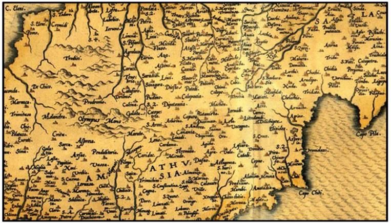
Figure 1: Geographical names and toponyms of Cyprus
From Abraham Ortelius, “Cypri Insulae Nova Descript, 1573”
1. 7000-3900 BC Neolithic Age
2. 3900-2500 BC Chalcolithic Age
3. 2500-1050 BC Bronze Age It is noted that all authoritative geographical names and toponyms of
4. 1050-750 BC Geometric Period Cyprus are included in a “Complete Gazetteer”. These names were
5. 750-325 BC Archaic and Classical Period derived from the official large scale cadastral map series and property
6. 333-325 BC Alexander the Great defeats Persia and Cyprus registers of the Department of Lands and Surveys.
becomes part of his empire.
7. 325-58 BC Hellenistic Period The following are some indicative examples, which show the wealth of
8. 58 BC - 330 AD Roman Period information which is hidden within geographical names.
9. 330-1191 AD Byzantine Period
10. 1191-1192 AD Richard The Lionheart And The Templars a) Religion – Village Names
11. 1192-1489 AD Frankish (Lusignan) Period
12. 1489-1571 AD Venetian Period Religion played an important role in the lives of the inhabitants of
13. 1571- 1878 AD OTTOMAN PERIOD Cyprus. The following map shows in blue colour the village
14. 1878-1960 British Period administrative areas of the villages that have names which include
15. 1960 Republic Of Cyprus the word “Agios”, or “Agia”, meaning “Saint”. Examples are: Agios
Georgios (Saint George), Agia Varvara (Saint Barbara), Agios Ioannis
Cyprus became an independent republic in 1960. It is a member of the (Saint John), Agios Nikolaos (Saint Nicholas), Agios Pavlos (Saint
United Nations, the European Union, the Council of Europe, and the Paul) etc.
Commonwealth.
Geographical Names in Cyprus
As explained above, Cyprus went through several periods in history,
which had an influence on the population, the language, the religion, the
customs, and the culture. Geographical names are of course a significant
part of cultural heritage, and as such, they have been affected
significantly by each period in history.
Geographical names, in several cases, reveal a significant part of the
history of the place they refer to.
An analysis was made using GIS technology. Geographical names and
toponyms were selected and grouped, based on character strings they
include.
Figure 2: Village Administrative Areas which include in their names
the word “Agios”, or “Agia”, meaning “Saint”
UNGEGN Information Bulletin No. 56 • June 2019 • Page 13b) Religion – Toponyms d) Sheep-Farms – Toponyms
A significant number of toponyms include the word “Agios”, or Livestock also played a very important role in Cyprus, and was also
“Agia”, meaning “Saint”. There are many examples of toponyms a significant source of income for the inhabitants. The following
which refer to nearby chapels, churches, monasteries and map shows points where toponyms include the word “Mandres”,
cemeteries, indicating the long history of Christianity in Cyprus. meaning “Paddocks”, or “sheep, goat and cow farms”. Examples
are: “Mandres tou Pieri”,” Mandra Kameni”, and “Mantroudes”.
Figure 3: Micro-toponyms which include in their names the
word “Agios”, or “Agia”, meaning “Saint” Figure 5: Micro-toponyms which include in their names the
word “Mandres” meaning “paddock” or “sheep, goat, or cow
c) Agriculture and Land – Toponyms farms”
Agriculture and land always played a very important role, and were e) Pano/Kato – Village Names
a significant source of income for the inhabitants of Cyprus. The
following map shows points where there are toponyms including The following map shows in brown color the administrative areas of
the word “Pervolia”, meaning “Field/Garden”, “Ambelia”, meaning villages of which their names include the character strings “Pano”,
“vine-yards”, “Alonia”, meaning “Threshing Floors”, and “Leivadia”, meaning “Up”, or Kato, Meaning “Down”. Examples are: Kato
meaning “Meadows”. Dikomo, Pano Dikomo, Kato Deftera, Pano Deftera, Pano and Kato
Lefkara etc. These villages have residential areas which are built at
different elevations.
Figure 4: Micro-toponyms which include in their names the
word “Pervolia”, meaning “Field/Garden”, “Ambelia, meaning
“Vine-yards”, “Alonia”, meaning “Threshing Floors”, and
“Leivadia”, meaning “Meadows”
Figure 6: Micro-toponyms which include in their names the
word “Pano”, meaning “Up”, or “Kato”, meaning “Down”
UNGEGN Information Bulletin No. 56 • June 2019 • Page 14f) Soil colour – toponyms
The following map shows the position of toponyms which include
the character strings “Aspro” meaning “White”, “Mavro”, meaning
“Black”, and “Kokkino” meaning “Red”, indicating the colour of the
soil that exists in each area, which also affects the quality of each
area for agricultural purposes. Examples are: “Asprochoma,
Asprovouno, Mavrogi, Mavrospilios, Kokkinorotsos, and
Kokkinokampos”.
Figure 8: Micro-toponyms which include in their names the word
“Ammos, Moutti and Laxia”
Conclusion
All of the above maps were produced strictly having as a base the
geographical names, and the character strings, or combinations of
Figure 7: Micro-toponyms which include in their names the word
character strings that are included in the names. It is evident, based on
“Aspro”, meaning “White”, “Mavro”, meaning “Black”, and the above indicative examples, that geographical names in Cyprus reveal
“Kokkino”, meaning “Red” a wealth of information which prove the long history, and the cultural
heritage of the country.
g) Land Morphology – Toponyms Andreas Hadjiraftis
President of Permanent Committee for the Standardization
The following map shows the positions of toponyms which include of Geographical Names of Cyprus
the character strings: “Ammos”, meaning “Sand” (examples: Ag. Chief Lands Officer,
“Ammovounaro, Ammoudies, and Ammokremmos”), “Moutti”, Cartography/Geodesy/Hydrography/Photogrammetry,
meaning “Peak” (examples: At omoutti, Aspri Moutti, and Department of Lands and Surveys, Ministry of Interior,
Kokkinomoutti), and “Laxia”, meaning “a wide opening with high Lefkosia, Cyprus
banks through which water flows”, (examples: “Laxia ton E-mail: ahadjiraftis@dls.moi.gov.cy
Mosfilion”, “Laxia tou Pafiti”, “Laxia tis Vournas”, and “Laxia
Ammatiou”).
Curiosities of geographical names in Czechia
T he names of settlements of all sizes, including solitary houses,
were collected for this article. Some interesting settlement
names, which no longer exist, were found. The origin of the
names was not explored but a word or a word based on the name was
looked up.
The most common name is Lhota (265 municipalities and their parts)
or diminutively Lhotka (76), often in conjunction with an adjective or
an attribute. It is a common name of the villages that originated in
the period of high medieval colonization in Bohemia, Moravia and
Silesia. It is believed that the formation of these settlements falls
mainly in the 13th century and the first half of the 14th century. The
There are 6,258 municipalities in Czechia. They are all gathered in the
oldest written documentary of Lhota in Czech territory relates to the
Geonames information system. Settlement names are not
year 1199. The inhabitants of newly founded villages had obligations
standardized in the Czech Republic, only registered.
towards suzerains, but those duties were usually suspended for a
The longest settlement names are Nová Ves u Nového Města na certain period (such as 5 – 8 years) as a compensation for felling of
Moravě (27 letters, 33 characters including spaces) and Brandýs nad forests and making the land available for agriculture. This period used
Labem-Stará Boleslav (29 letters, 32 characters). The shortest names to be called "lhóta" (= 'due period') and often became a part of the
are Aš and Eš. The average length of a municipality name is 8.77 village name. However, the most common phrase for a new village is
characters. Nová Ves (New Village, en.)(62).
UNGEGN Information Bulletin No. 56 • June 2019 • Page 15Table no. 1 contains examples of names of municipalities derived from given names. Some given names are not typical for the territory with Slavic
(Czech) language, i.e. Svatogothardská Lhota according to the German name Gotthard, Gothard in Czech. This name is used in surrounding European
countries more often.
Given name Geographical name
Anna Annenské Údolí, Annín, Annino Údolí
Gothard Svatogothardská Lhota
Jan Janohrad, Janovice nad Úhlavou, Svatý Jan pod Skalou, Uhlířské Janovice, Vrchotovy Janovice
Jiljí Jiljov
Josef Josefov, Josefův Důl, Josefova bouda
Karel Karlova Studánka, Karlovy Vary
Klára Klárov
Marie Mariánská Týnice, Mariánské Lázně, Mariánský Týnec
Pavel Pavlínov, Pavlovice, Pavlovsko
Petr Petrov, Petrovice, Petřiny
Tereza/Terezie Terčí Dvůr, Terezín
Table no. 2 has a list of some geographical names with the origin of the name as a part of the human body.
Part of human body - English Part of human body - Czech Geographical name
head Hlava Hlavňovice, Kostelní Hlavno, Hlavenec
bone Kost Kost, Kostníky, Kostrčany
elbow Loket Loket
foot, leg Noha Nohavice
finger Prst Prstná
hand Ruka Rukáveč
heart Srdce Srdov
bald head Pleš Pleše, Nové Ves pod Pleší
gob – slang word for mouth ústa-hovorově držka Držkov, Držková
beard Vousy Holovousy
innards Střeva Holostřevy
anus Řiť Řitka
Table no. 3 displays names of municipalities describing different status of persons.
Status of persons - English Status of persons - Czech Geographical name
emperor Císař Císařský, Císařov
pop Papež U Papežů
earl Hrabě Hrabětice, Hraběšice, Hraběcí Huť
prince Kníže Knížecí Pláně, Kněžmost
knight Rytíř Rytířova Lhota, Rytířov
Table no. 4 contains names of municipalities describing type of soil and landcover.
Type of cover - Type of cover - Czech Geographical name
English
Soil hlína Hlineč, Hliněný Újezd, Hlinky, Hlinná, Hlinsko
Clay jíl Jílové u Prahy, Jíloviště
Bush křoví Křoví
Forest les Krásný Les, Mezilesí, Mrsklesy, Praskolesy, Víska pod Lesy, Zálesí
meadow louka Loučka, Loučky, Loučná, Loukovice, Luhov, Luhy, Lužany, Lukavec
glade paseka Dolení Paseky, Hoření Paseky, Paseky, Paseky nad Jizerou
orchard sad Sadová, Sadská, Sazená
rock skála Skalice, Skalná, Svatý Jan pod Skalou, Škalí
garden zahrada Zahrádky, Zahradní Město
UNGEGN Information Bulletin No. 56 • June 2019 • Page 16Vous pouvez aussi lire