Proceedings of the ACEWATER2 Scientific Workshop - Accra (Ghana) 31 Oct - 3 Nov 2016 - JRC ...
←
→
Transcription du contenu de la page
Si votre navigateur ne rend pas la page correctement, lisez s'il vous plaît le contenu de la page ci-dessous
Proceedings of the ACEWATER2
Scientific Workshop
Accra (Ghana) 31 Oct – 3 Nov 2016

   AU/NEPAD Networks of Water Centres of Excellence

                                          Editors:
                                          Ronco, P.
                                          Crestaz, E.
                                          Carmona Moreno, C.
                                          2017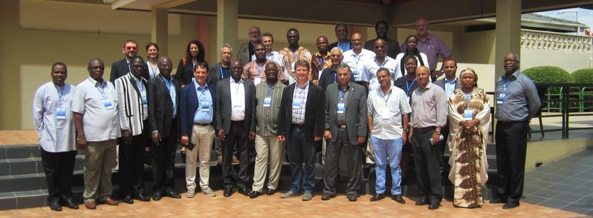
This publication is a Workshop report by the Joint Research Centre (JRC), the European Commission’s science and knowledge
service. It aims to provide evidence-based scientific support to the European policymaking process. The scientific output expressed
does not imply a policy position of the European Commission. Neither the European Commission nor any person acting on behalf
of the Commission is responsible for the use that might be made of this publication.

Contact information
Name: César Carmona Moreno
Address: Joint Research Centre, via Enrico Fermi 2749, TP 121, 21027 Ispra (VA), Italy
Email: cesar.carmona-moreno@ec.europa.eu
Tel.: +0332 789654

JRC Science Hub
https://ec.europa.eu/jrc

JRC105941

PDF       ISBN 978-92-79-71744-4         doi:10.2760/872966

Ispra: European Commission, 2017

© European Union, 2017

Reuse is authorised provided the source is acknowledged. The reuse policy of European Commission documents is regulated by
Decision 2011/833/EU (OJ L 330, 14.12.2011, p. 39).

For any use or reproduction of photos or other material that is not under the EU copyright, permission must be sought directly
from the copyright holders.

How to cite this report: Ronco P., Crestaz E., Carmona Moreno C., Proceedings of the ACEWATER2 Scientific Workshop
Accra (Ghana) 31 Oct – 3 Nov 2016, European Union, Ispra (VA), Italy, 2017, ISBN 978-92-79-71744-4, doi:10.2760/872966,
JRC105941.

All images © European Union 2017.
Table of Contents

Table of Contents ............................................................................................................................................................................... 3
Introduction ........................................................................................................................................................................................ 4
Session 1 : CLIMATE ISSUES ........................................................................................................................................................ 5
Hydrologie et ressources en eau à l’échelle des petits et moyens bassins du Burkina Faso .............................................................. 5
IGAD-HYCOS project achievement and challenges ............................................................................................................................. 7
Climate variability and its impact on water resources in semi-arid areas - the case of Botswana ..................................................... 8
Promoting a water secured Africa through adaptive research and innovative sensing ..................................................................... 9
Le Système d'information sur l'eau pour une meilleure connaissance et une gestion durable des ressources en eau en Afrique
centrale. ............................................................................................................................................................................................ 13
NWRC-Egypt contribution in the framework of ACEWATER2 project .............................................................................................. 17
Session 2: WATER-ENERGY-FOOD AFRICAN NEXUS .................................................................................................................. 19
Scientific activities performed by the National University of Science and Technology of Zimbabwe .............................................. 19
Research activities performed by the Water Research Centre (University of Khartoum) relevant to ACEWATER2 project ............ 21
Water-related research activities performed by the University of KwaZulu-Natal (South Africa) and potential contribution to
the ACEWATER2 Project ................................................................................................................................................................... 23
NUST Research projects (2015 & 2016) ............................................................................................................................................ 27
Vulnérabilité climatique et variabilité des ressources en eau en Afrique de l’Ouest : l’exemple du bassin du Sénégal .................. 28
Unlocking the potentials for multiple utilization of dams and reservoirs in Nigeria ........................................................................ 35
Impact assessment and viability of irrigations schemes programs in the Sokoto Rima Basin Development Authority (SRRBDA)
project for intensified agriculture and poverty alleviation in Nigeria ............................................................................................... 39
Baseline IWRM information – an interdisciplinary project approach ............................................................................................... 43
Session 3: GROUNDWATER ...................................................................................................................................................... 48
Activities of AMCOW on groundwater ............................................................................................................................................. 48
UNESCO CHAIR in Hydrogeology as a center of excellence of Southern Africa at the forefront of capacity building, research
and development of groundwater professionals ............................................................................................................................. 51
Specific interests for water resources management and development for Zambia ........................................................................ 55
Shallow groundwater irrigation for food security in northern Ghana .............................................................................................. 56
Session 4: WATER GOVERNANCE AND DIPLOMACY .................................................................................................................. 57
IWEGA past and ongoing water-related activities in Southern Africa region and potential contribution in the framework of
ACEWATER2 project .......................................................................................................................................................................... 57
Coupling for Coping, CoOPLAaGE: an integrative strategy and toolbox fostering multi-level hydrosocial adaptation.................... 58
The BeWater Project: making society an active participant in water adaptation to global change. ................................................ 64
LIST OF PARTICIPANTS .............................................................................................................................................................. 68

                                                                                                                                                                                       3|P a g e
Introduction
The African Centers of Excellence on Water (ACEWATER2) project, in its second phase (2016-19), promoted by the African
Ministers of Water and financed by DG DEVCO, aims at supporting the establishment of Human Capacity Development Programme
of the AMCOW (African Ministers’ Council on Water) in the Water Sector, strengthens institutional networking and improving
research support to policy making by scaling up the approach of the pilot phase.
The main activities of the project consist in:
Strengthening of two existing NEPAD water Centers of Excellence networks in West and Southern Africa;
Expanding the NEPAD water Centres of Excellence network to Central and Eastern Africa;
Strengthening institutional networking and improving research support to policy making in the water sector;
Supporting the implementation of the African Water Ministers’ declaration urging AUC and NEPAD Centers of Excellence
to develop a “Human Capacity Development Programme for junior professional and technician level capacity challenges
in the water sector”;
Developing an Atlas on Regional Water Cooperation.
The project geographical scope covers three major regions: Southern Africa (8 countries), Western Africa (4 countries) and
Eastern/Central Africa. The project is implemented by DG JRC (overall project management and scientific cluster) with UNESCO
(human capacity development cluster).
Within this project, a Workshop has been organized in Accra (Ghana) from October 31st to November 3rd 2016, specifically devoted
to the sharing among CoEs of scientific interests, competences and methods towards the effective planning of (scientific) activities,
achievement and delivery of scientific tools and products to support (science-based) decision making processes. By means of
scientific as well as technical presentations, round tables and participative sessions, the participants (35 people representing more
than 30 Institutions among Universities, Research Centres, River Basin Authorities, Regional Economic Communities and key
stakeholders on water issues, further to European research Institutions as CIRAD and CREAF) shared valuable experiences and
competences, including case studies, around key thematic pillars, such as: Climate Issues (Session 1), African Water-Energy-Food
nexus (Session 2), Groundwater (Session 3) and Water Governance&Diplomacy (Session 4).
Workshop Proceedings gather all relevant contributions in the form of (extended) abstracts and short papers, providing a general
overview of key relevant issues and partners scientific interests, turning to be a valuable resource for effective planning of next
project steps.
4|P a g e
Session 1 : CLIMATE ISSUES
Hydrologie et ressources en eau à l’échelle des petits et moyens bassins du Burkina Faso
DIARRA Abdoulaye, 2iE, Burkina Faso
2iE à travers son laboratoire hydrologie et ressources en eau (LEAH) travaille depuis 14 ans sur les aspects irrigation, hydrologie,
hydrogéologie et adaptation des populations aux changements globaux. Les activités du laboratoire LEAH visent à contribuer à
l’amélioration des connaissances des ressources en eau de surface et souterraine dans un contexte de changements globaux et à
étudier les stratégies d’adaptation des populations face à ces changements. Le LEAH se concentre prioritairement sur les petits et
les moyens bassins versants. Parmi les projets pilotés par le laboratoire, on peut citer :
le projet AMMA (Analyses Multidisciplinaires de la Mousson Africaine, 2004-2009) qui a été mené par un consortium de
chercheurs de plus 57 institutions de recherche et dont le volet «Ressources en Eau» a été piloté par LEAH. Ce projet
avait pour but de modéliser la Mousson Ouest Africaine pour une meilleure prévision climatique et d’évaluer la
vulnérabilité des ressources en eau pour des scénarios climatiques futurs (2020 et 2050) ;
Le projet Afromaison (2011-2014) a été mené par un consortium de 15 partenaires du Nord et du Sud. Il avait pour
objectif de contribuer à la mise en place du concept de gestion intégrée des ressources naturelles (GIRN) à l’échelle méso-
géographique sur des sites pilotes situés en Afrique du Sud, Éthiopie, Ouganda, Tunisie et Mali;
le projet Challenge Program (2011-2013) s’était focalisé sur la gestion et l’optimisation des petits réservoirs (Barrage de
Bourra au sud du Burkina et Binaba au Nord-Est du Ghana) ;
Le projet irrigation de complément (2011-2015) avait pour objectif la sécurisation de l’agriculture pluviale au Sahel par
l’irrigation de complément dans un contexte de variabilité et changement climatique ;
Le projet GRIBA (2012-2015) avait pour objectif de comprendre et de prédire le comportement des eaux souterraines en
zones de socle africaines ;
Le projet UEMOA Hydrologie (2012-2015) avait pour objectif de contribuer à l’amélioration de la conception et la gestion
des infrastructures hydrauliques et routières en les adaptant aux nouvelles conditions hydrologiques ;
Le projet AMMA 2050 (2015-2019) a pour objectif d’analyser les événements climatiques extrêmes à l’horizon 2050 en
Afrique de l’Ouest et leurs impacts sur l’agriculture au Sénégal et sur l’hydrologie de la ville de Ouagadougou.
Dans le cadre de ses projets de recherche, le laboratoire LEAH a mobilisé différents outils et méthodes selon les domaines de
recherche :
Climat (les sorties de modèles climatiques) : RCM AMMA-ENSEMBLES (11 RCMs) et RCM CORDEX (3 RCMs) ;
Hydrologie : GR4J (Global, Journalier), GR2M (Semi-distribué, mensuel), IHACRES (Global, Journalier), ORCHIDEE
(Distribué, Demi-heure), SWAT (Distribué, journalier) ;
Hydrogéologie : FEFLOW (Trois dimensions: Ecoulement, Transport de masse et transfert de chaleur) ;
Socio-économie /Agriculture : CROPWAT (modéle de culture), WEAP (Water Evaluation and Planning System) et MIKE
BASIN.
5|P a g e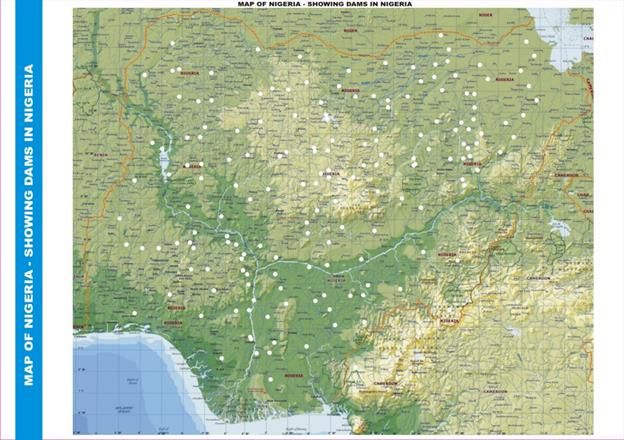
À travers ses projets de recherche LEAH dispose de données détaillées sur des sites pilotes:
Bassin versant expérimental de Tougou au Burkina Faso (Données socio-économiques, hydrologiques, climatiques et
agronomiques depuis 2004) ;
Bassin versant du Nakambé (Burkina Faso), Bassin versant de l’Ouémé au Bénin et les sous Bassins du Fleuve Sénégal
(Gourbassy, Bafing Makana et Oualia) : Evaluation des ressources en eau et de leur vulnérabilité pour des scénarios
climatiques futurs (2020 et 2050) ;
Etude des débits maximaux sur les petits bassins sahéliens (7 bassins au Burkina Faso et 7 bassins au Sénégal, Mali et
Guinée) ;
Gestion et optimisation des petits réservoirs (Barrage de Bourra au sud du Burkina et Binaba au Nord-est du Ghana)
(Données climatiques, Niveaux d’eau, Evaporation) ;
Site expérimental de recherche de Sanon au Burkina Faso : données hydrogéologiques depuis 2011) ;
Etude du Fonctionnement hydrique, de la productivité agricole, érosion des sols dans le bassin de Tougou dans un
contexte de CC (recherche en cours) ;
Prévision des événements climatiques extrêmes à l’horizon 2050 en Afrique de l’Ouest et Impacts des événements
météorologiques extrêmes sur l’hydrologie urbaine au Sahel : cas de la ville de Ouagadougou, Burkina Faso (recherche
en cours + suivi hydrologique en cours).
Le laboratoire travaille en collaboration avec le laboratoire HydroSciences de l’IRD de Montpellier, le laboratoire Ecohydrologie
de l’EPFL de Lausanne, le Consortium de recherche sur le Climat OURANOS (Canada), ACMAD (Niger), IWMI-Accra, CIRAD,
Université de Montpellier 2, Université Pierre et Marie Curie Paris 6, le CNRST du Burkina Fao, IEPF (Canada), le CEH (Royaumes
unies) et l’Université de Ouagadougou.
6|P a g e
IGAD-HYCOS project achievement and challenges
ABDOURAHMAN Houmed Gaba Maki, IGAD-ICPAC, Kenya
The IGAD-HYCOS (Hydrological Cycle Observation System) Project is one of the major activities of the IGAD Water Programme
(Inland Water Resources Management Programme - INWRMP). INWRMP is to strengthen regional and national capacities in the
sustainable management of water resources in the region for peace and security, stability and integration and improved water
governance. The INWRMP was supported by EU and implemented by IGAD through Technical Assistance (TA) Team between 2010
and 2016 following identified four areas of implementation:
Establishing Regional Water Dialogue Forum;
Improve Policy and Legal Frameworks in the Region;
Strengthen Regional and National Water Institutions in the Region;
Develop a Regional Water Information System (IREWIS) including IGAD-HYCOS Project.
IGAD-HYCOS provides inputs to the INWRMP’s result area 4; it is implemented by the World Meteorological Organization (WMO)
through a Project Management Unit (PMU) based in ICPAC premises, Nairobi. At the request of East African Community (EAC) the
scope of the IGAD-HYCOS project has been extended to cover additional countries. The participating countries in the IGAD HYCOS
Project are the IGAD countries plus Burundi and Rwanda. The project is operational since June 2011 and will be completed on
November 2016.
The project is designed to provide the participating countries with a hydrological information system, a tool for regional integrated
water resources assessment, monitoring and management. It will also reinforce regional infrastructure for data collection,
transmission, archiving and retrieval. The project is expected to also enhance the skills of the NHS’s personnel in various technical
fields related to the water resources in the participating countries. It will strengthen Regional cooperation in the field of water
resources management.
The project is completing the implementation of:
163 Stations including 116 for weather and surface water monitoring and 47 for Groundwater monitoring stations. Most
of the stations are on data transmission system using GPS/GPRS or METEOSAT network;
Water database and web portal in every country concerned by the project;
Seven Regional Training of Trainers on relevant fields for 125 personnel of key institutions;
Five National training per country are under completion targeting more than 500 peoples at national level;
Completing the Establishment of IGAD Regional Water Information system to be transferred in ICPAC.
Challenges:
Difficulties in stations operation and maintenance at national level;
Data Transmission system issues, GPRS and EUMETSAT;
Lack of capacity at national level on technical skills;
Output/products yet to be defined and agreed upon;
Missing proper data sharing agreement.
The project was conducted in coordination with National Hydrological services of the 9 concerned countries. The technical support
from WMO was considerable. The Regional Water information system created by this project need to be sustained and ultimately
extended with more stations. The sustainability of the IREWIS will require strong regional support service in ICPAC and national
institutional capacity building.
7|P a g e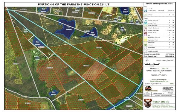
Climate variability and its impact on water resources in semi-arid areas - the case of
Botswana

PARIDA Bhagabat Prasad and KENABATHO P.K., University of Botswana

Manifestation of the response of the earth systems to the global change such as climate, land use and land cover changes impact
on the intensity and magnitude of floods, droughts and agricultural production, among others. These have far reaching
implications on sustainable livelihoods and food security, particularly in semi-arid/arid areas. Botswana located in the Southern
African region experiences a semi-arid climate with low rainfall and high evaporation and suffers from frequent droughts, flash
floods and inadequate fresh water availability which impact on its food security and livelihood. This water related disasters are
also observed in the SADC region, particularly countries around Botswana with different scale and magnitude. Since most of the
water related disasters are either climate related or related to land use or both, understanding and planning towards overcoming
such disasters would need a regional mapping of such problems.
In the presentation, a general overview of the water resources and climatic variability in Botswana has been discussed based on
long term climate data. To understand the climatic regime changes, intervention analyses have been undertaken and then trend
determined for the non-intervened data. Furthermore, delineation of rainfall regions has been undertaken using Radial Basis
Function and the results are presented to highlight the possible impact of land use on the regional characteristics and vice-versa.
Besides this, based on a case study, the contribution of land-use and climate change on water resources has been discussed. To
understand the drought dynamics, changes in dryness conditions leading to severity of droughts have been undertaken using
Standardised Precipitation and Evaporation Index (SPEI) in different time scales viz: 1-month, 6-month and 12months, and their
association with Aridity Index discussed. For drought preparedness planning, the duration for which SPEI was determined has
been explored and the state of future conditions determined (i.e. whether it is likely to be wet, dry or continuation of the existing
conditions has been assessed through the use of Hurst’s coefficient) through rescaled range analysis.
Overall, the presentation will assist the water managers in formulating science-based policies to address water related disasters
through sound water resources management policies and strategies particularly in water scarce areas/ semi-arid regions.

                                                                                                                         8|P a g e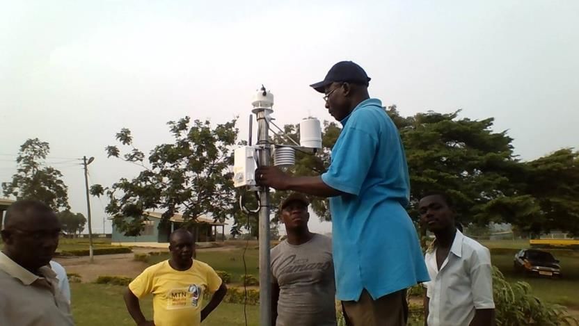
Promoting a water secured Africa through adaptive research and innovative sensing

ANORNU G.K. 1 , ANNOR F. O. 1 , 2 , VAN DE GIESEN N. 2 , SELKER J. S. 3 , BOATENG-GYIMAH M. 4 and ODURO-
KWARTENG S. 1
1   Civil Engin eering Dep artmen t, Kwame Nkrumah U niversity of Science and Technology, Kumasi, Ghan a.
2   Facu lty of Civil Engin eering a nd Geos ciences, Wa ter Res ources Section, Delft Un iversity of Technolog y, D elft, Netherlan ds.
3
    Biological & Ecolog ica l Engin eering, Oregon State Un ivers ity, Corvallis, USA.
4   Water Res ou rces Commis sion /Global Water Pa rtn ersh ip -Gh ana, Accra, Gha na

ABSTRACT
Water Security requires the provision of water in good quality and quantity. This is only possible when water bodies are protected,
the right facilities for water treatment and distribution are built and stakeholders are motivated and effectively engaged in the
provision of water services for productive uses. Ghana, like most countries of the Sub-Saharan Africa region, faces various
challenges in ensuring water security for its inhabitants. The challenges include urbanization and population growth, increasing
pollution loads from untreated and unmanaged waste (solid and liquid), seemingly weak institutions and the lack of enforcement
of laws and regulations. These are further exacerbated by the impacts of climate change. In order to address these challenges,
there is the need to identify the root causes, appraise options for solving them, implement measures that make communities and
inhabitants more resilient to these challenges, find innovative ways to monitor and evaluate the effectiveness of the measures
put in place and determine their impacts with time (Annor, 2014). In all of these, research which appears not to have received
enough attention in countries of the Sub-region is at the heart of the solution for addressing the challenges identified. Adaptive
research entails the use of innovative tools to solve trending challenges. It calls for continuous data collection using innovate
sensors (in terms of costs and robustness), project appraisals, training in technological advancement and effective engagement
with stakeholders especially those at the grassroots, and analysis for informed decision making. The KNUST Regional Water and
Environmental Sanitation Centre, Kumasi (RWESCK) is carrying out cutting edge postgraduate capacity development programme
(Modules) targeted at supporting policies, guidelines and technologies to address challenges with water resources management
in Ghana and West Africa. The Centre is involved in building hydro-meteorological database through the Trans-African Hydro-
Meteorological Observatory (TAHMO). The TAHMO is an initiative building Public Private Partnerships (PPPs) with National
Hydrological and Meteorological Services in Africa to make water and weather data readily available for adaptive research. This
data is essential for developing early warning systems for flood and drought, and agriculture water management in general. The
Centre through its staff and research partners such as the Delft University of Technology in the Netherlands, the Water Resources
Commission of Ghana, the Ghana Global Water Partnership, the International Water Management Institute and the Volta Basin
Authority have carried out extensive research and applications in the area of water resources management in the Volta basin. This
includes Agriculture Water Management, Innovative Sensing, and Mainstreaming of Water Security and Climate Resilient
Development in development planning in Ghana and other parts of Sub-Saharan Africa. Current research includes mapping open
water bodies, flood mapping, run-off and evaporation estimation, as well as soil moisture monitoring in the Volta basin using
current satellite images such as Landsat 8, Spot5, Sentinel-1, Sentinel-2 and Radarsat-2 acquired through the European Space
Agency’s (ESA) TIGER, Alcantara and Spot5-Take5 projects, as well as the Canadian Space Agency’s SOAR Africa project. Staff of
the Centre supported the development of a water allocation model to evaluate trade-offs between hydropower production and
downstream flow requirements for the Akosombo and Kpong dams sponsored by the African Development Bank and led by the
Water Resources Commission of Ghana . Research focus areas of the Centre include Integrated Flood Management, Rain Water
Harvesting Technologies, Downscaling General Circulation Models (GCMs), Groundwater Exploration and Monitoring techniques,
developments of Low-Cost High-Tech Irrigation systems, Water Treatment Technologies and Transboundary Water Management.
This paper presents a case study of one of the on-going research by the KNUST Regional Water and Environmental Sanitation
Centre, Kumasi (RWESCK) that draws lessons for promoting water security in Ghana and the rest of Sub-Saharan Africa.

                                                                                                                                    9|P a g e
INTRODUCTION
The Trans-African Hydro-Meteorological Observatory (TAHMO) is an initiative started by the Delft University of Technology (TU
Delft) in the Netherlands together with the Oregon State University (OSU) in the USA. In Ghana, the initiative is led by the Kwame
Nkrumah University of Science and Technology (KNUST) with the support of the two founding Universities (TU Delft and OSU), the
Ghana Meteorological Agency and Farmerline Limited (a private agro-industry content provider in Ghana).

The World Meteorological Organization (WMO, 2015) reports of a total loss of US$ 2.4 Trillion caused by hydro-meteorological
disasters over the past four decades. Sub-Saharan African countries bear the full brunt of these losses: changing climate and
weather are challenging its capacity to collect localized information and deliver adequate tools for planning and decision making
(Annor et al., 2016). TAHMO intends to help bridge the data gap in Africa, by improving the network of meteorological stations
together with National Hydrological and Meteorological Services (NHMS) in Sub-Saharan Africa to a density of 1 station within
every 30 km (WMO recommendation). This requires the installation of about 20,000 Automatic Weather Stations (AWS) in Africa.
TAHMO has three components: i) the design of robust and cost-effective automatic weather stations suitable for the African
climate, ii) climate education in schools (pre-tertiary and tertiary institutions), as well as the iii) development of business models
to sustain the operation and maintenance of the weather stations to be installed. After working in Africa for almost 30 years, the
initiators of TAHMO realized that maintenance of hydro-meteorological equipment and instruments was a major set-back in the
collection of continuous and reliable data for sound decision making through hydrological models. This challenge motivated the
TAHMO researchers to design a station that required very little maintenance, had no moving part, no cavity, extremely robust and
cost effective (Figure 1). The stations were built with the support of Decagon Devices (now called Meter), a company based in the
USA with over 30 years’ experience in the design, building, manufacturing and marketing of scientific equipment in the world.

 Figure 1: Staff of the Ghana Meteorological Agency installing a TAHMO Generation 2 Weather station at a school in Ghana (Source: Annor et
                                                                   al., 2016)

APPROACH
TAHMO uses the three components stated in the previous section as follows: the design concept is stimulated through “design
competitions” organized for tertiary institutions in various countries. Young engineers and scientists from Universities and
Polytechnics are motivated to build their own suites of sensors that they find suitable for the collection of data in Africa. Very
promising ones like the lightning detection sensors developed by Gilbert Mwangi Kamau from Kenya are then enhanced and
scaled-up with the support of Decagon Devices Company. The AWSs designed have telemetry to allow for hourly transmission of
data to the servers of the meteorological agencies where functional database is set up to store and process the data collected.
The collected data is first passed through an automated quality control system. The sensor suites on the third generation station
(MEM) provides a 5-minute resolution data for temperature, humidity, rainfall, wind speed, wind direction, barometric pressure,
lightning occurrence within 40 km, solar radiation and has an accelerometer to check the movement of the station. All these
measurements are provided each hour by default via a web-API although the reporting time could be set to a few seconds to once
daily depending on user needs, preferences and the application. The water and climate education component of TAHMO looks at

                                                                                                                             10 | P a g e
the placement of the weather stations in educational institutions. This provides a safe and conducive environment for the
operation and maintenance of the Stations as well as used for geography and science lessons in the schools under the auspices of
the Ministries of Education in the various countries. This is currently very active in Ghana, Uganda and Kenya. At schools,
environmental clubs with the support of science and geography teachers can easily dust the solar panel of the station and do
minor maintenance while the Meteorological Agencies and TAHMO Engineers attend to major maintenance works when needed.
Data is shared with the school using the school2school (www.school2school.net) portal developed (See Figure 2).
Figure 2: TAHMO School2School Portal
The last component of TAHMO looks at the financial sustainability of the operation and maintenance of the stations. This is what
led TAHMO to pilot the PPP arrangement with the NHMS. Various business models have been developed and are being tested to
ensure that the stations are kept on-line at all times with a downtime of less than 48 hours with over 95% reliability. To provide
user-centered products and services, market surveys have been carried out to determine the specific needs of end-users especially
companies that might pay for the services and farmers who need the products and services for the sustenance of their livelihoods.
Data is made free of charge to government agencies, for research and for universities.
RESULTS
So far over 100 stations have been installed with a total of 400 planned by the end of 2017. The initiative is just 2 years old and
hopes to achieve its aim by 2025. Over 60 schools are active on the School2School program. Two key design workshops have been
organized, two Memoranda of Understanding (MoU) have been signed in West Africa (Ghana, Benin) with four more near
completion (Burkina Faso, Mali, Cameroon, Nigeria). MoU with Cote d’Ivoire is under preparation. In East and Southern Africa,
two MoUs (Kenya, Malawi) have been signed with four (Tanzania, Ethiopia, Uganda, Rwanda) underway.
CONCLUSION
The difficulty of collecting hydro-meteorological data is a major concern and largely due to the fact that the hydro-meteorological
data is considered a public good with the full cost borne by government. However, governments support to the NHMS has
dwindled over the past decade, making the installation of new stations and the maintenance of existing ones extremely difficult
for the national agencies. Development partners have been filling in the gap where national governments have failed. Notably,
their supports have been more of aids through projects and the maintenance aspect of the stations remains a challenge after the
project completion. TAHMO’s PPP arrangement intended to solve this problem while supporting farmers to increase food
production for the growing population in the sub-regions. It is projected that Africa will provide 65% of the world’s food in the
next two decades because of its arable land and climate (AfDB, 2016). This will only be possible with sound planning based on
useful and localized agronomic information including soils, water and weather. Research institutions are therefore required to
11 | P a g emake good use of the data and continuously co-develop products and services that will support adaptation to climate change and
climate resilient development in the water-energy-food nexus in Africa.
REFERENCES
African Development Bank, 2016. World Food Day: Adapting Africa’s agriculture to the exigencies of climate change. Available via
http://www.afdb.org/en/news-and-events/article/world-food-day-adapting-africas-agriculture-to-the-exigencies-of-
climate-change-16218/ [Accessed on 16/11/2016].
F.O. Annor, A. Abbasi, N. van de Giesen, J. S. Selker, E. Jachens, E. van Andel, F. vos de Wael and M. Shafiei, 2016. Promoting water
and climate education through the Trans-African Hydro-Meteorological Observatory (TAHMO). WENM 2016, Tehran, Iran.
F.O. Annor , 2014. Review of National Adaptation Responses in the context of Water Security and Climate Resilient Development.
Ghana Country Water Partnership (CWP-Ghana) Water, Climate and Development Programme (WACDEP).
The Trans-African Hydro-Meteorological Observatory. www.tahmo.org [Accessed on 15/11/2016]
World Meteorological Organization, 2015. http://www.wmo.int/pages/prog/drr/.
12 | P a g eLe Système d'information sur l'eau pour une meilleure connaissance et une gestion durable
des ressources en eau en Afrique centrale.
TANANIA KABOBO Charles, Economic Commu nity of Central African States, Gabon
ABSTRACT
The analysis of water resources management in Central Africa highlight the lack of reliable water information systems at both
country, basin and regional levels, with at best the existence of scattered systems handling one or more thematic, but with no
access to other actors in the water sector. Although some countries in the Region have a national water information system, and
for those who are implementing it, a regional gathering and synchronization system seems essential and must be implemented at
the basin and regional levels to gather needed data to process the reliable and detailed water information for a sustainable
management, development and valuing of water resources with appropriate water infrastructures.
L’analyse des états des lieux mettent en évidence l’absence de systèmes d’information sur l’eau fiable au niveau des pays et des
bassins avec au mieux, l’existence de systèmes épars traitant d’une ou plusieurs thématiques mais restant inaccessibles aux autres
acteurs du secteur de l’Eau. Quoique certains pays de l’Afrique centrale disposent déjà d’un SINEAU, et pour ceux qui le mettent
en place entre temps, un dispositif de collecte et de synchronisation régional s’avère indispensable et doit être mis en place au
niveau des bassins et régional pour récupérer les informations nécessaires avec le niveau de détail du Système d’Information sur
l’Eau pour la gestion, le développement et la valorisation des ressources en eau à travers des infrastructures hydrauliques
adaptées.
CONTEXTE GENERAL DE L’INFORMATION SUR L’EAU EN AFRIQUE CENTRALE
L’état de l’information sur l’eau dans la Région de l’Afrique Centrale est caractérisé par une complexité à décrypter en trois grands
aspects. Il s’agit de :
1. La complexité liée à la diversité des échelons de production et d’utilisation des données et des informations sur l’eau.
Ces échelons s’étendent : i) au niveau transfrontalier: étendue spatiale régionale et de bassin, et ii) au niveau national et
local;
2. La complexité liée à la dispersion des données sur l’eau. En fait, l’étude de l’état des lieux, menée au niveau régional et
dans dix pays de la région, sur la disponibilité et la gestion des données sur l’eau et de l’information sur l’eau a révélé des
faiblesses et des lacunes marquées par l’existence de systèmes épars traitant d’une ou plusieurs thématiques mais
restant inaccessibles aux autres acteurs du secteur de l’eau.
3. La complexité liée aux difficultés d’accès à l’information technique et scientifique sur l’eau. L’accès reste très limité
lorsqu’il existe, et dans ce cas les données et les informations sont souvent peu fiables et surannées.
Devant ce tableau complexe de la gestion des données et de l’information sur l’eau, et face aux constats pessimistes quant à la
capacité actuelle des pays à fournir les données statistiques exigibles pour une gestion durable et efficiente des ressources en eau
avec le niveau de qualité et de régularité demandé, les Hautes Autorités de l’Afrique Centrale ont, dans le cadre de la mise en
œuvre de la Politique Régionale de l’Eau adoptée en 2009 à Kinshasa par les Chefs d’État et de Gouvernement, décidé de mettre
en place le Système régional d’Information sur l’Eau (SIE).
Le SIE aidera à combler les lacunes en matière de disponibilité et de gestion des données et de l’information sur l’eau en Afrique
centrale et dans chacun de ses pays en prenant en compte les facteurs institutionnels, les systèmes d’information sur le secteur
de l’eau et les réseaux hydrométriques, hydrologiques, hydrogéologiques, climatologiques et qualitatifs existants.
Les résultats escomptés de la mise en place du SIE devront permettre à cerner les besoins et les demandes en eau en terme de
développement des infrastructures hydrauliques et de valorisation des ressources en eau de l’Afrique Centrale. Ils contribueront
13 | P a g eaussi à renforcer les capacités thématiques, technologiques et humaines des acteurs nationaux et régionaux de l’eau en matière
de gestion des SIE (Figure 1).
Figure 1: les 5 Axes de la Politique Régionale de l’Eau de l’Afrique Centrale (gauche) et Ensemble d’Outils inter reliés pour assurer la bonne
gouvernance de l’eau (droite).
VISION DU SYSTÈME D’INFORMATION SUR L’EAU DE L’AFRIQUE CENTRALE
La Vision du système d’Information sur l’eau de l’Afrique Centrale est de mettre en place un outil organisé comprenant des
éléments relatifs à l'eau (données, équipements, logiciels, procédures, personnels, institution, etc.) constitués en ensembles inter
reliés qui se coordonnent (mesure, saisie, stockage, traitement) pour concourir à la restitution d'une information d'aide à la prise
de décisions éclairées en gestion intégrée des ressources en eau, pour leur valorisation et leur développement durable.
Cette information restituée vise à l'avancement des connaissances des administrations, des gestionnaires, des aménageurs
d'ouvrages hydrauliques, des intervenants des secteurs institutionnels et privés, ainsi que du « grand public ».
Le SIE se fonde sur un référentiel régional sur lequel s’imbriquent les référentiels nationaux communs en vue de modéliser et de
structurer les données et les informations sur l’eau et de les classer sous forme de domaines thématiques pour une coordination
efficiente permettant une restitution de l’information homogène et utile à l’aide à la décision (Figure 2).
Figure 2 : cadre conceptuel du SIE.
14 | P a g eOBJECTIFS DU SYSTÈME D’INFORMATION SUR L’EAU
L’objectif du Système d’Information sur l’Eau de l’Afrique Centrale et de constituer une base de données et d’informations fiables
sur les ressources en eau et leurs usages en Afrique Centrale, en vue d’en assurer un suivi dynamique et environnemental, et de
permettre et de renforcer l’échange de données entre acteurs et produire des outils d’aide à la décision.
ETAT DE LA SITUATION DE LA SITUATION DE L’INFORMATION SUR L’EAU EN AFRIQUE CENTRALE
Les tableaux ci-dessous (Figure 3) donnent les résultats de l’analyse de l’état des lieux de la gestion des données et de l’information
sur l’eau en Afrique Centrale. En somme, il se dégage :
La faible capacité des pays de l’Afrique Centrale à fournir des données exigibles par le système d’information sur
l’eau ;
Les données disponibles sont brutes et éparses avec une qualité souvent pas trop satisfaisante ;
Les disponibilités des ressources en eau sont mal connues et les usages mal perçus.
Figure 3 (a/b) : analyse de l’état des lieux de la gestion des données et de l’information sur l’eau en Afrique Centrale; LDNG = Données non
gérées au niveau pays; DG = Données gérées au niveau du pays avec indication éventuelle du système permettant sa gestion; DNC =
Informations manquantes sur la gestion au niveau pays des données.
15 | P a g eAvec l’analyse de la situation de l’information sur l’eau, les besoins ci-après ont été identifiés. Il s’agit notamment de:
1. Mettre en place des Systèmes nationaux d’Information sur l’eau arrimés au Système Régional d’Information sur l’Eau:
Offrir l’accès aux structures disposant des données ou bases de données sur l’eau à déposer dans le SIE selon
une fréquence donnée et un format approprié;
Améliorer les arrangements institutionnels pour la gestion du Système d’Information sur l’Eau.
2. Articuler le SIE à trois niveaux pour répondre à la Vision SIE:
Référentiel commun au niveau régional afin de faciliter le partage, la codification et l’encapsulation des données
au niveau pays, bassins et région;
Constitution des Centres de compétence à rayonnement régional avec des équipes partageant des outils de
connaissance et de gestion des ressources en eau de l’Afrique Centrale.
3. Établir des protocoles d’échanges de données sur l’eau entre acteurs:
Besoins en données générales, thématiques et sur les ressources en eau;
Diffusion de l’information et partage des données;
Besoins en renforcement des capacités.
DOMAINES THÉMATIQUES DE CLASSIFICATION ET D’INTÉGRATION DE L’INFORMATION SUR L’EAU EN AFRIQUE
CENTRALE
Les domaines thématiques de classification et d’intégration de l’information sur l’eau en Afrique Centrale peut être matérialisée
dans les deux structures (Figure 4) ci-dessous qui montrent respectivement comment l’information sur l’eau s’intègre globalement
dans l’information environnementale, dans les programmes et projets de valorisation des ressources en eau, le tout dans un
contexte de la Politique régionale de l’eau adoptée en 2009 par les Chefs d’État et de Gouvernement de la Communauté
Économique des États de l’Afrique Centrale.
Figure 4: structures de classification et d’intégration de l’information sur l’eau en Afrique Centrale.
16 | P a g eNWRC-Egypt contribution in the framework of ACEWATER2 project
SAAD Samy Abdel-Fattah, National Water Research Centre, Egypt
The Nile River basin is one of the most complex river systems in the world. It extends from 4° South latitude to 31° North latitude,
from wet regions of fairly heavy rainfall on the Ethiopian and Equatorial lakes plateaus to arid and rainless regions in the north of
the basin. The basin contains many varieties regarding climate, topography, geography, and other physiographic, geomorphologic
and hydrologic characteristics. The Nile basin is shared by eleven countries: Burundi, D.R. Congo, Egypt, Eritrea, Ethiopia, Kenya,
Rwanda, Sudan, South Sudan, Tanzania and Uganda. It has a length of about 6,750 km and a catchment area of about 3,300,000
km2. It originates in two distinct geographical and climatological zones: the Blue Nile, Atbara and Sobat rivers originate from the
Ethiopian Plateau and the White Nile, which originates from the Equatorial Lakes.
Only a fraction of the rain falling on the watershed is channeled through the river to its downstream part. The revenue of the Nile
River from the proceeds of rain falling on Equatorial, Ethiopian plateau constitutes 5% of the total amount of rainfall which is
estimated at 1660 billion cubic meters annually. In spite of that, the water shares of Egypt and Sudan are only 55.5 and 18.5 BCM,
respectively, in accordance with the 1959 Agreement. The main tributaries draining the discharge of the Equatorial Lakes are Bahr
EI-Gebel and Bahr El-Zaraf, where they both discharge into the White Nile. Bahr El-Gazal catchment starts with several tributaries
that discharge in some swamps where most of the water is lost by evapotranspiration and deep percolation in a very wide swamp
region.
On other hand, Egypt faces serious risks from climate change. With 93% of its water coming from the Nile River and 97% of its
population living along the Nile River Delta, a substantial reduction in flow of the Nile would pose a serious risk to Egypt. In
addition, sea level rise threatens settlements and agriculture in the Nile Delta and also in the Red Sea. Egypt has no effective
rainfall, except in a narrow band along the northern coastal areas where some rain-fed agriculture is practiced. Ground water
underlying the Nile Valley and the delta entirely depends on both deep percolation and seepage of irrigation water diverted from
the Nile. These characteristics and conditions of the Nile basin offer great opportunities for the shared countries to cooperate in
order to achieve the sustainable developments for their people.
The National Water Research Center NWRC is the research arm of the Ministry of Water Resources and Irrigation of Egypt. NWRC
is a center of excellence that possesses the knowledge and expertise in water resources, and dedicated to conduct applied
research at the highest water policy-making level. NWRC conducts applied research vital to the management, development and
protection of Egypt’s water resources. In addition, NWRC leads the way in monitoring and assessing the status of water quantity
and quality, and to find the proper and economic design for water structures.
NWRC’s organization consists of twelve research institutes; basically tackling the following water related topics: Water Resources
Planning, Development, Management and Conversation, Irrigation and Drainage, Hydraulic structures and Machinery, Navigation
and River Transport, Application of Nano Technology and Nano Materials in Hydraulics and Water Quality, Surface and
Groundwater Hydrology, Erosion and Sediment Transport, Water Quality Management, Coastal and Lake/Shore Environment
Protection, Integrated Coastal Zone Management (ICZM), Climate Change and Geo-Measurements Analysis, Socio-Economic
Aspects in Water Related Projects, Water-Food-Energy Nexus. Each of the institutes covers one or more of these research areas.
NWRC offers a wide spectrum of high quality capacity building programs and hosts a number of training modules supported by
national, regional and international donors. Among these modules are:
Quality of Laboratory Analysis to Counter Environmental Risks
Maintenance and Aquatic Weed Management in Open Channel
Physical Modeling and its Applications in River Management
Hydrographic Survey and GIS Applications in Rivers
17 | P a g e Basic and Applied Techniques for Flow Discharge and Bed Sampling Measurements in Rivers
Flash Flood Management: From Theory to Practice
Watershed Modeling and Application of GIS in Hydrology
Engineering Aspects of Water Harvesting in Arid / Semi - Arid Environments
Hydropower Development
Pump Design, Performance, Operation, and Maintenance
Environmental Impact Assessment of Water Related Projects in Dry Regions
Introduction to Climate changes sciences, data, models, vulnerability and adaptation
The cooperation between the African centers of excellences in water in the scientific and capacity building activities through the
ACEWATER-2 project will enables us to overcome the challenges of shortage of water availability per capita, food security, climate
issues.
18 | P a g eSession 2: WATER-ENERGY-FOOD AFRICAN NEXUS
Scientific activities performed by the National University of Science and Technology of
Zimbabwe
CHINYAMA Annatoria, National University of Science and Technology , Zimbabwe
National University of Science and Technology (NUST) is mainly focused on science and technology research although it also looks
at socio-political issues surrounding the science and technology especially in water and environmental science. The main “water-
crises-cooperation” thematic area of interest for NUST are as follows: Climate Change / Variability; Water Quantity and quality;
WEF (Water-Energy-Food nexus); Industry; Health (Sanitation, waterborne diseases); Socio – demography; Politic –Governance.
The geographical research scope for the institution has been at regional scale as we are in a drought prone water scarce region.
Collaboration on National projects with other universities and research institutions have also been undertaken. Past and ongoing
case studies have been on management of water demand in collaboration with the local municipality, water pollution of rivers
bordering the city from waste from the city’s industry and wastewater plants; water pollution of rivers in the region from small
scale mining activities; water treatment technologies for rural communities in the region; waste water reuse for irrigation and
food production.
Planned projects include wastewater management technologies and climate change adaptability strategies. Methods of analysis
have been statistical and experimental, models in hydrology have been limited by lack of resources. Data scale and sources are
regional and local. Ground based collected data is in the form of reports of projects produced and monitoring networks, have not
been established. Spatial and temporal data collection frequency is as per needs of a particular project.
EXAMPLES OF CASE STUDIES
Exploitation of alluvial aquifers for increased food production in Mzingwane Sub-Catchment, Limpopo transboundary basin.- (A4
Labs - Arid African Alluvial Aquifer Labs securing water for development)
Partners: UNESCO-IHE, Dabane Water Trust, ZINWA, Mzingwane Catchment Council, ADCR, Direcção Nacional, Oxfam
Novib, Oxfam Mozambique, Mekelle University-Ethopia, Wukro Saint Mary College- Ethopia, Relief Society of Tigray REST-
Ethopia, University of Zimbabwe, National Directorate of Water Supply and Sanitation- Mozambique, Dept. of Irrigation
Development- Zimbabwe
19 | P a g e Developing a groundwater and surface water management framework for utilization of potable water resources within
Bulawayo and its surrounding environs
Coordinated by Geophysics Research Group- NUST
TOOLS AND METHODS
GIS and remote sensing techniques, rainfall data analysis (MESA weather station being set up) and water table monitoring
for the entire area of study;
Use of structural geology and stratigraphy to establish the vulnerability of groundwater resources to contamination;
2D visual model of the vadose zone solute transport;
numerical models;
screening area surveys to map out levels of background radiation.
The biggest challenge in scientific activities at the institution has been lack of resources as well as effective collaboration with
external institutions such as the Meteorological Department. Under the ACEWATER2 project, efforts will be made to strengthen
relations with organizations that can share data as well as those that can use the data generated.
20 | P a g eResearch activities performed by the Water Research Centre (University of Khartoum)
relevant to ACEWATER2 project
GAMALELDIN MORTADA Abdo, University of Khartoum, Sudan
The Water Research Centre, University of Khartoum is a multidisciplinary research and capacity-building center established by the
University of Khartoum in 2009 within the Faculty of Engineering. It aims at conducting multi-disciplinary research and
development studies about water and the environment, promoting capacity-building through continued training of water
resources professionals, providing technical, strategic and policy advice to policy makers and stakeholders and enhance the role
of the university in community development and its involvement and leadership in regional and international water activities. In
2014, the Ministry of Higher Education and Scientific Research have awarded the Centre as Centre of Excellence in Water Research.
The center has seven departments specialized in various aspects of water resources and environmental management and
conducting research in areas relevant to the scientific component of ACEWATER2 project. Research areas include arid zone and
dry land hydrology, flash flood and drought management, water conservation, watershed modeling and management, climate
change studies, irrigation management and water use efficiency, water supply sanitation, water quality management as well as
transboundary water management and water-energy-food security nexus for the Nile river basin. The center has scientific
collaboration with many universities, research institutions, specialized networks and programs nationally, regionally and
internationally. These include UNESCO International Hydrological Program (IHP), Global G-Wadi (Water and Development
Information), African G-Wadi, Arab G-Wadi, International Flood Initiative (IFI), International Sediment Initiative (ISI ), World Bank-
Nile Basin Initiative NBI/, Eastern Nile Technical Regional Office (ENTRO), UNESCO-IHE, Delft University in Netherlands, Cologne
University of Science and Technology in Germany, Imperial College of Science and Technology in London, Oxford University as well
as many African Universities including Addis Ababa and Nairobi Universities, Kenyatta University, Dar el Salaam, Cairo and Ain
Shams Universities. The following are few case studies in which advanced methodologies have been applied such as hydrological
and hydro-geological modeling, climate change modeling and remote sensing (RS) and geographic information system (GIS).
CASE STUDY 1: DEVELOPMENT OF REGIONAL FLOOD FREQUENCY CURVES FOR THE EASTERN NILE RIVERS (ABDO, 2014)
In this study, flood frequency analysis was carried out for the rivers of the Eastern Nile basin (the Blue Nile and its tributaries and
river Atbara). The aim of the study was to establish the underlying statistical distributions for various sites in the basin, to derive
hydrologically homogenous regions and establish the corresponding regional frequency curves. The analysis was statistical using
at site instantaneous annual maximum flood peaks as well as regional data. For around 30 years at seven stations across the basin,
different flood frequency models and parameter estimation methods have been used. The selection of the best site model was
based on the results of a Chi-squared test, the root mean squared error and the standard error estimates. To cater for very high
floods with larger return periods and to avoid inaccuracies resulting from extrapolation of the probability distribution, a separate
analysis of the general behavior of the tail of the distribution was carried out using the extreme value theory and Q-Q plots. The
results of the at- site analysis show that the three parameter log normal distribution allows a most accurate calibration for all the
stations. The extreme value analysis reveals a normal tail for all the stations and the EVI or Gumbel distribution as the best fit.
Regional frequency analysis shows that the Easter Nile basin can be divided into two distinct homogenous regions, namely the
Blue Nile and River Atbara regions. Consequently, a flood frequency curve was developed for each region (Figure 1). Regression
analysis was later applied to develop a relationship between the mean annual flood and catchment characteristics. The developed
regional frequency curves and regression model can be applied for the estimation of floods with various return periods in un-
gauged catchments homogenous with the regions under consideration.
21 | P a g eVous pouvez aussi lire