Verdun-sur-le-Doubs Saône Doubs Bresse 2018/2019 - I - Office de Tourisme Saône Doubs Bresse à ...
←
→
Transcription du contenu de la page
Si votre navigateur ne rend pas la page correctement, lisez s'il vous plaît le contenu de la page ci-dessous
Verdun-sur-le-Doubs
Saône Doubs Bresse

        2018/2019

       TOURISTIQUE
             GUIDE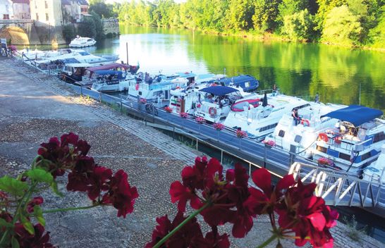
GARAGE AUTOMOBILE                                                                                  Hôtel Restaurant
                                                                                              Les Trois Maures
                                                                                              Pochouse Verdunoise
                                                                                                   Grenouilles
                                                                                                Friture du Doubs
      Pierre Poillot
  7 rue Mugnier - 71590 GERGY                                          20 place de la Liberté
       Tél. 03 85 91 73 21                                             71350 Verdun sur le Doubs     lestroismaures@yahoo.fr
       gergyautos@yahoo.fr                                             Tél. 03 85 91 51 17                       www.h3m.fr

                                       L’ A G E N C E D E C O M M U N I C AT I O N
        www.edipublic.com
                                       DES COLLECTIVITÉS
       CONCEPTION           EdiPublic (groupe IB Médias)
       GRAPHISME            33 av. des Temps Modernes - 86360 Chasseneuil (Futuroscope) - 05 49 01 44 11
                            Plusieurs agences en France
       RÉGIE PUBLICITAIRE
                                                                                   10-31-1240
       IMPRESSION           Document imprimé en CEE : 780 219 000 21 RCS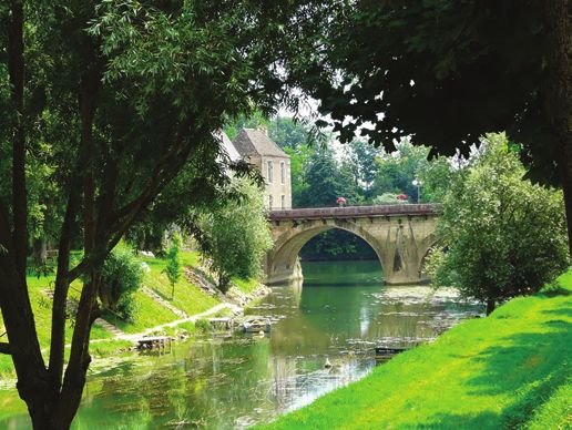
BIENVENUE                                                                            SOMMAIRE
                                                                                            | Contents | Inhalt
La Communauté de Communes Saône-Doubs-Bresse vous
accueille entre rivières et campagne, pour un séjour nature.
Partez à la découverte de nos paysages riches et variés :
prairies verdoyantes, champs aux différentes cultures
céréalières, berges de rivières, et le charme de nos 28                              6    Se balader
villages qui offrent de nombreuses curiosités architecturales :                           Villages de Saône
églises, moulins, ponts, châteaux, tours, calvaires…                                      Doubs Bresse
Un grand choix d’hébergements et de nombreuses activités                                  | Wander around : The villages of the
nature vous attendent. L’office de tourisme propose un accueil                               « Saône Doubs Bresse » area
spécialisé pour les cyclotouristes, de nombreuses visites                                 | Spaziergänge : Dörfer im Gemein-
                                                                                             deverband « Saône Doubs Bresse »
guidées en été (sortie nature, historique, producteurs locaux…),
des pots d’accueil le jeudi, ainsi que de nombreuses brochures
pour découvrir notre territoire. N’hésitez pas à nous contacter ou                   21   Découvrir
à venir nous voir.                                                                        À visiter
                                                                                          | Discover : Places to visit
  OFFICE DE TOURISME                                                                      | Entdecken : Sehenswertes

  SAÔNE DOUBS BRESSE
  Classé catégorie 3                                                                 24   Profiter
  3 place Charvot 71350 Verdun-sur-le-Doubs                                               Activités sportives,
  Tél. 03 85 91 87 52                                                                     pleine nature, détente
  contact@tourisme-verdun-en-bourgogne.com                                                | Enjoy : sporting and leisure
  www.tourisme-verdun-en-bourgogne.com                                                       activities
                                                                                           | Genießen : Sport, Natur,
  M Office de Tourisme Saône Doubs Bresse - Verdun sur le Doubs                              Entspannung

                                                                                     32   Déguster
                                                                                          Restaurants, brasseries,
HORAIRES D’OUVERTURE 2018                                                                 salons de thé, snacks
                                                                                          | Try : restaurants, cafes, tea rooms,
de l’Office de Tourisme Saône Doubs Bresse :                                                 snacks bars
Du 1er janvier au 30 avril et 1er octobre au 31 décembre                                  | Schlemmen : Restaurants, Bistros,
         du lundi au vendredi de 9h30 à 12h et de 14h à 17h30. ;                             Cafés und Teestuben
         Samedi de 9h30 à 12h. Fermé les jours fériés.
Du 1er mai au 30 septembre
         du lundi au samedi de 9h30 à 12h30 et de 14h à 18h. Jours fériés de 10h à
                                                                                     34   Se reposer
         12h. En juillet / août : le dimanche de 10h à 12h. Fermé le 1er mai.             Gîtes et meublés,
Fermeture annuelle du 22 décembre 2018 au 6 janvier 2019.                                 chambres d’hôtes,
                                                                                          hôtels, campings
 LÉGENDE PICTOGRAMMES                                                                     | Where to stay : holiday rentals, self-
                                                                                             catering, B&Bs, hotels, campsites
      Commerce Shop / Geschäft                 Départ randonnées
                                               balisées                                   | Entspannen : Ferienhäuser und
      Pharmacie - médecin                      Start of marked walks / Wandern               -wohnungen, Gästepensionen,
      Pharmacy - doctor / Apotheke - Arzt                                                    Hotels, Campingplätze
                                               Aire service
      Restaurant                               Motorhome services areas /
      Restaurant / Restaurant                  Servicestationen für Campingbüsse     36   Flâner
      Distributeur de billets                  Borne de rechargement
      Cash machine / Geldautomat               véhicule électrique                        Commerces
                                               Electric vehicle charging station /        | Stroll : Shops
      Station essence                          Ladestation für Elektrofahrzeuge           | Bummeln : Einzelhändler
      Petrol station / Tamkstelle                                                                                               3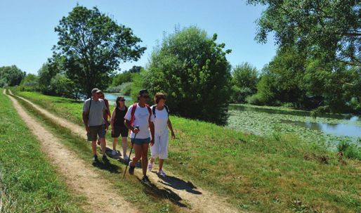
Plan de Verdun sur Le Doubs
VERDUN-SUR-LE-DOUBS

                                                                           BRAGNY
                                                                           S/SAONE
    CAMPING                                                                ECUELLES
                                                                           PALLEAU

                                                                                LA
                                                                                     SA
                                                                                       ON
                                                                                         E
              PISCINE
                        TENNIS
                                                                                                                                            E
                                                                                                                                        AON
                                                                                                                                 LA S
                              GYMNASE

                                         COLLÈGE

                                                         ECOLES
                                                                  MAIRIE

        ST GERVAIS EN VALLIERE
        ST MARTIN EN GATINOIS
        ALLEREY SUR SAONE
        BEAUNE

                                                                                                                            E
                                   tte

                                                                                                                            ON
                              Caro

                                                                                                                          SA
                          de la

                                                                                                                       E
                                                                                                                       IT
                         min

                                                                                                                      T
                                                                                                                   PE
                        Che

                                                                                                                  LA

                                                                                             CAPITAINERIE

                                                                                             OFFICE DE TOURISME
                                                                                                                       SAUNIERES
                                                                                                                       CHARNAY
                                                                                                                       LES CHALON
                                                      PLACE
                                                   DU FAUBOURG
                                                                                                                                        © 2013 EdiPublic 05 49 01 44 11

                CENTRE
                DE SECOURS

    VERJUX                                                                                                        CIEL
    GERGY                                                                                                         SERMESSE
                                                                                                                  PONTOUX
                                                                                                                  NAVILLY
                                                                            STADE                                 LA VILLENEUVE
                                                                                                                  CLUX
                                                                                                                  TOUTENANT

                                                                                                                  CHALON SUR SAONE
4
COMMUNAUTÉ DE COMMUNES
               Saône Doubs Bresse

                               5
Se balader : les villages
| Wander around: the villages | Spaziergänge: Dörfer

   Allériot                                                                  Bey

                                                                             Mairie - 2 place de l’Église - 71620 BEY
                                                                             Tél. 03 85 47 56 92
   Mairie - 2 rue du Bourg - 71380 ALLÉRIOT                                  mairie.bey.71@wanadoo.fr
   Tél. 03 85 47 56 83                                                       www.mairie-bey.fr
   mairie.dalleriot@wanadoo.fr
   www.mairie-alleriot.fr                                                  Bey est un charmant village bénéficiant d’un cadre
                                                                           naturel riche et varié, qui se niche entre la Saône et la
 De tradition agricole, Allériot est doté d’une nature                     forêt. L’endroit est propice aux balades, en bordure de la
 verdoyante et d’un petit port charmant qui a su rester                    rivière, comme au travers de son vaste domaine boisé,
 authentique. Des chemins piétonniers et agricoles                         traversé de sentiers de randonnées. Le patrimoine
 permettent la découverte des bords de Saône. Le centre                    bâti architectural est riche : lavoir en pierre, église,
 du bourg, édifié en surplomb de la Saône, est riche de                    et de magnifiques bâtisses anciennes parfaitement
 son église et de son clocher aux tuiles vernissées, de sa                 conservées. Le village est accueillant, dynamique et ne
 cure, de sa mairie dans un bâtiment historique, de son                    laisse pas ses visiteurs indifférents avec ses commerces
 lavoir… Son bord de rivière, calme et accueillant, avec                   de proximité (restaurant/bar/tabac, boulangerie, salon de
 ses restaurants, permet aussi la pratique de la pêche.                    coiffure), son cabinet paramédical (infirmière, ostéopathe,
 Ses hameaux excentrés sauront vous séduire grâce à                        praticienne hypnose), ses nombreuses entreprises et
 leurs charmes, tel que Montagny avec son château et son                   artisans, et son tissu associatif particulièrement riche
 lavoir.                                                                   et actif. La commune organise, au mois de juin, chaque
                                                                           année, une séance de cinéma plein-air, et un concert en
        Rooted in agricultural tradition, Allériot boasts a lush green
        landscape and a delightful small port that retains its original
                                                                           extérieur pour la fête de la musique.
 features. Here, footpaths and farm tracks let you explore the banks              This charming village is set in the rich, varied natural lands-
 of the Saône. The village centre, overlooking the Saône, is rich in              capes between the Saône and the forest. Here you can enjoy
 architectural details, including the church with its bell tower           walks along the riverbank or the many hiking paths through the ex-
 covered in glazed tiles, the rectory, the historic building that houses   tensive woodland. There is also a rich architectural heritage: stone
 the town hall, and the wash house. The riverbank, with its                wash-house, church, and some immaculately preserved magnificent
 restaurants, is calm and enticing. It is also perfect for fishing. The    old buildings. This friendly, lively village has everything visitors could
 surrounding hamlets are filled with charm, such as Montagny with          want: local shops (restaurant/bar/tobacconist, bakers, hairdressers),
 its Chateau and wash-house.                                               paramedical centre (nurse, osteopath, hypnosis practitioner), as well
                                                                           as many businesses and craftspeople complement its particularly
        Das landwirtschaftlich geprägte Dorf Allériot bietet grüne
                                                                           rich and vibrant community life. Each June, the village organises an
        Natur und einen hübschen kleinen Hafen, der seine
                                                                           open-air cinema show, and an outdoor concert for France’s Fête de
 Authentizität hat wahren können. Fuß-und landwirtschaftliche Wege
                                                                           la Musique.
 führen am Ufer der Saône entlang. Der die Saône überblickenden
 Ortskern umfasst eine Kirche, einen Kirchturm mit glasierten                    Bey ist ein reizendes Dorf, das in reicher und vielfältiger Natur
 Dachziegeln, eine Pfarrei, das Rathaus in einem historischen                    zwischen Saône und Wald liegt. Der Ort lädt ein zu Spazier-
 Gebäude und ein Waschhaus. Das ruhige und einladende Flussufer            gängen, sei es am Fluss entlang oder durch sein weitläufiges, von
 lädt zum Angeln, die dort vorzufindenden Restaurants zum Verweilen        Wanderwegen durchzogenes Waldgebiet. Auch das Architekturerbe
 ein. Die zur Gemeinde gehörenden Ortschaften in der Umgebung              von Bey mit einem Waschhaus aus Stein, einer Kirche und wunder-
 sind nicht minder charmant, so zum Beispiel Montagny mit seinem           schönen, perfekt erhaltenen alten Gebäuden kann sich sehen lassen.
 Schloss und seinem Waschhaus.                                             Das Dorf ist gastfreundlich, dynamisch und bietet seinen Besuchern

6 SE BALADER : LES VILLAGES
Nahversorgungsläden (Restaurant/Bar/Tabakladen, Bäckerei, Fri-
seursalon), eine paramedizinische Praxis (Krankenpflegerin, Osteo-
path, Hypnotherapeutin), zahlreiche Unternehmen und Handwerker
                                                                          Charnay-les-
sowie ein vielfältiges und aktives Vereinsleben. Die Gemeinde orga-
nisiert jedes Jahr im Juni eine Filmvorführung unter freiem Himmel
                                                                          Chalon
sowie anlässlich der Fête de la Musique am 21. Juni ein Konzert im
Freien.

  Bragny-sur -Saône

                                                                          Mairie - 2 route de Seurre
                                                                          71350 CHARNAY-LES-CHALON
                                                                          Tél. 09 75 81 98 31
                                                                          mairiecharnayleschalon@wanadoo.fr
  Mairie - 15 rue de Montée                                             Charnay-les-Chalon est situé en amont du Doubs et de
  71350 BRAGNY-SUR-SAÔNE                                                la Saône. Ses rives ombragées vous invitent à la flânerie
  Tél. 03 85 91 50 26                                                   et même, pourquoi pas, à taquiner le brochet si le cœur
  71.mairie.bragny@wanadoo.fr                                           vous en dit, car ses rives disposent d’un milieu à la faune
                                                                        abondante et variée.
  www.bragny-sur-saone.fr                                               Son église date des XVe et XVIe siècles. L’édifice est dédié
                                                                        à saint Grégoire et possède un clocher franc-comtois.
Bragny-sur-Saône est habité depuis la Préhistoire... Ce                 Le village possède deux calvaires du XVe, dont un classé
village, construit sur un plateau dominant deux rivières                monument historique situé sur la place de l’église.
la Saône et la Dheune, s’étend sur 1479 hectares. Des
associations dynamiques et complices animent le                                Charnay-les-Chalon is situated upstream and between the
village et participent à sa convivialité. Son camping en                       Doubs and the Saône. The shaded river banks are a place of
bordure de Saône est ouvert du 1er mai au 30 septembre.                 abundant and various fauna and they encourage gentle strolling,
Le charme de ce village et de ses rivières attirent les                 plus there are excellent fishing spots. The church dates from the
                                                                        15th and 16th centuries.
pêcheurs, les promeneurs et les vacanciers toute l’année.               The church is dedicated to Saint Gregoire and has a Franc -Comtois
       The village is built on a plateau overlooking the rivers Saône   bell tower. The village has 2 Calvarys dating from the 15th century,
       and Dheune and spreads over 1479 ha . Active and friendly        one of which is a classified monument and is situated in the Place
associations add to the life of the village. The camping site on the    de l’église.
banks of the Saône is open from 1st of may until 30th of September.
                                                                               Dieses Dorf ist zwischen Doubs und Saône gelegen. Die
The charm of this village and its rivers attract anglers, walkers and
                                                                               schattigen Ufer des Dorfes mit einer üppigen und vielfältigen
holidaymakers all year long.
                                                                        Fauna laden zum Spazierengehen und zum Angeln ein. Die Kirche
        Das Gemeindegebiet des auf einer Hochebene über Saône           stammt aus dem 15. und 16. Jahrhundert.
        und Dheune errichteten Dorfes erstreckt sich über 1 479 Hek-    Das Gebäude ist dem Heiligen Gregor geweiht und besitzt einen
tar. Die Bevölkerung zählt 600 Einwohner aller Generationen. Zwölf      für die Franche-Comté typischen Kirchturm. Darüber hinaus gibt
dynamische und freundschaftlich verbundene Vereine bringen Leben        es in dem Dorf auch zwei Bildstöcke aus dem 15. Jahrhundert,
und Geselligkeit ins Dorf. Der Campingplatz unweit der Saône ist        von denen einer als historisches Monument klassifiziert ist und auf
während der Sommermonate geöffnet. Der Charme dieses Dorfes             dem Place de l’église, dem Kirchplatz, steht.
und seiner 0 lockt das ganze Jahr über Angler, Spaziergänger und
Feriengäste an.

                                                                                                              SE BALADER : LES VILLAGES    7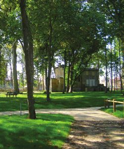
Se balader : les villages
| Wander around: the villages | Spaziergänge: Dörfer

   Ciel                                                                          Clux-Villeneuve

   Mairie - 30 rue du Bourg - 71350 CIEL
   Tél. 03 85 91 55 94
   mairie.ciel@wanadoo.fr                                                        Mairie - 23 Voie Romaine
   www.mairie-ciel.fr                                                            71270 CLUX-VILLENEUVE
 Ciel, situé dans la plaine de Saône, ne passe pas inaperçu.                     Tél. 03 85 49 14 22
 C’est son église qui caractérise cette bourgade. En effet, à                    mairie.clux-villeneuve@orange.fr
 quinze kilomètres à la ronde, on aperçoit son clocher, haut                     www.clux-villeneuve.fr
 de plus de 50 mètres. Cette église romane date de la fin du
 XIIe siècle. Ciel a gardé ses commerces de proximité avec                     Située à proximité de la Côte d’Or, du Jura et aux portes
 une épicerie, une boulangerie, une boucherie, un salon de                     de la Bresse, Clux-Villeneuve est bordée d’une magnifique
 coiffure et un restaurant. Notre commune dispose d’une                        forêt domaniale, et est traversée par une ancienne voie
 salle des fêtes et d’une halle. Vous pouvez aussi vous                        romaine. Vous pourrez voir la ferme Saint-Claude, ancien
 divertir tous les samedis soir au dancing « La Récréation ».                  manoir, qui abritait les moines de Saint-Claude. L’oratoire,
                                                                               juste en face, contient une représentation de l’évêque
         Ciel is located on the Saône river plain and is not easily missed.
                                                                               bisontin en chape (XVIe siècle). L’église, placée sous le
         The church dominates the village and its tower at over 50
 metres can be seen from every direction. Ciel has kept its local shops        vocable de saint Denis, date du XVIIe et XVIIIe siècles et
 with a grocer, bakery, butcher, hairdresser and a restaurant. Our village     abrite une chaire à prêcher de bois sculptée de 1699.
 also has a village hall and a covered market. The “Recreation” dance                 Not far from Côte d’Or, Jura and gateway to the Bresse,
 hall is open on Saturday nights for your amusement.                                  Clux-Villeneuve is surrounded by a beautiful public forest
        Ciel, liegt in der Saône-Ebene und ist alles andere als unauffällig.   and is crossed by an ancient Roman way. You can see St Claude’s
        Seine Kirche ist es, die den Ort charakterisiert. Der 50 Meter hohe    farm, a former manor house which used to to be home to the
 Kirchturm ist in jeder Richtung aus 15 Kilometer Entfernung zu sehen. Die     monks of Saint-Claude. Just opposite, the Oratory of Saint-Claude
 romanische Kirche stammt aus dem späten 12. Jahrhundert und wurde             contains a 16th century statue of the bishop of Besançon in his
 im 18. Jahrhundert teilweise renoviert. Mit einem Lebensmittelgeschäft,       cope. The church, dedicated to St Denis was build from the 17th and
 einer Bäckerei, einer Metzgerei, einem Friseursalon und einem Restaurant      18th centuries houses a wooden pulpit sculpted in 1699.
 hat Ciel einen wohnohrtnahen Einzelhandel bewahren können. Die Ge-                   Der in der Nähe des Departements Côte d’Or, dem Jura und
 meinde verfügt über einen Festsaal und eine Halle. Und jeden Samstaga-               vor den Toren zur ehemaligen Provinz Bresse gelegene Ort
 bend können Sie im Dancing RECREATION das Tanzbein schwingen.                 wird von einem herrlichen Staatsforst gesäumt, durch den eine

    Garage WEBER
                                                                               ehemalige Römerstraße führt. Der Bauernhof Saint-Claude, der
                                                                               heute auf einem herrschaftlichen Landsitz, in dem früher die
                                                                               Mönche von Saint-Claude untergebracht waren, bewirtschaftet
                                                                               wird, kann besichtigt werden. In dem gleich gegenüber liegenden
                                                                               Oratorium ist eine aus dem 16. Jh. stammende Abbildung des in
                                                                               seinen Bischofsmantel gekleideten Bischofs von Besançon zu
                                                                               sehen. Die Kirche steht unter der Schirmherrschaft des Heiligen
  RENAULT                                                                      Denis. Das aus dem 17. und 18. Jahrhundert stammende Bauwerk
                                                                               birgt eine handgeschnitzte Kanzel aus dem Jahre 1699.
               ZA Charbonneau - 71350 CIEL
                   03 85 91 52 67
                   contact@garageweber.fr

8 SE BALADER : LES VILLAGES
Damerey                                                                     Écuelles

  Mairie - 1 place de la Mairie - 71620 DAMEREY
  Tél. 03 85 47 50 43                                                         Mairie - 1 place Jean Nicolle
  mairie-damerey@wanadoo.fr                                                   71350 ÉCUELLES
  www.damerey.fr                                                              Tél. 03 85 91 50 04
                                                                              ecuelles.mairie@wanadoo.fr
Cette petite commune est bordée de nombreux bois du                         Ce village situé sur les bords des méandres de la Saône, a été
coté Est, tandis que la Saône longe toute sa partie Ouest ;                 fondé vers 577 par Gontran, roi des Burgondes. En 1832, lui
notre sentier thématique et ludique du « Grand Pâquier »                    est rattaché le village de Molaise, où, au XIIe siècle, une abbaye
permet une balade découverte qui nous emmène à la                           cistercienne (depuis disparue) a été construite. C’est là aussi
rivière et aux villages voisins ; la pêche dans la Cosne et                 qu’est né l’instituteur Pierre Vaux victime d’une tragédie qui
les balades « nature » sont des loisirs appréciés. Des gîtes                reste dans de nombreuses mémoires.
ruraux peuvent vous accueillir et une aire de camping-car                   Les trésors d’Écuelles : les 1000 ha dont 83 en forêt domaniale
privée permet une pause dans notre village. Une belle et                    gérée par Natura 2000 (faune et flore) vous invitent pour
attractive salle polyvalente, près de l’aire sportive, est                  faire des promenades agréables et reposantes. Les bords
offerte à la location. Le centre-bourg est vivant avec ses                  de Saône, intacts et sauvages où admirer de magnifiques
commerces : restaurant, boulangerie-pâtisserie, épicerie-                   oiseaux. Le canal et l’écluse à grand gabarit pour voir passer
tabac-librairie-Poste, sans oublier l’étonnant château                      péniches et bateaux de plaisance. L’église Saint-Cyr et Sainte-
Bresse et Castille et notre petit patrimoine local rénové tels              Julitte. La chapelle Saint-Louis de Molaise.
que le pigeonnier et le four à pain !                                               This village of 262 inhabitants tucked into the banks of a bend
         The village is bordered by woods on the eastern side and by                in the Saône, was founded around 577 by Gontran, king of the
        the river Saône on the western side. Our fun nature trail called    Burgunds. In 1832, it was attached to the village of Molaise which, in
“Grand pâquier” takes visitors on a journey of discovery to the river       the 12th century, had been home to a Cistercian Abbey (nothing re-
and the neighbouring villages. There is fishing on the Cosne and            mains of the Abbey today). It is also the place where the school tea-
nature trails that are much appreciated. There are two self catering        cher Pierre Vaux was born and whose tragic story is still remembered
cottages available as well as a private parking area for camping cars.      by many people. Things to do and to see : the 1 000 hectares of land,
A beautiful village hall, next to the sports area, is available for hire.   including 83 hectares of public forest , managed by Natura 2000
The centre of the village is lively and busy with a range of shops;         (flora and fauna) where you can take a pleasant walk. The quiet river
restaurant, bakery, general store and Post Office, not to mention the       banks which may bring you into contact with a variety of beautiful
amazing “Castille et Bresse” chateau, as well as our renovated little       birds. The canal and the large gauge lock where you can watch
bits of local heritage like the dovecote and bread-oven.                    barges and pleasure boats passing through. The church of St Cyr and
                                                                            St Julitte. The St Louis chapel at Molaise.
       Diese kleine Gemeinde wird auf der Ostseite von mehreren                    Das Dorf am Ufer einer Flussschlinge der Saône wurde um
       Wäldern gesäumt, während die Saône das Gebiet über die                      das Jahr 577 von Gontran, König der Burgunder, gegründet.
gesamte Länge im Westen begrenzt. Ein Spaziergang auf unse-                 Im Jahre 1832 wird der Ort an das Dorf Molaise angeschlossen, wo
rem Themenpfad „Grand Pâquier“ führt am Fluss entlang zu den                im 12. Jahrhundert eine Zister-zienser- Abtei erbaut wurde, die al-
Nachbarorten und bietet Gelegenheit zum spielerischen Lernen.               lerdings heutzutage nicht mehr besteht. Molaise ist ebenfalls der
Angeln im Wasserlauf der Cosne und Spaziergänge in freier Natur             Geburtsort des Gundschullehrers Pierre Vaux, Opfer einer Tragödie,
sind besonders beliebte Freizeitaktivitäten. Ferienwohnun-                  an die sich viele Ortsansässige erinnern. Die Schätze von Écuelles
gen und ein privater Wohnmobil-Campingplatz bieten Unter-                   : 1 000 ha Waldflächen, von denen 83 ha Staatswald von Natura
bringungsmöglichkeiten, um eine gemütliche Auszeit in unserem               2000 verwaltet werden (Fauna und Flora), laden zu entspannenden
Dorf einzulegen. Ein schöner und angenehmer Gemeindesaal                    und erholsamen Spaziergängen ein. Die Ufer der Saône, intakte,
neben dem Sportplatz steht zur Vermietung frei. In den Geschäf-             kaum von Menschenhand geprägte Naturlandschaften, bieten Ge-
ten des Ortskern herrscht reges Treiben: Restaurant, Bäckerei-              legenheit, prächtige Vögel zu beobachten. Der Kanal und die breite
Konditorei, Lebensmittel- und Tabakgeschäft mit Buchhandlung                Schleuse sind ideale Standorte, um dem gemächlichen Gleiten der
und Postbüro, und nicht zu vergessen das erstaunliche Schloss               Haus- und Sportboote auf dem Wasser beizuwohnen. Die beiden
Castille et Bresse sowie unser liebe-voll restauriertes Architektu-         Kirchen Saint-Cyr und Sainte-Julitte lohnen einen Besuch. Auch die
rerbe wie z. B. der Taubenschlag und der Dorf-Brotofen !                    Kapelle Saint-Louis de Molaise ist sehenswert.

                                                                                                                    SE BALADER : LES VILLAGES     9
Se balader : les villages
| Wander around: the villages | Spaziergänge: Dörfer

   Guerfand                                                                 Les Bordes

   Mairie - 1 bis rue du Bourg
   71620 GUERFAND
   Tél. 03 85 47 78 50                                                      Mairie - 9 route de Saunières
   mairieguerfand@wanadoo.fr                                                71350 LES BORDES
   www.guerfand.fr                                                          Tél. 03 85 91 51 85
                                                                            mairie-lesbordes@wanadoo.fr
 Le village est entièrement entouré de bois qui recouvrent
 plus du tiers de son territoire. Prairies, champs et étangs              Village situé au confluent de la Saône et du Doubs, il tire
 façonnent aussi son paysage. L’église Saint-Michel,                      sa réputation de la pêche. La chapelle est une ancienne
 située face à la mairie, marque le point central de la                   dépendance paroissiale de Verdun. Sous l’ancien régime,
 commune. La motte castrale du Biron, accompagnée                         ce village n’a jamais possédé d’église ; il existait cependant
 de ses légendes, témoigne de notre passé. Un centre du                   une chapelle placée sous le vocable de saint Pierre à
 Tourisme Équestre permet de découvrir la région à poney,                 l’entrée du village. Autrefois les mariniers venaient rendre
 à cheval ou en calèche.                                                  grâce à leur saint patron Nicolas, le rite disparut (peut-
                                                                          être après 1910) et la chapelle fut délaissée puis détruite
         The village is entirely surrounded by woods which cover          en 1960 pour permettre l’élargissement de la chaussée.
         over one third of its territory and meadows, fields and ponds
 help form its landscape. Saint-Michel’s church, opposite the town               A village situated at the confluence of the rivers Saône and
 hall, is the central spot of the village. The “Biron” motte and bailey          Doubs, it has built its reputation on fishing. The chapel is a
 castle and its legends bear witness to our past. There is a riding       former parochial dependency of Verdun-sur-le-Doubs. Under the old
 school that enables visitors to discover the region on horseback, by     regime, the village never had a church, however there was a chapel
 pony or in a carriage.                                                   dedicated to St Peter at the entry to the village. In times past, sailors
                                                                          would come and ask the blessing of their patron saint, St Nicolas, but
        Das Dorf wird rundherum von Wäldern gesäumt, die mehr als         this particular ceremony has ceased to exist (probably around 1910),
        ein Drittel seines Territoriums ausmachen. Auch Wiesen,           and the chapel was abandoned and then knocked down in 1960
 Felder und Seen prägen das Landschaftsbild. Die Kirche Saint-            when the foot-path was widened.
 Michel gegenüber der Gemeindeverwaltung bildet den Mittelpunkt
 des Ortes. Der Burghügel von Biron und die Legenden, die sich um                Ein Dorf am Zusammenfluss von Saône und Doubs. Das Dorf
 ihn ranken, zeugen von unserer bewegten historischen                            ist für seine Fischerei bekannt. Die Kapelle war ehemals eine
 Vergangenheit. Ein Reiterhof mit einem breit gefächerten                 Nebenstelle der Pfarrei von Verdun. Unter dem Ancien Régime besaß
 Reittourismusangebot bietet Gelegenheit, die Region auf dem Pony-        das Dorf nie eine Kirche. Es gab jedoch am Ortseingang eine dem Hl.
 oder Pferderücken zu entdecken oder sie bei einer Kutschfahrt zu         Petrus geweihte Kapelle. Früher verehrten die Schiffer ihren Schutz-
 erforschen.                                                              patron, den Heiligen Nicolas, doch der Brauch starb (kurz nach 1910)
                                                                          aus und die Kapelle wurde aufgegeben und schließlich 1960 im Rah-
                                                                          men der Straßenverbreiterung abgerissen.

10 SE BALADER : LES VILLAGES
Longepierre Montcoy
Mairie - 3 rue du Bourg Mairie - 1 rue Pierre Adrien Piguet
71270 LONGEPIERRE 71620 MONTCOY
Tél. 03 85 49 12 43 Tél. 03 85 47 76 78
communedelongepierre@orange.fr mairie.montcoy@orange.fr
www.montcoy.fr
Le village est situé dans la paisible vallée du Doubs avec
de nombreuses « mortes » pour la pêche. Dans les bois, nous pouvons notamment admirer la
L’église, bâtie en briques, date du XVe siècle avec une statue, au piédestal si particulier, de « La Vierge de
partie juxtaposée du XVIIe. Au cimetière se trouve un l’Immaculée Conception » réalisée par Joseph Baudrand
calvaire du XVe siècle, monument classé. en 1873 ; une messe annuelle y est célébrée pour le 15
Deux sentiers de découvertes : août, jour de l’Assomption. N’oublions pas le château au
cœur de son écrin de verdure, ainsi que l’ancien moulin
• Basse vallée du Doubs : chemin de marche d’une bordé de son magnifique étang, toutes deux propriétés
longueur de 7 km avec faune et flore variées privées. La salle polyvalente, récemment réhabilitée,
• Circuit Pierre Vaux à l’intérieur du village. permet d’accueillir diverses manifestations privées ou
publiques.
Possibilité de pique-niquer au petit étang de la Pouge.
The river Doubs wraps itself around the village, with many In the woods, is found the statue of the Immaculate Concep-
little coves or “mortes” for fishing. The church is built with tion created by Joseph Baudrand in 1873; its unusual pe-
bricks and dates from the 15th century with an additional part added destal is worth seeing. Once a year on Assumption day (August,
during the 17th century. In the cemetery there is a 15th century Cal- 15 ), a mass is celebrated. Don’t miss the chateau nestling in its
th
vary that is a classified monument. verdant surroundings and the old mill with its beautiful millpond.
Both the castle and the mill are private properties. The village hall
Two Discovery Trails: has recently been restored and is able to host various private or
• Lower Doubs Valley: a walk of around 7km with a variety of flora public events.
and fauna visible
• The Pierre Vaux Circuit within the village. Im Wald kann man eine Statue mit einem ganz besonderen
Picnicking is possible at the La Pouge pond. Sockel bewundern: die im Jahre 1873 von Joseph Baudrand
in Stein gehauene „Jungfrau der unbefleckten Empfängnis“. Al-
Das Dorf wird vom friedlichen Doubstal umflossen und bietet ljährlich wird hier an Maria Himmelfahrt, am 15. August, eine
zahlreiche Altärme zum Angeln. Die aus Ziegelstein erbaute Messe zelebriert. Zwei weitere Kleinode des Dorfes sind das
Kirche stammt aus dem 15., ein angebauter Teil aus dem 17. Jah- Schloss, welches in eine herrlich grüne Landschaft eingebettet ist,
rhundert. Auf dem Friedhof steht ein denkmalgeschützter Bildstock und die ehemalige Mühle mit ihrem Weiherbeide in Privatbesitz.In
aus dem 15. Jahrhundert. dem erst kürzlich renovierten Gemeindesaal finden regelmäßig
Es gibt zwei Entdeckungspfade: verschiedene private und öffentliche Veranstaltungen statt.
• Unteres Doubstal: 7 Kilometer langer Fußweg mit abwechs-
lungsreicher Fauna und Flora
• Rundweg Pierre Vaux innerhalb des Ortes.
Picknickstelle am Weiher „Etang de la Pouge“.
SE BALADER : LES VILLAGES 11Se balader : les villages
| Wander around: the villages | Spaziergänge: Dörfer
Mont-les-Seurre Navilly
Mairie - 10 rue de l’Eglise
71270 MONT-LES-SEURRE
Tél. 03 85 49 17 69 Mairie - 1 La Place - 71270 NAVILLY
mairie.mont.les.seurre@orange.fr Tél. 03 85 49 11 74
L’église de Mont-lès-Seurre, dédiée à saint Martin,
mairiedenavilly@orange.fr
remonte au XVe siècle. Elle est le dernier édifice à avoir
Navilly est situé au confluent du Doubs et de la Guyotte. On
conservé des murs à pans de bois et torchis, unique en
peut y admirer deux ponts édifiés au XVIIIe siècle par Emiland
Bresse bourguignonne. La commune est située entre le
Gauthey. L’un de ces ponts, situé sur le Doubs, est classé
Doubs et la Saône. La partie la plus ancienne du village
monument historique. L’église date du XIXe, et est placée sous
de Mont-lès-Seurre se trouve sur une hauteur non loin
le vocable de l’Assomption de la Vierge. Le village compte aussi
du Doubs, et l’origine de son nom vient de cette situation
un château du XVIIIe (privé) et la chapelle Saint-Léger du XIe
dans une région de plaine inondable. La maison du pâtre
siècle. Le Doubs avec ses berges ombragées fait le bonheur
communal qui, jusqu’entre les 2 guerres, conduisait
des pêcheurs qui peuvent loger dans différents gîtes ruraux
les troupeaux de tous les propriétaires dans les vaines
de la commune. Ses 185 ha de forêt communale offrent de
pâtures, a été conservée et transformée en abri de bus.
nombreux sentiers de promenades. Le restaurant « Au Goujon
La commune dispose d’une mise à l’eau à Chazelles.
Frétillant » vous propose de déguster les poissons du Doubs.
The church in Mont les Seurre is dedicated to St Martin and
Situated at the confluence of the Doubs and the Guyotte, Navilly is fa-
dates from the 15th century. It is the last to have conserved its
mous for its two 18th century bridges built by Emiland Gauthey. The
half-timbered and cob walls and is unique in Burgundian Bresse. The
bridge on the Doubs is classified as a historical monument. The church was
commune is situated between the Doubs and the Saône. The oldest
built in the 19th century and is dedicated to the Assumption of the Virgin. In the
part of Mont les Seurre is found on a rise not far from the Doubs in a
village, there is also a private chateau from the 18th century and the St Leger
region of flood plains, hence its name. The communal Shepherd’s Hut
chapel dating from the 11th century. The shaded banks of the Doubs are a fa-
which, until the inter-war period was still in use by shepherds driving
vourite with anglers who can find accommodation in the self-catering cottages
their herds into the empty pastures, has been conserved and
of the village. There are also numerous nature trails in the public forest (185
transformed into a bus shelter. The commune has a slipway at
hectares). In the restaurant « Au goujon frétillant », you can taste Doubs’s fish.
Chazelles.
Navilly ist am Zusammenfluss von Doubs und Guyotte gelegen.
Die Kirche von Mont les Seurre ist dem Heiligen Martin geweiht
Zwei im 18. Jh. von Emiland Gauthey errichtete Brücken sind
und stammt aus dem 15. Jahrhundert. Sie ist das letzte
besonders sehenswert Eine der Brücken führt über den Doubs und steht
Gebäude, welches seine Fachwerkmauern aus Holz und Strohlehm
als historisches Baudenkmal unter Denkmalsschutz. Die Kirche, unter
bewahrt hat, und damit einzigartig in der Bresse Bourguignonne. Die
der Schirmherrschaft von Maria. Himmelfahrt, stammt aus dem 19. Jah-
Gemeinde liegt zwischen dem Doubs und der Saône. Der älteste Teil
rhundert. Darüber hinaus besitzt das Dorf ein Schloss aus dem 18. Jh.
von Mont les Seurre befindet sich auf einer Anhöhe nicht weit vom
(Privatbesitz) sowie die Kapelle Saint-Léger aus dem 11. Jh. Der Doubs
Doubs entfernt und der Name rührt ursprünglich von dieser Lage in
mit seinen schattigen Ufern ist ein Anglerparadies. Übernachten können
einer überschwemmungsgefährdeten flachen Region her. Das
Angelfans in den verschiedenen Ferienunterkünften der Gemeinde.
kommunale Haus des Viehhirten, das bis zur Zeit zwischen den beiden
Durch den 185 Hektar großen Gemeindewald führen viele Wanderwege.
Weltkriege genutzt wurde, um die Herden aller Besitzer auf die leeren
Das Restaurant “Au goujon frétillant“: auf der Speisekarte stehen Fischs-
Weiden zu führen, wurde erhalten und in ein Bushaltestellenhäuschen
pezialitäten, die aus Flussfischen des Doubs zubereitet werden.
umgewandelt.. Die Gemeinde besitzt eine Slipanlage in Chazelles.
12 SE BALADER : LES VILLAGESPalleau Pontoux
Mairie - 14 Grande Rue - 71270 PONTOUX
Tél. 03 85 49 10 66
Mairie - 41 rue Principale - 71350 PALLEAU mairie-pontoux@wanadoo.fr
Tél. 03 85 91 54 75 Cette commune se cache dans la vallée de la Saône et
mairie.palleau@orange.fr du Doubs. Ancien siège d’un prieuré clunisien, Pontoux
www.commune-palleau.fr possède une église reconstruite en 1773 avec un beau
pavement de terre cuite du XVIIIe siècle. Le village compte
À flanc de colline, Palleau descend lentement de sa aussi un château à tour crénelée du XVIIe siècle (privé) et
forêt vers ses trois rivières, la Dheune, la Bouzaise et quelques jolies maisons bressanes. Le bois de Pontoux est
le Meuzin, particulièrement poissonneuses, qui font propice à la randonnée pédestre, et les amateurs de pêche
le bonheur des pêcheurs et des promeneurs le long de trouveront leur bonheur dans le Doubs, avec la mise à l’eau
leurs berges ombragées. Les 500 hectares de la forêt pour les bateaux. Un jardin botanique-roseraie (privé) se
domaniale, classée « Natura 2000 », riche en biodiversité, visite sur rendez-vous (Tél. 06 77 68 59 37).
offrent de nombreux chemins de promenades familiales.
This little village, hides in the Saône and Doubs valley. For-
On the side of a hill, Palleau slopes gently down to the forest mer seat of a Clunisian priory, Pontoux’s church was rebuilt
by the three rivers, the Dheune, the Bouzaize and the in 1773 with a fine floor in terracotta from the 18th century. It also
Meuzin, those are particularly well stocked to interest both has a privately owned chateau with a crenellated tower dating from
fishermen and walkers along the shaded banks. The 500 hectares the 17th century, and several lovely Bressan houses. The Pontoux
of public forest are classified by “Natura 2000”, a great biodiversity, woods are ideal for hiking and those who like to fish are well ser-
offering many walking trails for families. ved on the Doubs with the slipway. A privately owned botanical and
rose garden can be visited by appointment (Tél. 06 77 68 59 37).
Der am Hang gelegene Ort Palleau zieht sich langsam vom Eine kleine Gemeinde im Saône- und Doubs. Pontoux, ehe-
Wald zu seinen drei fischreichen Bächen Dheune, Bouzaise mals Sitz eines clunisianischen Priorats, besitzt eine 1773
und Meuzin hinunter, die mit ihren schattigen Ufern sowohl Angler als wieder aufgebaute Kirche mit einem schönen Pflaster aus Terra-
auch Spaziergänger begeistern. Der 500 Hektar große Staatswald ist kotta aus dem 18. Jahrhundert. Pontoux besitzt außerdem ein
ein “Natura 2000“-Schutzgebiet mit hoher Artenvielfalt und bietet Schloss (privat), einen mit Zinnen versehenen Turm aus dem 17.
zahlreiche Wege für Spaziergänge mit der Familie. Jahrhundert sowie einige für die Bresse charakteristische schöne
Häuser. Die Wälder von Pontoux sind ideal zum Wandern und Angler
werden im Doubs ihr Glück finden. Eine Slipanlage für Boote ist
vorhanden. Ein botanischer Rosengarten (in Privatbesitz) kann
nach Terminvereinbarung besichtigt werden (Tél. 06 77 68 59 37).
AU GOUJON FRÉTILLANT
Spécialités du bord de l’eau
FRITURE - GRENOUILLES
FILETS DE SANDRE
4 place de la Mairie - 71270 NAVILLY
03 85 47 03 80
SE BALADER : LES VILLAGES 13Se balader : les villages
| Wander around: the villages | Spaziergänge: Dörfer
Saint-Didier-en-
Saint-Gervais-en-
Bresse
Vallière
Mairie - 4 route de Toutenant Mairie - Bourg
71620 SAINT-DIDIER-EN-BRESSE 71350 SAINT-GERVAIS-EN-VALLIÈRE
Tél. 03 85 47 77 07 Tél. 03 85 91 59 25
mairie.saintdidierenbresse@wanadoo.fr mairie.gervais.val@wanadoo.fr
Saint-Didier-en-Bresse se caractérise par un habitat Autour de ce village, rivière et forêts s’offrent aux
diffus, et de nombreuses exploitations agricoles avec promeneurs et pêcheurs. Sur le plan archéologique,
encore quelques maisons typiquement bressanes. Son on peut mentionner les mottes féodales de Cercy et
espace, ses petites routes et ses nombreux chemins à Champseuil, tandis qu’une fontaine à dévotion et un
travers bois invitent à la balade en famille. Un circuit à oratoire consacré à saint Gervais témoignent d’un passé
vocation « découverte agricole » est ouvert au public. rural riche. L’église des XVIe et XVIIe siècles possède
Sa salle des fêtes (salle Michel Philippe) et sa grande un témoin historique infiniment rare et précieux avec
place autour de l’église sont régulièrement le théâtre de la châsse de saint Gervais, reliquaire en pierre du haut
mariages ou autres réjouissances. Moyen-Âge.
Around the village there are rivers and forests to tempt an-
The village of Saint-Didier is mostly a scattered settlement glers and hikers. On the archaeological front, there are the
with a number of farmhouses and a few typical Bressan feudal mottes in Cercy and Champseuil, as well as a devotional
houses. The space, small roads and numerous footpaths that fountain and an oratory dedicated to St Gervais, evidence of a rich
crisscross the woodlands are a favourite for family walks. A circular rural past. The church from the 16th and the 17th centuries contains
walk offering “an introduction to farming” is open to the public. The an historic object infinitely more rare and precious; the reliquary of
village hall “Salle Michel Philippe” and the large square around the St Gervais, an ossuary in stone from the late Middle Ages.
church are regularly the venue for weddings and other celebrations.
Rund um dieses Dorf bieten der Fluss und die Wälder ein
Saint-Didier ist eine typische Streusiedlung und von
ideales Gelände für Spaziergänger und Angler. Was die Ar-
zahlreichen Landwirtschaftsbetrieben sowie einigen
chitektur angeht, so kann man die Erdhügelburgen von Cercy und
traditionellen, für die Region Bresse typischen Fachwerk-
Champseuil erwähnen, während ein Wunderbrunnen und ein St
Ziegelbauten geprägt. Die weitläufigen Landschaften, kleinen
Gervais geweihtes Oratorium von einer reichen ländlichen Ver-
Straßen und zahlreichen Waldwege laden zu ausgedehnten
gangenheit zeugen. Die Kirche ist aus dem 16. Und 17. Jahrhun-
Spaziergang mit der ganzen Familie ein. Demnächst wird hier ein
dert. In der Kirche sind eines Kunstwerk zu sehen: der Heiligens-
allen zugänglicher Rundweg zum Thema „Die Landwirtschaft
chrein von Saint Gervais (Ossarium aus Stein aus dem
entdecken“ eingeweiht. Der Gemeindesaal (Saal Michel Philippe)
Frühmittelalter).
und sein großer Platz um die Kirche herum ist regelmäßig
Schauplatz von Hochzeiten und allerlei anderen Festen.
14 SE BALADER : LES VILLAGESSaint-Martin-en- Saint-Martin-en-
Bresse Gâtinois
Mairie - 1 place du Monument
71620 SAINT-MARTIN-EN-BRESSE
Tél. 03 85 47 72 97
mairie-st-martin-en-bresse@wanadoo.fr Mairie - Bourg
www.saint-martin-en-bresse.fr 71350 SAINT-MARTIN-EN-GÂTINOIS
Tél. 03 85 91 81 73
mairiestmartinengatinois@wanadoo.fr
De nombreuses associations tant sportives que Charmant village très ancien, il est traversé par une
culturelles, la bibliothèque, l’antenne de l’écomusée voie romaine dont il reste des vestiges. Elle aurait été
de la Bresse bourguignonne sur le thème de « la forêt construite par Agrippa, gendre de l’empereur Auguste,
et du bocage », ainsi que de nombreux services tels afin de favoriser le commerce entre Lyon et cette région
que : écoles, collège, cabinets médicaux, commerces… très fertile. Subsistent encore les restes d’une motte
constituent les éléments essentiels du bien vivre à Saint- féodale destinée à supporter un château fort, dont
Martin-en-Bresse. Par ailleurs, l’histoire du village a certains vestiges récupérés sont visibles. Son église du
été marquée douloureusement par la Seconde Guerre XIe siècle est placée sous le vocable de saint Martin. À
mondiale. Au hameau de La Madeleine, un monument voir aussi les rives de la Dheune pour les promeneurs
du souvenir a été édifié symbolisant le martyre de quatre comme pour les pêcheurs.
civils et quatre maquisards exécutés par les nazis, lors de
Saint-Martin-en-Gâtinois is a very old and charming village
la tragédie des 8 et 9 mars 1944.
and is crossed by traces of an ancient Roman way that are
still visible. This is reputed to have been built by Agrippa who was
There are a number of sporting and cultural associations,
the son-in-law of the emperor Augustus, to promote trade between
the library, an annex of the “Ecomusée de la Bresse
Lyon and this very fertile area. The remains of a feudal motte which
bourguignonne” dealing with forest and woodlands, as well as a
would have supported an ancient fortified castle are still visible.
number of other facilities; primary and secondary schools, doctors’
The 11th century church is named for Saint- Martin. The banks of
surgeries, shops…all elements essential to quality of life in Saint-
the river Dheune are very popular with walkers and anglers alike.
Martin-en-Bresse. The village was painfully marked during the
Second World War. In the hamlet of la Madeleine, there is a
memorial to 4 civilians and 4 members of the Resistance who were Ein sehr altes Dorf, denn man findet hier Spuren einer von
executed by the Nazis, in March 1944. Agrippa gebauten alten römischen Straße. Die römische
Straße, die durch das Dorf führt, wurde gebaut, um den Handel
Zahlreiche Sportvereine und ein breites kulturelles Angebot, zwischen Burgund und Lyon zu fördern. Einige Überreste des Burg-
wie die Bibliothek, eine Antenne des Ökomuseums der bur- berges, der dem Bau einer Festung dienen sollte, sind heute noch
gundischen Bresse mit dem Thema „Wälder und Bocage-Ebenen“ zu sehen. Die Kirche wurde 1271 gebaut und ist dem Heiligen Mar-
sowie zahlreiche weitere Einrichtungen und Dienstleistungen: Vor- tin geweiht. Die Dheune bietet eine ideale Umgebung zum Angeln
und Grundschule, Sekundarstufe I, Arztpraxen, Geschäfte usw. bil- und Spazierengehen.
den die wichtigsten Elemente, die für die hohe Lebensqualität in
Saint- Martin-en-Bresse sorgen. Die historische Vergangenheit des
Dorfes ist von den schmerzlichen Ereignissen des Zweiten
Weltkriegs geprägt. Im Weiler La Madeleine wurde ein Denkmal
errichtet, welches das Martyrium von vier Zivilisten und vier Maqui-
sards (Widerstandskämpfern im Maquis) darstellt. Sie waren
während der tragischen Ereignisse am 8. und 9. März 1944 von
Nazis ermordet worden.
SE BALADER : LES VILLAGES 15Se balader : les villages
| Wander around: the villages | Spaziergänge: Dörfer
Saint-Maurice- Saunières
en-Rivière
Mairie - 46 Grande Rue Mairie - 1 rue Bords du Doubs
71620 SAINT-MAURICE-EN-RIVIÈRE 71350 SAUNIÈRES
Tél. 03 85 47 51 43 Tél. 09 67 05 76 23
mairie.stmauriceenriviere@wanadoo.fr mairie.saunieres@wanadoo.fr
Saunières est située en bordure de la rivière : le Doubs.
Village essentiellement touristique pour ses promenades,
C’est délimitée par une petite rivière et une grande forêt la pêche et le pique-nique. Une rampe de mise à l’eau
que, sur 1857 ha, s’étale notre commune. Une commune a été réalisée. Un chemin pédestre vous fera découvrir
aux terrains variés propices aux randonnées. le Doubs et vous conduira à Charnay-les-Chalon ou à
Verdun-sur-le-Doubs, où vous pourrez rejoindre la Voie
D’Ouest en Est se côtoient une prairie inondable, des Bleue.
terres alluviales, un village dispersé et enfin des terrains
forts et la zone boisée. Saunières is located along the river Doubs. Visitors mainly
come to Saunières to walk, go fishing or have a picnic on the
Saint-Maurice covers an area of 1857 hectares and is river banks. A slipway has been built to facilitate entry to the water,
bordered by a small river and a big forest, its varied terrain and there is a foot path with information about the Doubs which
offers some interesting hikes. takes you up to Charnay les Chalon or to Verdun-sur-le-Doubs,
Spreading from east to west are flood plains giving way to where you can rejoin the “Voie Bleue”.
alluvial fields, the scattered houses of the village and the wooded
countryside. Saunières liegt am Ufer des Flusses Doubs. Ein hauptsächlich
touristisches Dorf, das sich ideal für Spaziergänge, zum An-
Unsere von einem kleinen Fluss und einem großen Wald geln und für Picknicks eignet. Auch eine Slipanlage ist vorhanden.
gesäumte Gemeinde erstreckt sich über eine Fläche von Ein Fußweg führt zur Doubs und nach Charnay les Chalon, oder nach
1 857 Hektar. Verdun-sur-le-Doubs, wo Sie auf die Voie Bleue gelangen.
Die vielfältigen Landschaften der Gemeinde sind bei Wanderfans
besonders beliebt. Von Westen nach Osten schließen Auen –
wasserreiches Wiesenland – fruchtbare Alluvialböden, vereinzelte
Siedlungen, dann fester Boden und schließlich bewaldete Gebiete
aneinander an.
16 SE BALADER : LES VILLAGESSermesse Toutenant
Mairie - 16 Route Nationale
71350 SERMESSE
Tél. 03 85 91 56 71 Mairie - 5 rue du Bourg - 71350 TOUTENANT
mairie.sermesse@wanadoo.fr Tél. 03 85 91 51 49
www.sermesse-71350.fr commune-toutenant@orange.fr
Sermesse est le paradis de la pêche et de la chasse car L’architecture de l’habitat est de style bressan. Son église
il se situe à proximité du Doubs et de nombreuses forêts. placée sous le vocable de la Nativité de la Vierge fut
Sermesse est également apprécié des randonneurs grâce construite en 1869 par l’architecte Narjoux. Elle est de
aux sentiers S4B et S6. En traversant les bois communaux, style néo-roman et ses dimensions sont exceptionnelles,
on y distingue une grande faune ornithologique. Une elle avait été conçue pour accueillir 2/3 de la population
petite aire de pique-nique ombragée au bas du pont de l’époque, soit plus de 350 fidèles. Une fromagerie,
de Saunières accueillera les gens de passage pour un avec une aire d’accueil pour camping-car, est ouverte à
moment de détente. Son église, construite en 1760, est la ferme du Mézaneau.
placée sous le vocable de saint Vincent. Récemment
rénovée à l’intérieur, on pourra y admirer un beau This village has a character distinctly Bressan. The church,
retable baroque. Enfin, la commune possède une salle dedicated to the Nativity of the Virgin was built in 1869 by
polyvalente ouverte à ceux qui désirent la louer. the architect Narjoux. It is a neo-Romanesque, style church whose
dimensions are some- what exceptional because it was built to
Sermesse is a paradise for fishing and hunting because it is receive two thirds of the population at the time, which would have
close to both the Doubs and a number of forests. It is also been around 350 people. A dairy selling cheese was established at
very popular with walkers following the S4B and S6 hiking trails. the Mezaneau farm.
There is interesting wildlife in the commune’s woods, especially
birds, and the little picnic area close to the bridge of Saunieres is a Die Architektur ist von der typischen Bauweise der Bresse
nice place for passers-by in need of a rest in the shade. The church geprägt. Die im Jahre 1869 von einem Architekten namens
was built in 1760 and is dedicated to St Vincent. The interior has Narjoux erbaute Kirche steht unter der Schirmherrschaft von Mariä
recently been renovated and visitors can admire a baroque retable. Geburt. Sowohl der neuromanische Stil als auch ihre Größe sind
Finally, the commune has a multipurpose hall that is available to beeindruckend. Sie wurde so konzipiert, dass sie zwei Drittel der
those who wish to hire it. damaligen Bevölkerung aufnehmen konnte, das heißt mehr als 350
Gläubige. Vor vier Jahren wurde auf dem Bauernhof „Ferme du
Durch ihre Nähe zum Fluss Doubs mit seinen zahlreichen Wäl- Mézaneau“ eine Käserei eröffnet.
dern ist die Ortschaft ein wahres Paradies für Angler und Jä-
ger. Auch Wanderer kommen gern nach Sermesse, da hier zwei be-
kannte Wanderrouten – S4B und S6 – verlaufen. Bei einem
Spaziergang durch den Gemeindewald wird man sich am besten der
ornithologischen Artenvielfalt bewusst. Ein schattiger Picknickplatz
unten an der Saunières-Brücke auf der Sermesse-Uferseite bietet
Durchreisenden Gelegenheit, sich bei einer erholsamen Pause zu
entspannen.
SE BALADER : LES VILLAGES 17Se balader : les villages
| Wander around: the villages | Spaziergänge: Dörfer
Verdun-sur-
le-Doubs
Mairie - Place de l’Hôtel de Ville
71350 VERDUN-SUR-LE-DOUBS
Tél. 03 85 91 52 52
mairieverdunsurledoubs@orange.fr
www.verdunsurledoubs.fr
Verdun-sur-le-Doubs, village niché au confluent de la
Saône et du Doubs, est situé à égale distance de Beaune
et de Chalon (22 km). Verdun, c’est avant tout la capitale
de la Pôchouse. La pêche est en effet un des points forts
de Verdun. On ne peut pas parler de Verdun sans évoquer
son port de plaisance, ses remparts et tours, son église
Saint-Jean du XVIIe siècle, ses nombreuses randonnées
pédestres le long de la rivière et cyclistes sur la Voie
Bleue, son musée du Blé et du Pain, son île du château et
son camping ombragé de 100 emplacements.
Verdun-sur-le-Doubs is a small town nestled in the
confluence of the Saône and the Doubs and is equidistant
between Beaune and Chalon-sur-Saône (22kms). Verdun is first
and foremost the capital of “Pôchouse”. Fishing is one of Verdun’s
major attractions. One cannot speak of Verdun without mentioning: ENTRETIEN, RÉPARATION AUTOMOBILE/MOTO/4X4/UTILITAIRE/NAUTISME
the marina, the ramparts and towers, the XVIIth century church of TOUTE MARQUE, POSE D’ACCESSOIRES
Saint Jean, the many walks along the river and rides along the
“Voie Bleue”, the Museum of “Ble et Pain” (wheat and bread), the 11 rue Neuve - 71350 VERDUN-SUR-LE-DOUBS
Ile de chateau and the shady camping site with 100 pitches. 03 45 77 97 86 - 06 29 45 65 14
carsandco71350@gmail.com - f CarsandcoVerdunsurleDoubs
Am Zusammenfluss der Saône und des Doubs, schmiegt sich
Verdun-sur-le-Doubs in die grüne Flusslandschaft. Die
Ortschaft ist jeweils 22 km von Beaune und Chalon entfernt. Verdun
ist vor allem die Hauptstadt der Pôchouse, einem Fischragout aus
Flussfischen. Tatsächlich ist das Angeln in Verdun ein sehr beliebter
Sport. Man kann jedoch nicht von Verdun sprechen, ohne: seinen
Yachthafen sowie, seine Befestigungsmauer und die Türme zu
erwähnen, Die Kirche Saint-Jean stammt aus dem 17. Jh, der
Ausgangspunkt für zahlreiche Wanderungen am Fluss entlang und
die Radwanderroute „Voie Bleue“, das Weizen- und Brot- museum,
die Schlossinsel, der schattige Campingplatz bietet 100 Stellplätze.
18 SE BALADER : LES VILLAGESVerjux Villegaudin
Mairie - Place de la Mairie - 71590 VERJUX
Tél. 03 85 91 68 40
mairie.verjux@orange.fr Mairie - Le Bourg - 71620 VILLEGAUDIN
www.commune-verjux.fr Tél. 03 85 47 79 67
communedevillegaudin@wanadoo.fr
Verjux, village typiquement rural, établi au bord de la
Saône, dispose d’un patrimoine remarquable et d’un On y découvre, au gré de la promenade, de nombreuses maisons
coeur de village complétement rénové. Son église, bressannes rénovées à pans de bois, dont deux sont à étages
dédiée à saint Pierre, date du XIIe siècle. La mairie et les construites au XVIIe siècle, une modeste église en briques
écoles sont de belle facture et ont été financées par Mme entourée d’un cimetière. En poursuivant chemin des Guérins, le
Marguerite Boucicaut, née à Verjux en 1816, et qui fut regard est attiré par une statue du XVIIIe siècle représentant saint
avec son mari, les fondateurs du grand magasin « Au Bon Urbain, pape, protecteur de la vigne, et thaumaturge, au pied
Marché » à Paris. Elle finança aussi le pont sur la Saône de laquelle coule une source miraculeuse. À voir également, les
entre Verjux et Gergy. Un monument à sa mémoire, situé vestiges du château de la Marche qui fut détruit par un incendie
près du pont, mérite le détour. en 1861 où naquit Olivier de la Marche en 1425. Il est fait
Verjux, which is a typically rural village built on the banks of chevalier par Charles le Téméraire, puis capitaine des gardes du
the Saône, has a remarkable historical heritage and a comple- dernier duc de Bourgogne. De ce château, il subsiste les douves,
tely renovated centre. The church dedicated to Saint Pierre dates la terrasse, des sculptures de lion ainsi que les dépendances.
back to the XIIth century. The townhall and the schools are beautifully
made and were financed by Marguerite Boucicaut born in Verjux in During the course of a walk, you can see typical half-timbered
1816, who, together with her husband, were the founders of the Paris Bresse houses that have been renovated with wooden frames, in-
department store “Au bon marché”. Mrs. Boucicaut also financed the cluding two with upper storeys built in the XVIIth century. There is also a
bridge over the Saône, between Verjux and Gergy. A monument to her modest brick church surrounded by a churchyard. If you follow the lane to
memory, close to the bridge, is worth a detour. “les Guérins”, your eyes are attracted to an XVIIIth century statue of St Ur-
bain - pope, protector of vines and miracle worker - at the foot of which
Verjux, ein typisch ländliches Dorf am Ufer der Saône, besitzt flows a miraculous spring. Also worth seeing are the ruins of the Chateau
ein bemerkenswertes architektonisches Erbe und einen voll- de la Marche, virtually destroyed by a fire in 1861, and where in 1425 was
ständig restaurierten Ortskern. Die dem Heiligen Pierre gewidmete born Olivier de la Marche. Made a knight by Charles the Bold, he became
Kirche stammt aus dem 12. Jh. Die stilvollen Gebäude des Rathauses captain of guards to the last Duke of Burgundy. All that remains of the
und der Schulen wurden einst von der im Jahre 1816 in Verjux ge- chateau now are the moats, the terrace, some lion statues and the outbuil-
borenen Madame Marguerite Boucicaut, finanziert. Sie hatte ge- dings.
meinsam mit ihrem Ehegatten das berühmte Warenhaus “Au Bon
Marché“ in Paris gegründet. Sie stiftete ebenfalls die erforderlichen Bei einem Spaziergang trifft man immer wieder auf vollständig
Geldmittel für die Brücke über die Saône zwischen Verjux und Gergy. renovierte und sehr schöne Bresse- Fachwerkhäuser, von de-
Das zu ihren Ehren in der Nähe der Brücke errichtete Denkmal lohnt nen zwei im 12. Jh. mit zwei Stockwerken erbaut wurden. Wenn man
einen Abstecher. auf dem Weg Chemin des Guérins weitergeht, fällt der Blick des Spa-
ziergängers unweigerlich auf eine Statue aus dem 18. Jh., die den
Heiligen Urban, einst Papst, Wundertäter und Schutzherr der Weingär-
ten, darstellt. An ihrem Fuße entspringt eine Quelle, deren Wasser eine
heilende Wirkung nachgesagt wird. Auch die Überreste des Schlosses
Château de la Marche, das im Jahre 1861 von einem Brand zerstört
wurde, sind sehenswert. Hier erblickte der Schriftsteller und General-
münzmeister Olivier de la Marche im Jahre 1425 das Licht der Welt. Er
wurde von Karl dem Kühnen zum Ritter geschlagen und später zum
Kapitän der Garde des letzten Herzogs der Bourgogne ernannt. Von
diesem Schloss sind heute noch der Schlossgraben, die Terrasse sowie
Löwenskulpturen und die Nebengebäude erhalten.
SE BALADER : LES VILLAGES 19Vous pouvez aussi lire