Calella Llafranc Tamariu - COASTAL - Palafrugell Turisme
←
→
Transcription du contenu de la page
Si votre navigateur ne rend pas la page correctement, lisez s'il vous plaît le contenu de la page ci-dessous
COVES AND
         COASTAL
         P A T H S
         PALAFRUGELL

         Calella
         Llafranc
         Tamariu

         Tel. 00 34 972 30 02 28
ENG/FR   www.visitpalafrugell.cat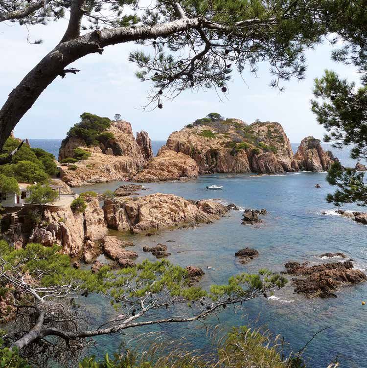
Camí vell de Tamariu

                                                                                                                                SECTION 5   TAMARIU

                                                                                                  GIV-6542
                                                     PALAFRUGELL
                                                           GI
                                                              V-

                                        STA. MARGARIDA
                                                              65
                                                                48
                                                    GI

                                                                   (A
                                                     P-6

                                                                     v.

                                                                                                                    SECTION 4
                                                                        d
                                                         54

                                                                      el
                                                         3

                                                                       M
                                                                            ar
     Via verda (Palafrugell-Pal

                                                                            )
                                amós)

                                                                                                        SECTION 3                SANT
                                                                                                                                 SEBASTIÀ

                         ERMEDÀS

                                                                                                              LLAFRANC
                                                                                 SECTION 2

                                                                                      CALELLA
                                                                                      DE PALAFRUGELL

                                                                    SECTION 1

02   MAP OF MUNICIPALITY / CARTE DE LA COMMUNE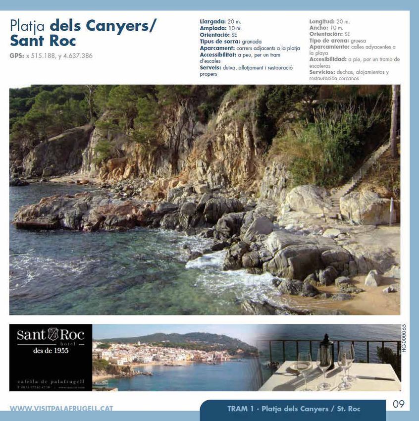
INDEX / SOMMAIRE
02    Map of the municipality                                                    Carte de la commune
04    Services                                                                   Services
05    Map 1. Sections 1 and 2                                                    Carte 1. Tronçon 1 et 2
06/07 Section 1. From El Golfet to Sant Roc                                      Tronçon 1. De El Golfet à Sant Roc
08 		 El Golfet beach                                                              La plage de El Golfet
09 		 Els Canyers / Sant Roc beach                                                 La plage de Els Canyers / Sant Roc
10/11 Section 2. From Sant Roc to Els Tres Pins                                  Tronçon 2. De Sant Roc aux Tres Pins
12		 El Port Pelegrí beach                                                         La plage du Port Pelegrí
13		 La Platgeta                                                                   La Platgeta (La petite plage)
14		 D’en Calau beach                                                              La plage d’en Calau
15		 El Port Bo or Les Barques beach                                               Le Port Bo ou plage de Les Barques
16		 Malaespina Port                                                               Le port de Malaespina
17		 El Canadell + Els Canyissos                                                   El Canadell + Els Canyissos
18/19 Map 2. Sections 3, 4 and 5                                                 Carte 2. Tronçons 3, 4 et 5
20/21 Section 3. From Els Tres Pins to Sant Sebastià                             Tronçon 3. Des Tres Pins à Sant Sebastià
22		 Llafranc beach                                                                La plage de Llafranc
23		 Llafranc Harbour                                                              Le port de Llafranc
24/25 Section 4. From Sant Sebastià to Cala Pedrosa                              Tronçon 4. De Sant Sebastià à Cala Pedrosa
26		 Sant Sebastià                                                                 Sant Sebastià
27		 El Cau or Cala de Gens                                                        El Cau ou cala de Gens
28/29 Section 5. From Cala Pedrosa to Aigua Xelida                               Tronçon 5. De Cala Pedrosa à Aigua Xelida
30		 Cala Pedrosa                                                                  Cala Pedrosa
31		 Els Liris beach                                                               La plage de Els Liris
32		 Tamariu beach                                                                 La plage de Tamariu
33		Aiguadolça                                                                     Aiguadolça
34		 Aigua Xelida Long beach                                                       La grande plage d’Aigua Xelida
35		 Cala Marquesa                                                                 Cala Marquesa

KEY
                                                   1                                       5
LÉGENDE
                          Departure Point        Beach          Arrival point       Point of interest   Part of the section     Not part of the section
                          Point de départ        Plage         Point d’arrivée           À voir         Itinéraire du tronçon   Itinéraire hors tronçon

                         Difficulty level / Niveau de difficulté                  Low Faible                   Medium Moyen                   High Élevé

Edita: Institut de Promoció Econòmica de Palafrugell · www.ipep.cat
Disseny gràfic: Grafic Art Studio · www.graficartstudio.cat
Fotografia: Fons fotogràfic IPEP, Paco Dalmau i Joan Guitart
Dipòsit legal: GI-414-2012

                                                                                   INDEX + KEY / SOMMAIRE + LÉGENDE
                                                                                                                                                     03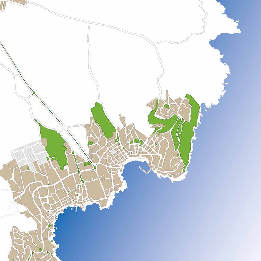
SCUBA DIVING CENTRE
CENTRES DE PLONGÉE                                                               GUIDES / GUIDES
CALELLA                                                                          Giroguies - Tel. +34 972 30 38 86 - www.giroguies.com
Poseidon Diving [pg.12]
Platja del Port Pelegrí, s/n - Tel. +34 972 61 53 45 - www.poseidoncalella.com   LAUNCHING AND ANCHORING OF BOATS
LLAFRANC
Barracuda Diving Llafranc
                                                                                 MISE À L’EAU ET MOUILLAGE D’EMBARCATIONS
C. de Pere Pascuet, 4 - Tel. +34 666 32 39 74 - www.barracudallafranc.com
Triton Diving Llafranc [pg.23]                                                   CALELLA
Pl. dels Pins, s/n - Tel. +34 620 53 00 36 - www.tritonllafranc.com
                                                                                 Club Vela Calella
TAMARIU
Stolli’s Divebase                                                                C. del Noi Gran, 3 - Tel. +34 972 61 46 19 - www.clubvelacalella.cat
Pg. del Mar, 26 - Tel. +34 972 62 00 35 - www.stollis-divebase.eu                Boies Ramon
                                                                                 Platja del Canadell - Tel. +34 972 61 57 20
BICYCLE RENTALS / LOCATION DE VÉLOS
                                                                                 www.lloguerdebarquescalella.com
CALELLA                                                                          LLAFRANC
Bikes MET [pg.16]                                                                Serveis nàutics Llafranc
C. de Lepant, 17 - Tel. +34 972 61 40 39 - www.maritimesmet.com
LLAFRANC                                                                         Pg. de Cípsela, 40 - Tel. +34 972 61 15 48 - www.llafrancboats.com
Tourist Service                                                                  Associació d’Amics i Veïns de Llafranc
Pg. de Cípsela, 1 - Tel. +34 696 02 72 03 - www.touristservice.es                Tel. +34 972 30 06 96 - www.aavll.com
PALAFRUGELL
Cicles Jk [pg.16]                                                                Port Esportiu del Club Nàutic Llafranc
C. Àngel Guimerà, 39 - Tel. +34 972 61 07 09 - www.ciclesjk.com                  Tel. +34 972 30 07 54 - www.nauticllafranc.net
Ciclo Sport                                                                      TAMARIU
C. de la Tarongeta, 149 - Tel. +34 972 30 58 55
                                                                                 Club Nàutic Tamariu
KAYAK / PADDEL SURF RENTAL AND EXCURSIONS                                        Passeig del mar, 11 - Tel. +34 972 62 00 33 - www.clubnautictamariu.cat
KAYAK /PADDLE SURF LOCATION ET EXCURSIONS                                        Craigs Boies Tamariu
                                                                                 Passeig del mar, s/n - Tel. +34 670 21 42 91 - www.craigs-boies-tamariu.com
CALELLA
Tourist Service
Platja del Canadell - Tel. +34 696 02 72 03 - www.touristservice.es              OTHERS / AUTRES
LLAFRANC                                                                         Aldara (diving articles)
Tourist Service
                                                                                 C. de Barris i Buixó, 16 - Tel. +34 972 61 15 79
Pg. de Cípsela, 1 - Tel. +34 696 02 72 03 - www.touristservice.es
TAMARIU                                                                          Escola nàutica Baix Empordà - Av. Josep Pla, 42 - Tel. +34 972 30 41 12
Kayaking Costa Brava                                                             www.escolanauticabaixemporda.com
Platja de Tamariu - Tel. +34 972 77 38 06 - www.kayakingcostabrava.com
                                                                                 Free public service ramp (until 4’5m.)
                                                                                 Llafranc from 7.30 am to 2 pm - Tamariu from 6 am to 11 pm
BOAT RENTAL AND EXCURSIONS
                                                                                 L’art de la Pesca 2 (fishing articles / fishing trips)
LOCATION DE BATEAU ET EXCURSIONS
                                                                                 C. Ample, 14 - Tel. +34 972 30 13 23
CALELLA                                                                          Vela - Club Vela Calella
Boies Ramon
                                                                                 C. del Noi Gran, 3 - Tel. +34 972 61 46 19 - www.clubvelacalella.cat
Platja del Canadell - Tel. +34 972 61 57 20
www.lloguerdebarquescalella.com
Marítimes Met [pg.16]                                                            BOAT SHOPS
Platja del Port Bo - Tel. +34 635 66 12 55 - www.maritimesmet.com                BOUTIQUES DE NAUTISME (SHIP CHANDLER)
LLAFRANC
Serveis nàutics Llafranc                                                         Comercial Auto Nàutica - C. Begur, 45/47 - Tel. +34 972 30 07 16
Pg. de Cípsela, 40 - Tel. +34 972 61 15 48 - www.llafrancboats.com               www.nauticamato.com
TAMARIU                                                                          TG La Nàutica - Paratge de la Portalada, 2 (Highway of Tamariu)
Paco Boats
Embarcador de Tamariu - Tel. +34 627 91 91 65 - www.pacoboats.com                 Tel. +34 972 30 01 29 - www.tglanautica.com
                                                                                 Motor Mares - Camí de la Fanga, 33 - Tel. +34 972 30 29 27

04        SERVICES / SERVICES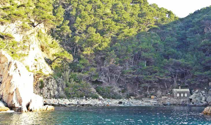
Platja dels
                                                                                                                    Canyissos
                                                                                                      El Canadell
                                                           Port d’en    Port Bo
                                                           Calau                                                     Els Tres Pins
                                                       La Platgeta                Port de
                                                                                  Malaespina                                         Punta de
                                                                                                 Mirador de                          la Torre
                                                                               Es Còdol          Manel Juanola i
                                                      Punta dels Burricaires                     Reixac (la casa
                                                                                                 Rosa)
                                           Port Pelegrí

                                        Els Banys d’en Caixa
                                                                        Section 2

                                     Els Canyers / Sant Roc

                                     La Foradada

                                    S’Amarrador

                                           Roques Planes

                                      El Castellet d’en Niell

                                                   Punta dels Forcats

                                          La Roca Vermella
                              Cala de la Font d’en Roques

                                 Section 1
                 Aiguadolça
                                                                                          Illes Formigues

         Cau Toixó
      L’Agulla del Golfet
El Golfet                                                                                                                               05
                                                             SECTION 1 AND 2 / TRONÇON 1 ET 2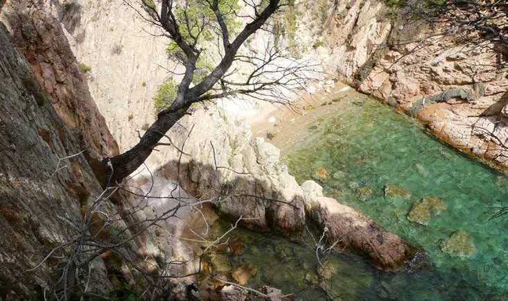
SECTION 1

                                                                                 Ro ers
        from Golfet to Sant Roc

                                                                             nt ny
                                                                                    c

                                                                                                            rte ües
                                                                           Sa s C a
        (Calella)

                                                                                                         Mos Aig
                                                                                                               s
                                                                            El

                                                                                                          Le
     Difficulty level / Niveau de difficulté:                                                              1

                                                                Sant Roc
                                                    1

                                                        2

                                                                3
                                                5
                                                            4

     Platja
     del                    6
     Golfet
                                7
8

06                          SECTION 1 / TRONÇON 1                                         TEL. 00 34 972 30 02 28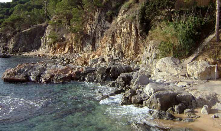
s

                                                                                                          ina

                                                                                                                                                                p R nic
                                     ts del

                                                                                                                                                       t
                                                                                                          el

                                                                                                                                                                   oig
                                                                     Ro nt d’ e la
             iel t

                                                                                                                                                    lfe
                                                                                                   d’e e la
          n N telle

                                                                                                                                                             Ca otà
                                                                                                 lfe a d
                                                                                                      nF
                                                                       qu en
                l

                                  rca ta

                                                   me a

                                                                      Fo la d

                                                                                                                                                  Go
                                                     lla

                                                                                             Fo la d

                                                                                                                                                          de rdí b
                                                                                             Go gull
                                                ver Roc
                                Fo Pun
      d’e Cas

                                                                         es

                                                                                                    t
                                                                       Ca

                                                                                              L’A
                                                                                              Ca
                                                                                                nt

                                                                                                                                                El
                                 La

                                                 La

                                                                                                                                                           Ja
       El

       2                           3             4                       5                      6               7                                            8

Departure Point: Els Canyers / Sant Roc beach                                           Point de départ: la plage de Els Canyers / Sant Roc
Arrival point: El Golfet beach                                                          Point d’arrivée: la plage de El Golfet
Distance: 1,407 m                                                                       Distance: 1.407 m
Duration: 40 minutes                                                                    Durée: environ 40 minutes
Type of path: coastal path with significant slopes with flights of stairs and           Types de chemin: chemin du littoral avec importants dénivelés franchis par
                                                                                        des escaliers et des tunnels.
tunnels.
                                                                                        Description de l’itinéraire: chemin particulièrement sauvage qui longe la
Description of the route: a particularly wild path that goes along the coast
                                                                                        côte jusqu’au centre de Calella.
to the centre of Calella.                                                               À voir: les Aigües Mortes, le Castellet d’en Niell, la pointe de Els Forcats,
Points of interest: Les Aigües Mortes, El Castellet d’en Niell, La Punta dels           la roca Vermella (la roche rouge), crique de la Font d’en Roques, crique de
Forcats, La Roca Vermella (the red rock), Cala de la Font d’en Roques, Cala de          la Font d’en Fina, l’Agulla del Golfet (l’Aiguille de El Golfet), le cap Roig, le
la Font d’en Fina, L’Agulla del Golfet, El Cap Roig, Cap Roig Botanical Garden.         jardin botanique de cap Roig.
Recommendations: follow the red and white GR-92 markers, do not take this               Recommandations: suivez toujours les marques blanches et rouges du GR-
route if there is rough weather. Use comfortable footwear and carry water.              92. N’empruntez pas le chemin en cas de fort vent d’est. Portez des chaussu-
                                                                                        res confortables. Emportez de l’eau.
Description:
The section from El Golfet to Sant Roc, which is particularly wild, can be started      Description:
                                                                                        Le tronçon de El Golfet à Sant Roc, particulièrement sauvage, peut être pris à
next to Hotel Sant Roc where there are some stairs that lead to the coastal path.
                                                                                        proximité de l’hôtel Sant Roc d’où part un escalier conduisant au chemin du
The walk allows you to enjoy a spectacular view of Calella seafront, to walk along      littoral.
the coast with significant slopes, with stairs and tunnels, to get a close-up view of   La promenade permet d’admirer une vue spectaculaire sur la façade maritime
the Formigues Islets -where a naval battle was fought in 1285 which destroyed           de Calella, de suivre la côte en franchissant des dénivelés importants grâce à
the fleet of Philip III of France, the Bold- to get to know Mediterranean plant life,   des escaliers et des tunnels, d’avoir une vue sur les Iles Formigues - où se dé-
and to listen to the birds singing, etc. You will also come across a series of stran-   roula une bataille navale en 1285, qui détruisit la flotte de Philippe le Hardi–,
ge rocks such as El Castellet d’en Niell, La Punta dels Forcats and L’Agulla del        de découvrir la végétation méditerranéenne, d’écouter le chant des oiseaux...
Golfet... finally arriving to El Golfet beach (if you leave behind the red and white    Vous trouverez de nombreux rochers curieux comme le Castellet d’en Niell, la
GR-92 markers which continue along a long flight of stairs to your right, and you       pointe dels Forcats, l’Agulla del Golfet... et vous rejoindrez finalement la plage
carry straight on).                                                                     de El Golfet (en quittant les marques blanches et rouges du GR-92 qui suivent
                                                                                        une grande partie de l’escalier sur la droite et en continuant tout droit).
To enjoy an aerial view of El Golfet beach, follow the GR-92 markers until you
                                                                                        Pour admirer une vue aérienne de la plage de El Golfet, vous pouvez suivre les
come to the Dorothy Webster square.
                                                                                        marques du GR-92 jusqu’à la place Dorothy Webster.
This section gives you an idea of the genuine Costa Brava.                              Ce tronçon vous permet d’avoir un aperçu de la véritable Costa Brava.
Once you arrive to El Golfet beach, continue along the GR-92 towards Cap                Une fois sur la plage de El Golfet, vous pouvez continuer sur le GR-92, direc-
Roig, you will find the Botanical Garden, from where you can admire the entire          tion cap Roig, où vous trouverez le jardin botanique dans les allées duquel
Mediterranean flora and continue towards Palamós or reverse the path and turn           vous pourrez admirer la flore méditerranéenne, puis poursuivre en direction de
into the Sant Roc district.                                                             Palamós ou quitter le chemin et retourner au quartier de Sant Roc.

WWW.VISITPALAFRUGELL.CAT                                                                                SECTION 1 / TRONÇON 1
                                                                                                                                                                      07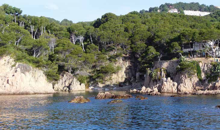
Length: 75 m                        Longueur: 75 m

Platja del Golfet                                 Width: 20 m
                                                  Orientation: E
                                                                                      Largeur: 20 m
                                                                                      Orientation: E
                                                  Type of sand: coarse                Types de sable: gros
GPS: x 514.884, y 4.463.564                                                           Stationnement: rues adjacentes à la
                                                  Parking: streets adjacent to the
                                                  beach                               plage
                                                  Accessibility: on foot, along the   Accessibilité: à pied, par le chemin
                                                  coastal path                        du littoral
                                                  Services: no                        Services: no

                                                      facebook.com/turisme.palafrugell
                                                      @visitPalafrugell
                                                                                       o l l o w u s!s!
                                                      #visitPalafrugell               F Suivez-no
08                SECTION 1 - Platja del Golfet                                             TEL. 00 34 972 30 02 28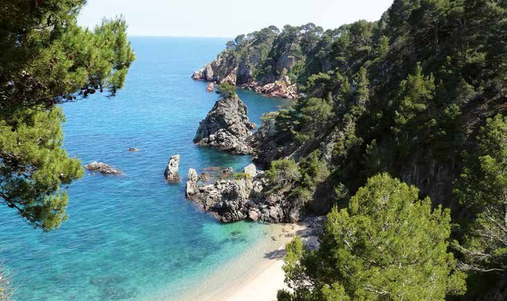
Platja dels Canyers/
                              Length: 20 m                               Longueur: 20 m
                              Width: 10 m                                Largeur: 10 m

Sant Roc
                              Orientation: SE                            Orientation: SE
                              Type of sand: coarse                       Types de sable: gros
                              Parking: streets adjacent to the beach     Stationnement: rues adjacentes à la plage
                              Accessibility: on foot, down some steps    Accessibilité: à pied, par quelques
GPS: x 515.188, y 4.637.386
                              Services: shower, hotels and restaurants   marches d’escalier
                              nearby                                     Services: douches, hôtels et restaurants à
                                                                         côté

                                                                                                                      HG-000065
    T. +34 972 61 42 50
  www.santroc.com

WWW.VISITPALAFRUGELL.CAT                    SECTION 1 - Platja dels Canyers / St. Roc
                                                                                                               09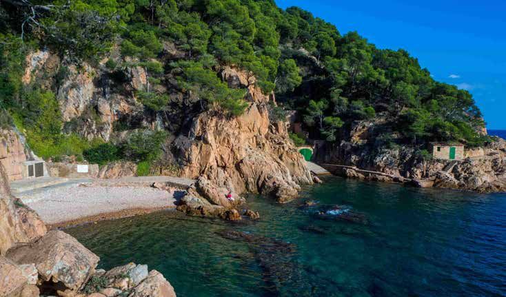
SECTION 2

                                                                                     Ro ers
                                                                                 nt ny
    from Sant Roc to Tres

                                                                                                                         grí
                                                                                       c
                                                                                             ers els
                                                                               Sa s Ca

                                                                                                                     el e
    Pins (Calella)

                                                                                        ca tja d

                                                                                                                 rt P
                                                                                          ny
                                                                                El
                                                           Església

                                                                                         Pla

                                                                                                               Po
Difficulty level / Niveau de difficulté:                                                  1                     2

                                               7                          10            11

                                           4           6   8
                                                   5
                                                                      9
                            3
                                                                               Els Tres
                                                                               Pins
             2

1

          Els Canyers / Sant Roc

                     SECTION 2 / TRONÇON 2                                                             TEL. 00 34 972 30 02 28
Ro i Rei nel
c
sa ) x a
tre)
sos
a
cen
(ca nola r M
ell
ta
s s
na
y is
o la
ltes
Pins Tre
tge
lau en
ad
tion
sp i
Jua irado
an
o
Ma rt de
Ca rt d’
(Int Per
Vo
an
eta
Pla
rt B
lae
C
r
C
rep
sa
Les
El
Els
Sa
Po
Po
Po
M
La
El
3 4 7 5 6 8 9 10 11
Departure Point: Els Canyers or Sant Roc beach Point de départ: la plage de Els Canyers ou de Sant Roc
Arrival point: Els Tres Pins (Punta de la Torre) Lieu d’arrivée: les Tres Pins (pointe de la Torre)
Distance: 1,350 m Distance: 1.350 m
Duration: approximately 35 minutes Durée: environ 35 minutes
Types de chemin: chemin du littoral avec quelques marches d’escalier et
Type of path: coastal path with some flights of steps and the streets of Calella. rues de Calella.
Description of the route: a path that goes along the coast passing the most Description de l’itinéraire: chemin longeant la côte et traversant les lieux
emblematic points of Calella. les plus emblématiques de Calella.
Points of interest: Hotel Sant Roc viewpoint, Les Voltes, Sa Perola (tourist infor- À voir: belvédère de l’hôtel Sant Roc, les Voltes (Arcades), Sa Perola (office
mation office and interpretation centre), M. Juanola viewpoint “the pink house”, all du tourisme et le centre d’interprétation), Belvédère M. Juanola “la maison
the coves along which the route runs. * Off the route: Calella Church rose”, toutes les criques desservies par le chemin. * Hors chemin: église de
Calella.
Recommendations: follow the path by the sea, do not take this route if there is Recommandations: suivez le chemin face à la mer. Ne l’empruntez pas en
rough weather. Use comfortable footwear and carry water. cas de fort vent d’est. Portez des chaussures confortables. Emportez de l’eau.
Description: Description:
From Els Canyers beach, carry along the seafront towards Banys d’en Caixa and Au départ de la plage de Els Canyers, continuez sur le front de mer vers les
Port Pelegrí. Then walk on to Punta dels Burricaires, where there is a magnificent Bains d’en Caixa et le Port Pelegrí. Puis ensuite vers la pointe des Burricaires,
où vous trouverez un superbe belvédère et la Platgeta (la petite plage).
viewpoint, and La Platgeta.
Continuez sur cette route plus urbaine de Calella en suivant le chemin le long
Continue along this more urban part of Calella following the path along the sea de la mer, partie du GR-92, pour arriver à le Port d’en Calau. Les criques se
that is part of the GR-92 and you arrive to Calau Port. There are contiguous coves succèdent et plus loin, vous découvrez le Port Bo, très connus pour ses arca-
until Port Bo beach, which is well known for its vaults and the recital of Habaneras des et pour la Cantada (concert) d’Havaneras de Calella, le premier samedi
of Calella or sea shanties, during the first Saturday of July. Just behind this, there de juillet. Juste derrière se trouve Sa Perola, ancien local de pêcheurs, dont
is Sa Perola, old fishermen’s premises, preserved with its original appearance and l’aspect d’origine a été conservé. Il accueille aujourd’hui l’office du tourisme et
currently the tourist information office and interpretation centre. le centre d’interprétation.
Ensuite, vous arrivez à Es Còdol, des rochers qui séparent la plage de Port Bo
Then, you pass by Es Còdol, a group of rocks which separate Port Bo beach and et le port de la Malaespina, qui est devenu un symbole de Calella.
Malaespina Port. Both have become a symbol of Calella. Après le quai situé sous Can Jaume Gil, vous poursuivez vers le mirador de
You will arrive to a jetty under Can Jaume Gil and continue towards the Primitiu Primitiu Guri. Continuez le long de la mer en traversant la terrasse avec droit
Guri viewpoint. Following along the coast, crossing the terrace of “the pink house” de passage, de “la maison rose” (Can Genís) pour déboucher sur la plage de
(Can Genís) which has right of way, until you arrive to El Canadell beach. El Canadell.
In this bathing area, very well known for its basement fishing huts under the houses, Cette zone de baignade, très connue pour ses sous-sols à ras de plage, donne
there is El Canadell promenade. Under Can Jubert and El Canyissos (or under Can accès au passage de El Canadell. Sous Can Jubert et le Canyissos (ou sous
Can Comes), se trouvent des petits recoins très appréciés des baigneurs, en
Comes) there are small areas highly appreciated by bathers during winter, which hiver. Grâce à des marches d’escalier, ils vous rapprochent des Tres Pins, où
take you by simple steps to Els Tres Pins, where you find Hotel la Torre, with the se trouvent l’hôtel la Torre et la tour de guet de Calella, construite en 1597,
Calella lookout tower, built in 1597 to control the pirate attacks of that period and dans le but de contrôler les attaques pirates de l’époque. Le chemin y passe et
from where you carry along the coastal path towards Llafranc. se dirige ensuite vers Llafranc.
WWW.VISITPALAFRUGELL.CAT SECTION 2 / TRONÇON 2
11Length: 75 m Longueur: 75 m
El Port Pelegrí Width: 30 m
Orientation: SE
Type of sand: coarse
Largeur: 30 m
Orientation: SE
Types de sable: gros
GPS: x 515.242, y 4.637.489 Parking: Port Pelegrí, 100 m Stationnement: Port Pelegrí, 100 m
Accessibility: on foot, down some steps Accessibilité: à pied, par quelques marches
Services: shower, lifeguard, d’escalier
accommodation and restaurants nearby Services: douches, sauveteur, hôtels et
and scuba diving centre restaurants à côté et centre de plongée
Cuina de mercat
Especialitat en arrossos i peix fresc
12 SECTION 2 - El port pelegri TEL. 00 34 972 30 02 28Length: 20 m Longueur: 20 m
La Platgeta Width: 22 m
Orientation: S
Largeur: 22 m
Orientation: S
Type of sand: coarse Types de sable: gros
GPS: x 515.322, y 4.467.566 Parking: Port Pelegrí, 125 m Stationnement: Port Pelegrí, 125 m
Accessibility: on foot, down some steps Accessibilité: à pied, par quelques
Services: shower, accommodation and marches d’escalier
restaurants nearby Services: douches, hôtels et
restaurants à côté
13 KG-000007
WWW.VISITPALAFRUGELL.CAT SECTION 2 - La PlatgetaPort d’en Calau
Length: 75 m Longueur: 75 m
Width: 17 m Largeur: 17 m
Orientation: S Orientation: S
GPS: x 515.382, y 4.637.593 Type of sand: coarse Types de sable: gros
Parking: building, Chopitea street Stationnement: edifice, rue Chopitea
Accessibility: on foot Accessibilité: à pied
Services: shower, accommodation and Services: douches, hôtels et restaurants à
restaurants nearby, shops, sailing school, côté, commerces, école de voile, rampe et
ramp and rental of buoys location de bouées
14 SECTION 2 - Platja d’en Calau TEL. 00 34 972 30 02 28El Port Bo o
Length: 100 m Longueur: 100 m
Width: 18 m Largeur: 18 m
Platja de les Barques
Orientation: S Orientation: S
Type of sand: coarse Types de sable: gros
Parking: building, Chopitea street Stationnement: edifice, rue Chopitea
Accessibility: on foot Accessibilité: à pied
GPS: x 515.448, y 4.637.599
Services: shower, lifeguard, accomodation Services: douches, sauveteur, hôtels et
and restaurants, shops and nautical trips restaurants, commerces et excursions
nautiques
HG-000058
Sentir-se com a casa!
www.novarahotels.com - Tel. 972 61 70 80
WWW.VISITPALAFRUGELL.CAT SECTION 2 - El Port Bo
15El Port de
Length: 47 m Longueur: 47 m
Width: 10 m Largeur: 10 m
Orientation: S Orientation: S
Malaespina Type of sand: coarse
Parking: building, Chopitea street
Accessibility: on foot
Types de sable: gros
Stationnement: edifice, rue Chopitea
Accessibilité: à pied par quelques marches
GPS: x 515.504, y 4.637.597 Services: shower, accommodation and d’escalier
restaurants nearby Services: douches, hôtels et restaurants à côté
16 SECTION 2 - El Port de Malaespina TEL. 00 34 972 30 02 28El Canadell
Length: 100 m / 98 m Longueur: 100 m / 98m
Width: 32 m / 15 m Largeur: 32 m /15m
Orientation: S Orientation: S
GPS: x 515.635, y 4.637.629 Type of sand: coarse Types de sable: gros
Els Canyissos Parking: Pirroig street/ Pg. de la Torre
Accessibility: on foot, down some steps
Services: showers, wc, lifeguard, amphibious
Stationnement: Rue de Pirroig/Pg. de la Torre
Accessibilité: à pied,par quelques marches d’escalier
Services: douches, wc, sauveteur, fautevil amphibie,
GPS: x 515.720, y 4.637.647 wheelchair, rental of buoys and kayaks, boat locations de bouées et kayaks, boat rental, paddle
rental, paddle surf, accommodation and surf, hôtels et restaurants.
restaurants
HG-000337
hotel@latorre.cat
Tel. 972 61 46 03
WWW.VISITPALAFRUGELL.CAT SECTION 2 - El Canadell + Els Canyissos
17Sect
Cap dels Frares TEL. 00 34 972 30 02 28
GR-92
Cova del Tabac
El Cau o Cala de Gens
Roca del President
El Tabal roca del
Font dels Ermitans
Font d’en Mascort
President
Can Mina dels
Salt de Roma-
Dolmen de
boira
Torrents
Puig de Rais
SECTION 3, 4 AND 5 / TRONÇON 3, 4 ET 5
Cap de St.
Sebastià
Punta del Pinell
Section 3
Els Ullastres
Badia de Llafranc
La Punta d’en Blanc
Els Tres Pins
18
El Canadell19
Rec dels Arbres
Cala Marquesa
Sa Roncadora
Cala Nova
N
Llosa de
Cala Ventosa
SECTION 3, 4 AND 5 / TRONÇON 3, 4 ET 5
Aigua Xelida
L‘Àvia Catalana
Punta des Quart d’Aigua Xelida
Es Foraió
El Castellet
Section 5
S’Ajoc
Aiguadolça
Platja de Tamariu
Platja dels Liris
Cruanyes
Font d’en
La Perica
Cala d’en Roig
Cala del Gamarús
Punta de la Musclera
WWW.VISITPALAFRUGELL.CAT
Puig Gruí
Cala Pedrosa
ion 4
Camí de ronda Illa BlancaSECTION 3
from Tres Pins to Sant
la
s s
rin e la
Pins Tre
re e
a
Sebastià
Tor nta d
ed
Ma la d
El
Ca
Pu
Difficulty level / Niveau de difficulté: 1 2
Premsa de Conjunt
vi romana
Església de Monumental
8
Santa Rosa de Sant
Sebastià
5
de la Guarda
6
7
4
3
2
Els Tres
Pins 1
20 SECTION 3 / TRONÇON 3 TEL. 00 34 972 30 02 28da ià
ar ast
la nt S tal
ó- e
Gu eb
r
de Sa men
nc ’en
urr r d
Fa
de nu nt
fra e
l P ta
a
ll
Lla tja d
Bla nta d
J. T irado
Mo nju
Lla rt de
ine
èci
de Pun
nc
nc
fra
Co
n
Pla
Po
Ve
Pu
La
M
3 4 5 6 7 8
Departure point: Els Tres Pins (Calella) Point de départ: les Tres Pins (Calella)
Arrival point: Sant Sebastià Mountain Point d’arrivée: montagne de Sant Sebastià
Distance: 2,450 metres Distance: 2.450 mètres
Duration: about 50 minutes Durée: environ 50 minutes
Type of path: a coastal path with some slopes with flights of steps and a paved Types de chemin: chemin du littoral avec quelques dénivelés franchis à
section. l’aide de marches d’escalier et tronçon de route.
Description of the route: the entire route follows the red and white GR-92 Description de l’itinéraire: l’ensemble du parcours suit les marques blanches et
markers. Follow the path along the coast until you reach Llafranc beach. Walk rouges du GR-92. Suivez le chemin face à la mer jusqu’à la plage de Llafranc,
around the bay until you get to the port. At the entrance of the port, on your left, longez toute la baie pour arriver au port. Poursuivez par la route jusqu’au
you have stairs that go up to the road. If you go uphill, you will arrive to Sant phare de Sant Sebastià.
À voir: hors parcours; Llafranc, pressoir romain, église Santa Rosa. À Sant
Sebastià lighthouse.
Sebastià ensemble de monuments: le village ibère (s.VI a.C.), la tour de guet
Points of interest: off the route; Llafranc, Roman wine press and Santa Rosa (s.XV), l’ermitage (s.XVIII), le phare (s.XIX), belvédères et les images de la
Church. Historial assets in Sant Sebastià: the Iberian settlement (6th c. BC), Divina Pastora et Sant Baldiri.
lookout tower (15th c.), hermitage (18th c.), the lighthouse (19th c.), the view-
points and the Divina Pastora and Sant Baldiri images. Recommandations: suivez toujours les marques blanches et rouges du GR-
92. N’empruntez pas le chemin en cas de fort vent d’est. Portez des chaussures
Recommendations: follow the red and white GR-92 markers, do not take this confortables. Emportez de l’eau.
route if there is rough weather. Use comfortable footwear and carry water.
Description: Après la pointe de la Torre, continuez sur le chemin du littoral
Description: After La Punta de la Torre, continue along the coastal path towards en direction de Llafranc. Le chemin permet d’apprécier la tranquillité de la
Llafranc. This route allows you to enjoy the tranquillity of the area. Go through région. Passez par la Marineda, la promenade Xavier Miserachs et une fois
La Marineda, Xavier Miserachs road. When you get to La Marinada square, go sur la place de la Marineda, descendez par les escaliers de Garbí jusqu’à la
down the Garbí steps, passing by Francesc de Blanes and Cípsela roads and you promenade Francesc de Blanes et la promenade de Cípsela où vous découvri-
will arrive to the Bay of Llafranc with multiple services: hotels, restaurants, bars, rez la baie de Llafranc. Vous y trouverez tous les services : hôtels, restaurants,
scuba-diving centres, supermarkets, shops, rental agencies, etc. bars, centres de plongée, supermarchés, commerces, agences de location...
Take the steps next to Llafranc Port and after a large number of steps*, follow the Prenez les marches le long du port de Llafranc puis après ces longs escaliers*,
road that climbs Sant Sebastià mountain, until you reach the viewpoint in front suivez la route qui monte à la montagne Sant Sebastià. Une fois au belvédère
situé devant le phare, vous pourrez admirer la vue panoramique sur Calella et
of the lighthouse from which there is a wonderful panoramic view of Calella and
Llafranc. Continuez encore un peu jusqu’à l’esplanade Sant Sebastià.
Llafranc. Carry on a little further until you reach the Sant Sebastià esplanade. Si vous regardez la mer depuis le belvédère, vous observerez la ligne d’horizon
If you look at the sea from the viewpoint, you will see that the horizon seems to courbée par un curieux effet optique. C’est un parcours idéal pour les person-
be curved due to a strange optical effect. This section is recommended for people nes qui veulent découvrir une partie de la côte de la commune sans beaucoup
who would like to get to know part of the coast of the municipality without having marcher. La partie de Llafranc à Sant Sebastià peut être faite en voiture.
to walk very far. The section from Llafranc to Sant Sebastià can be done by car. *En suivant la route, vous croiserez la rue du Pinell, en cul de sac, avec une pe-
*By following the road you will arrive to Pinell street, which is a dead-end street tite esplanade à l’extrémité. Vous y verrez les rochers du Pinell où il est possible
with a small esplanade at the end. Here there are the Pinell Rocks where you can de pratiquer l’escalade (12 voies équipées du niveau 4 à 3c).
practice climbing (12 tracks of fourth grade at 3c). Les amateurs de plongée trouveront face à la Pointe du Pinell, un des lieux
Scuba diving amateurs will find one of the best places for immersions in front of La favoris pour la pratique de ce sport : les Ullastres (montagnes sous le niveau
Punta del Pinell, a place called Ullastres (mountains under the water). de la mer).
WWW.VISITPALAFRUGELL.CAT SECTION 3 / TRONÇON 3
21Platja de Llafranc
Length: 347 m Longueur: 347 m
Width: 32 m Largeur: 32 m
Orientation: S Orientation: S
GPS: x 516.265, y 4.638.212 Type of sand: smooth Types de sable: fin
Parking: Jaume I square (100 m) Stationnement: place Jaume I (100 m)
Accessibility: on foot Accessibilité: à pied
Services: showers, foot showers, wc, Services: douches, rince-pieds, wc, fauteil
amphibious wheelchair, accommodation and amphibie, hôtels et restaurants, locations de
restaurants, rental of buoys, ramp, shops, bouées, rampe, commerces, sauveteur, excursions
lifeguard, nautical trips, boat rentals and kayaks nautiques, location d’embarcations et kayacs
HG-002397
C. Farena 36 · 17211 · Llafranc
Tel. 972 61 00 55
22 SECTION 3 - Platja de Llafranc TEL. 00 34 972 30 02 28Harbour of Llafranc
CLUB NÀUTIC LLAFRANC CLUB NÀUTIC LLAFRANC
Port esportiu, s/n Port esportiu, s/n
Tel. +34 972 300 754 Tel. +34 972 300 754
GPS: x 516.430, y 4.638.165 - POSICIÓ/N: 41º 53’ 5’’ N-3º www.nauticllafranc.net www.nauticllafranc.net
Services: petrol station, crane up to Services: station-service, grue jusqu’à
11’ 6’’ E 6 tonnes, meteo, aspiration of oils and 6 tonnes, aspiration d’huiles et d’eaux
wastewater, showers, first-aid kit, 24h résiduelles, douches, armoire à pharmacie,
surveillance, cafe-bar, sailing school surveillance 24h, bar-cafétéria, école de
voile
23 HG-000081
WWW.VISITPALAFRUGELL.CAT SECTION 3 - Port de LlafrancSECTION 4
ar tià e
Gu as l d
la eb nta
from St. Sebastià to
da
Cala Pedrosa
de nt S me
Sa nu nt
ric nt
Mo nju
Ibè cime
ita
Co
Erm
Ja
Difficulty level / Niveau de difficulté:
1 2
Cala Pedrosa
6
5
4
3
2 Conjunt
1 Monumental de
Sant Sebastià
de la Guarda
24 SECTION 4 / TRONÇON 4 TEL. 00 34 972 30 02 28ns
ri
Ge
a
ldi
res
ira
o d ac el
la /
os
Ba
Tab va d
Fra
Pe la
bo
Ro lt de
de
Ca Cau
dr
nt
Ca
ma
els
Co
Sa
Sa
El
3 4 5 6
Departure point: Monumental Site of Sant Sebastià de la Guarda Point de départ: Ensemble Monumental Sant Sebastià de la Guarda
Arrival point: Cala Pedrosa Point d’arrivée: Cala Pedrosa
Distance: 2,137 m Distance: 2.137 m
Duration: 45 minutes Durée: 45 minutes
Type of path: trail Types de chemin: sentier
Description of the route: the coastal path is not used. You can follow the red Description de l’itinéraire: le chemin du littoral n’est pas en service. En
and white GR-92 markers that go through the interior path and take you to Cala suivant les marques blanches et rouges du GR-92 qui passent par l’intérieur,
Pedrosa. vous arrivez à la crique de Cala Pedrosa.
Points of interest: see page 26, Salt de Romaboira, Roca del Cavall, Cala À voir: regarder le p. 26, le Salt de Romaboira, le rocher del Cavall (du cheval),
Pedrosa. la crique Cala Pedrosa.
Recommendations: a section recommended for hikers used to mountain Recommandations: itinéraire conseillé aux randonneurs habitués à la mon-
walks. Follow the red and white GR-92 markers, use comfortable footwear and tagne. Suivez les marques blanches et rouges du GR-92. Portez des chaussures
carry water. confortables. Emportez de l’eau.
Description: Description:
After leaving the lookout tower and having reached Sant Baldiri hermitage, follow Après avoir dépassé la tour de guet, vous arrivez à Sant Baldiri. Suivez les
the GR-92 markers to the north, from where you will be able to enjoy a view of marques du GR-92 vers le nord. Vous pourrez y admirer le spectacle des
the vertical coast, with lead and cinnamon coloured rocks. Worthy of a mention is falaises et les tonalités plomb et cannelle des rochers. Le Salt de Romaboira
Salt de Romaboira, a cliff that goes down to the sea and which is impressive due est remarquable. Il s’agit d’une falaise surplombant la mer, qui surprend par
to its height (187 m). Follow the GR-92 markers inland. This section is recommen- sa hauteur (187 m). Suivez les marques du GR-92 par l’intérieur. Cet itinéraire
ded for hikers used to mountain walks. If you take this path, be extremely careful est conseillé aux randonneurs habitués à la montagne. Si vous empruntez ce
with the first section as the path goes so close to the cliffs, which are not protected. chemin, faites particulièrement attention dans la première partie, car il passe
Going along the GR-92 inland passing through Mediterranean forests which are très près des falaises et n’est pas protégé.
very leafy and will help you disconnect from the usual noise of towns and cities. Poursuivez le GR-92 par l’intérieur en traversant la forêt méditerranéenne. Elle
Finally, you will arrive to Cala Pedrosa, a cove covered in stones with two shacks. vous permettra d’oublier les bruits habituels des villes et villages. Vous arrivez
finalement à Cala Pedrosa, crique de galets où se trouvent deux cabanons.
WWW.VISITPALAFRUGELL.CAT SECTION 4 / TRONÇON 4
25Conjunt monumental de Historial assets of cultural interest:
the Iberian settlement (6th c. BC),
Ensemble de monuments d’intérêt
culturel:
watchtower (19th c.), the hermitage (18th c.), le village ibère (s.VI a.C.), la tour de guet
Sant Sebastià de la Guarda the lighthouse (19th c.), Sant Sebastià
mountain visitors center, the viewpoints and
(s.XV), l’ermitage (s.XVIII), le phare (s.XIX),
centre des visiteurs de la montagne de
GPS: x 516.883, y 4.638.566 the Divina Pastora and Sant Baldiri images. Sant Sebastià, belvédères et les images
Parking: yes de la Divina Pastora et Sant Baldiri.
Watchtower: cultural heritage of national interest Services: accommodation and Stationnement: oui
Tour de guet: bien culturel d’intérêt national restaurants Services: hôtels et restaurants
HG-002301
T. 972 301 639
hotel@elfar.net
www.hotelelfar.com
Muntanya de
Sant Sebastià
26 SECTION 4 - Sant Sebastià TEL. 00 34 972 30 02 28El Cau / Cala de Gens
Length: 55 m Longueur: 55 m
Width: 18 m Largeur: 18 m
Orientation: SE Orientation: SE
Type of sand: pebbles Types de sable: galets
GPS: x 514.138, y 4.638.883 Parking: no Stationnement: no
Accessibility: only by sea Accessibilité: uniquement par la mer
Services: no Services: no
Our Gastronomy
FROM JANUARY TO MARCH
OCTOBER - NOVEMBER el Niu
WWW.VISITPALAFRUGELL.CAT SECTION 4 - El Cau/Cala de Gens
27SECTION 5
from cala Pedrosa to
era
a
a
scl
os
Aigua Xelida
ric
Pe la
Mu
dr
Pe
Ca
La
La
Difficulty level / Niveau de difficulté: 1 2
8
7
6
Aigua Xelida
4 5
3
2
1
Cala Pedrosa
28 SECTION 5 / TRONÇON 5 TEL. 00 34 972 30 02 28s
ora
Liri
a
ad
olç
els
esa
ari de
Xe gua
nc
a
d
d
u
lid
ua
rqu
Tamdia
Ro
tja
Ma la
Ai
Ca
Aig
Pla
Ba
Sa
3 4 5 6 7 8
Departure point: Cala Pedrosa Point de départ: Cala Pedrosa
Arrival point: Aigua Xelida Point d’arrivée: Aigua Xelida
Distance: 3,970 metres Distance: 3.970 mètres
Duration: 2 hours Durée: 2 heures
Type of path: A path going through the forest, along rocks, paved areas and Types de chemin: Sentier traversant la forêt, au-dessus des rochers, route
coastal paths. et chemin du littoral.
Description of the route: from Cala Pedrosa to Tamariu, a path that winds Description de l’itinéraire: de Cala Pedrosa à Tamariu, sentier au milieu
between pine forests and rocks, following the GR-92, to Tamariu. From this point des pinèdes et des rochers, qui suit le GR-92, jusqu’à Tamariu. À partir de là,
on, continue by road or get back on the coastal path at the end of l’Illa Blanca par la route ou par le chemin du littoral jusqu’au bout de la rue Illa Blanca.
street. À voir: la Cala Pedrosa, la Musclera, la Perica, Tamariu, Aigua Xelida, Sa
Points of interest: Cala Pedrosa, La Musclera, La Perica, Tamariu, Aigua Xeli- Roncadora, la Cala Marquesa.
da, Sa Roncadora, Cala Marquesa. Recommandations: suivez toujours les marques blanches et rouges du GR-
Recommendations: follow the red and white GR-92 markers, do not take this 92. N’empruntez pas le chemin en cas de fort vent d’est. Portez des chaussures
route if there is rough wheather. Use comfortable footwear and carry water. confortables. Emportez de l’eau.
Description:
Description: Une fois à Cala Pedrosa, prenez les escaliers qui partent de la plage et
Once in Cala Pedrosa, follow the stairs that lead up from the beach towards the continuez vers le nord en suivant le GR-92. Vous arrivez à la Musclera et à
north, following the GR-92. You will come to La Musclera and La Perica, which la Perica où se retrouvent fréquemment des pêcheurs à la ligne. Vous arrivez
are frequented by fishermen, after that you will arrive to Tamariu. From here, there finalement à Tamariu. À partir de là, le chemin du littoral ne continue pas vers
is no coastal road to the north. One way of getting to the coves of Aigua Xelida le nord par la côte. La solution pour arriver aux criques d’Aigua Xelida est de
is by car following the road or on foot going around a series of residential estates prendre la route en voiture ou, à pied, de contourner les lotissements et de
and taking the coastal path. reprendre le chemin du littoral.
By road, take Pescadors street, turn into Aiguablava street and continue until Par la route, prenez la rue Pescadors, coupez la rue d’Aiguablava et suivez
Vicenç Bou avenue. When you arrive to a roundabout, continue on Montgrí street l’avenue Vicenç Bou. Au rond-point, prenez la rue Montgrí et la rue Avi Xaixu
and l’Avi Xaxu street to the end, where you will take some steps that lead to the jusqu’au bout. Puis prenez les escaliers qui conduisent à la grande plage d’en
large beach of En Gotes (Aigua Xelida). If you go left, you can take the coastal Gotes (Aigua Xelida). En continuant à gauche, vous pouvez prendre le chemin
path to the north to get to Sa Roncadora, although it is not recommended: the path du littoral vers le nord, jusqu’à Sa Roncadora, même si cela est déconseillé : le
is not signposted and there are a lot of brambles. However, if you do follow it, you chemin n’est pas balisé et il y a beaucoup de ronces. Mais si vous y passez,
will discover a cleft in the rock which has its entrance in the sea and its exit on dry vous découvrirez une crevasse dans la roche qui unit la mer et la terre ferme.
land, forming a bridge over itself. On days when there is strong wind, you can Elle forme un pont qui, les jours de tempêtes du levant, rugit quand l’eau de
hear bellow sounds when the sea water crashes into it and then spurts out a few mer la frappe et jaillit à plusieurs mètres, éclaboussant les pins alentours. Plus
metres on, in the air, sprinkling the surrounding pine trees. Further to the north, au nord, vous arriveriez à Cala Marquesa (la vue du sommet est spectaculaire).
you would arrive to Cala Marquesa (the view from above is spectacular), a cove Il y a quelques années, il était possible d’y accéder par la terre par un petit
that some years ago could be accessed by land through a very steep track that sentier très pentu que les pluies ont fini par tant éroder qu’il est devenu un
the rain has worn away making it a dangerous, impassable gully. Nowadays, it précipice dangereux et impraticable. Aujourd’hui, tous ceux qui y accèdent, le
font par la mer, à l’aide de petites embarcations.
can only be reached by sea, in small boats.
En partant de Tamariu à pied, vous pouvez suivre la rue Pescadors, monter
On foot, from Tamariu, you can go to the Pescadors street, go up some steps, quelques marches d’escalier, continuer par la rue du Port de la Malaespina
continue along Port de la Malaespina street and go across Illa Negra street until et traverser la rue Illa Negra jusqu’à la rue Illa Blanca, où vous retrouverez le
you arrive to Illa Blanca street, where you take the coastal path that leads to chemin du littoral qui conduit à Aigua Xelida.
Aigua Xelida. En suivant la côte, par la mer, vous découvrez le Rec dels arbres et les
If you follow the coast, by sea, you will arrive to El Rec dels Arbres and the Gispert Coves d’en Gispert (grottes), des sites d’une grande beauté, particulièrement
coves, places of great beauty which are particularly recommended. You can get conseillés. Il est possible de réaliser des sorties organisées en canot à moteur
there with organised trips by motorboat or kayak. ou en kayak.
WWW.VISITPALAFRUGELL.CAT SECTION 5 / TRONÇON 5
29Length: 33 m Longueur: 33 m
Cala Pedrosa Width: 30 m
Orientation: E
Type of sand: pebbles
Largeur: 30 m
Orientation: E
Types de sable: galets
GPS: x 517.234, y 4.639.781 Parking: road before going down to Stationnement: route avant de
An area of natural interest in the Begur mountains. Tamariu, 10 minutes walk away descendre à Tamariu, 10 minutes à pied
Listed by the Generalitat in the inventory of Areas of Geological interest. Accessibility: on foot, along the coastal Accessibilité: à pied, par le chemin
Espace naturel des montagnes de Begur. path du littoral
Classée par la Generalitat comme Espace d’intérêt Géalogique. Services: no Services: no
30 SECTION 5 - Cala Pedrosa TEL. 00 34 972 30 02 28Length: 24 m Longueur: 24 m
Platja dels Liris Width: 35 m
Orientation: SE
Type of sand: coarse
Largeur: 35 m
Orientation: SE
Types de sable: gros
GPS: x 517.269, y 4.640.800 Parking: de la Riera street (Tamariu) Stationnement: rue de la Riera (Tamariu)
Accessibility: on foot, along the coastal Accessibilité: à pied, par le chemin du
path littoral
Services: shower, accommodation and Services: douches, hôtels et restaurants
restaurants nearby à côté
C/ Passeig del mar, 2 - 17212 Tamariu (Girona) Espanya
T. +34 972 620 031 - hotel@tamariu.com - www.tamariu.com
WWW.VISITPALAFRUGELL.CAT SECTION 5 - Platja dels Liris
31Length: 160 m Longueur: 160 m
Platja de Tamariu Width: 40 m
Orientation: SE
Type of sand: coarse
Largeur: 40 m
Orientation: SE
Types de sable: gros
GPS: x 517.322, y 4.640.883 Parking: de la Riera street Stationnement: rue de la Riera
Accessibility: on foot Accessibilité: à pied
Services: showers, wc, accomodation and Services: douches, wc, hôtels et restaurants,
restaurants, scuba diving centre, shops, centre de plongée, commerces, sauveteur, chaise
lifeguard, amphibious wheelchair, beachlibrary, amphibie, biblioplage, paddle surf, location
paddle surf, boat rentals and kayaks d’embarcations et kayacs
HG-000286
C/ Passeig
C/ delmar,
Passeig del Mar,22- -17212
17212Tamariu
Tamariu(Girona)
(Girona)Espanya
Espanya
T. +34 972
T. +34 972 620
620 031
031 -- hotel@tamariu.com - www.tamariu.com
hotel@tamariu.com - www.tamariu.com
32 SECTION 5 - Platja de Tamariu TEL. 00 34 972 30 02 28Aiguadolça (Tamariu)
Length: 25 m Longueur: 25 m
Width: 8.5 m Largeur: 8,5 m
Orientation: S Orientation: S
GPS: x 517.468, y 4.640.891 Type of sand: pebbles Types de sable: galets
Parking: de la Riera street (Tamariu) Stationnement: rue de la Riera
Accessibility: on foot (Tamariu)
Services: shower, nearby Accessibilité: à pied
accommodation and restaurants Services: douches, hôtels et restaurants
à côté
KG-000041
C/ Costa Rica, 2
Roses del vent arrecerades
17212 TAMARIU - Palafrugell (Gi)
T. 972 62 04 22
de Pere Planells
info@campingtamariu.com
www.campingtamariu.com
WWW.VISITPALAFRUGELL.CAT SECTION 5 - Aiguadolça
33Length: 25 m Longueur: 25 m
Platja d’Aigua Xelida Width: 11.5 m
Orientation: E
Type of sand: coarse
Largeur: 11,5 m
Orientation: E
Types de sable: gros
GPS: x 517.965, y 4.641.299 Parking: l’avi Xaixu street Stationnement: rue de l’avi Xaixu
Accessibility: on foot, down some steps Accessibilité: à pied, par quelques
Services: no marches d’escalier
Services: no
34 SECTION 5 - Platja d’Aigua Xelida TEL. 00 34 972 30 02 28Cala
Length: 17 m Longueur: 17 m
Width: 7 m Largeur: 7 m
Orientation: E Orientation: E
Marquesa Type of sand: pebbles
Parking: no
Accessibility: only by sea
Types de sable: galets
Stationnement: no
Accessibilité: uniquement par la mer
GPS: x 518.014, y 4.641.584 Services: no Services: no
WWW.VISITPALAFRUGELL.CAT SECTION 5 - Cala Marquesa
35Tel. 00 34 972 30 02 28
Aigua Xelida
www.visitpalafrugell.catVous pouvez aussi lire