Towards a European Spatial Planning geoportal: The French " géoportail de l'urbanisme November 2013 - plan4business

La page est créée Aurélien Allard
 
CONTINUER À LIRE
Towards a European Spatial Planning geoportal: The French " géoportail de l'urbanisme November 2013 - plan4business
Towards a European Spatial
                    Planning geoportal: The
                    French « géoportail de
                          l’urbanisme

                                November 2013

                                    François Salgé
                         Ministry in charge of housing
                             EUROGI - Vice president

                                        Ministère de l'Égalité des Territoires et du Logement
Direction de l’habitat, de l’urbanisme et des paysages              www.territoires.gouv.fr
Towards a European Spatial Planning geoportal: The French " géoportail de l'urbanisme November 2013 - plan4business
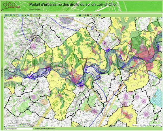
Content

Setting the context in two slides
Illustrating the political will
Presenting the regulation context
Changing the paradigm
Showing the geoportal in three slides
Dematerialsing spatial planning
Showing that France is not unique in n slides
Towards a European Spatial Planning geoportal: The French " géoportail de l'urbanisme November 2013 - plan4business
Setting the context: Spatial Planning in France
Towards a European Spatial Planning geoportal: The French " géoportail de l'urbanisme November 2013 - plan4business
Setting the context: Spatial Planning in France

 A complex hierarchy of plans with a spatial dimension
                       Présentation synthétique de la hiérarchie des normes

                                                                                   Documents et
          Compatibilité                               Prise en compte           données de référence

                                                                                       DTADD, SRCAE, PRAD,
        Lois Montagne et Littoral                                                       SRADT,
                                                                                       schéma départemental
                                                                                       des carrières, schémas
                                                SRCE, PCET, schéma stratégique          relatifs aux déchets,
      SDRIF, SAR, PADDUC, DTA
                                                de façade, schéma régional de          atlas des zones inon-
      chartes PNR et PN
                                                développement de l'aquaculture         dables, atlas régional
      SDAGE, SAGE,
                                                Marine, programmes d'équipement        et plans de paysages,
      PGRI ,
                                                (État, collectivités territoriales,    schéma départemental
      directive de protection
                                                établissements et services publics)    des aires de nomade,
      et de mise en valeur des paysages
                                                chartes de développement d'un pays     PDH,Basias-Basol...

                                          SCOT « intégrateur »

                  PLH, PDU
                                                                                 servitudes d'utilité
                                              PLU (1)+CC                     publique (PPR,ZPPAUP...)
              (1) Le PLU intercommunal tient lieu de PLH et parfois de PDU
Towards a European Spatial Planning geoportal: The French " géoportail de l'urbanisme November 2013 - plan4business
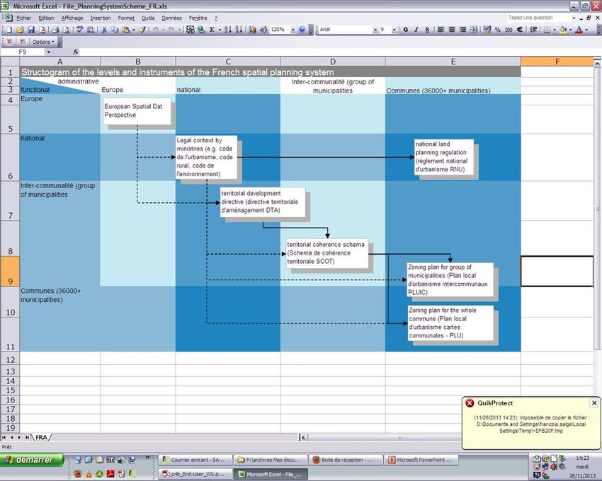
Illustrating the political: President Holande
                  declaration
Towards a European Spatial Planning geoportal: The French " géoportail de l'urbanisme November 2013 - plan4business
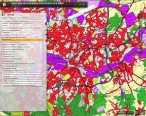
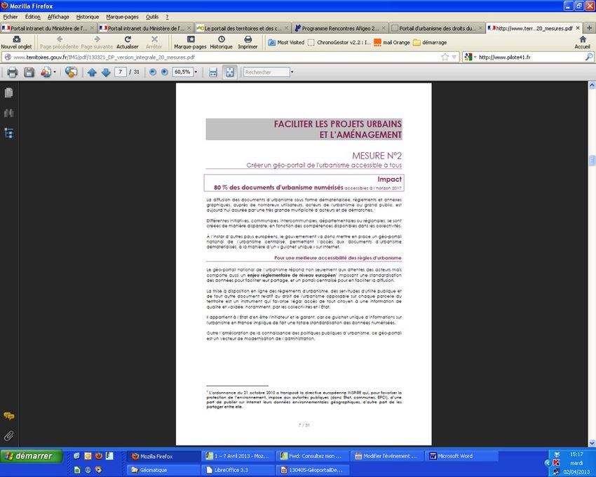
Presenting the new regulation

The “executive order” of December 2013
    all citizens must be equally enabled to access quality and validated
        information
    Requirement for local authorities to digitize and publish digital standardized
      version of their planning documents
    Obligation for the central government to do the same for public interest
      easements
      (SUP)
Calendar
    July 2015: public bodies must provide their SUP in CNIG-standarised format
    January 2016: all local authorities
                     Must provide their new planning documents in electronic form in the
                       CNIG standardised format
                     Must post on their website their “in force” planning document in
                       electronic form (free format)
    2020: The planning documents in online digitized and standardized will be
       enforceable if and only if they are published on the Geoportal
Towards a European Spatial Planning geoportal: The French " géoportail de l'urbanisme November 2013 - plan4business
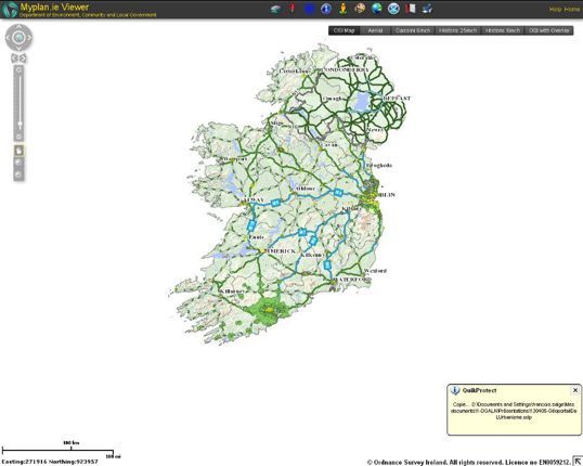
Changing the paradigm: Current

                       Local governments                              Documents
                                                                      d’urbanisme

                                               Application du droit
                                                     des sols
                       Documents d'urbanisme                          General
      Porté à
connaissance des                                                       public
servitudes d’utilité
     publique

                        State government

                             Servitudes

                       Easement managers
Towards a European Spatial Planning geoportal: The French " géoportail de l'urbanisme November 2013 - plan4business
Changing the paradigm: Future

                                Local government

                                                                  Servitudes et PLU sur
                                                                    le géoportail de
                                                                       l'urbanisme
                                                                                          General
 Servitudes dématérialisées    Documents d'urbanisme                                       public
format CNIG dans le porté à   dématérialisés format CNIG
        connaissance

                                State government
                                                                                            Thème 3.4
                                                                                            Usage des
                                                                                               sols
                                                           Thème 3.11 zones de
                                                                gestion, de
                              Servitudes dématérialisées
                                                           réglementation et de
                                     format CNIG
                                                                rapportage

                               Easment managers                                             INSPIRE
Towards a European Spatial Planning geoportal: The French " géoportail de l'urbanisme November 2013 - plan4business
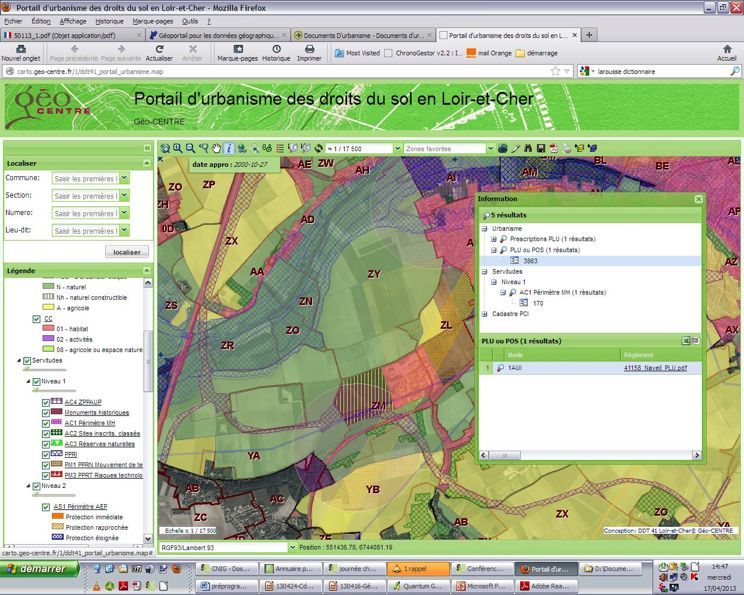
Showing the geoportal: an example

http://carto.geo-centre.fr/1/ddt41_portail_urbanisme.map
Towards a European Spatial Planning geoportal: The French " géoportail de l'urbanisme November 2013 - plan4business
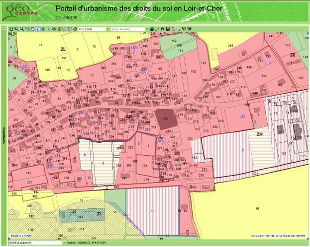
Showing the geoportal: détail
Showing the geoportal: till the regulation
Dematerialsing spatial planning documents
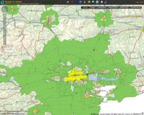
Showing that France is not unique

Ireland: http://www.myplan.ie/viewer/
Showing that France is not unique
Je vous remercie de votre attention
Vous pouvez aussi lire